Quantcast
Channel: Treasure Maps
Viewing all 103 articles
Browse latest View live

By Horse to Talysarn: Prince and Corwen

$
0
0
Courtesy of National Library of Wales
In my early twenties I lived near a forestry commission woods where the trees were being harvested by a team using a horse. This wonderful Clydesdale was called "Barney" and I got to know him pretty well. He was master of the job, patient and strong, but with a very definite personality. One year, we gave him a special grooming and cleaned all his harness so that he could pull the village May Queen. He seemed to love the attention that day, yet the day after when I found him at work in the woods, he nodded his head in greeting, as if to say "business as usual, pal!"

When I started to study the quarries of the Nantlle area, the recurring photographs of the tramway horses began to fascinate me. I remembered old Barney and wondered what the story of these horses was.

Boyd's book (see the references at the end) was a good starting point. For the record, the railway was a horse-drawn waggonway that carried slate from Pen-yr-Orsedd and all points in-between to sidings at Talysarn. Originally it had run all the way to Caernarfon, but was taken over in 1865 by what later became the London and North Western Railway and was converted to standard gauge from Caernarfon as far as Talysarn.  Ironically, while much of the route of the 3'6" gauge waggonway through the quarries survives, the old LNWR trackbed is now the road that you would use if you came to Talysarn from the Porthmadog-Caernarfon road at Penygroes.

Information about the horses is scarce; few written records seem to have been kept. What I know so far has been kindly imparted to me by several locals, especially John Williams and the late Dr Gwynfor Pierce Jones. Luckily, one of the great photographers of the 1950's, Geoff Charles, took an interest in Dorothea and made many images of the horses and the folk who worked the Nantlle quarries in the 1950's. The header image is of "Corwen" and "Prince" and is shown courtesy of the wonderful National Library of Wales Collection.

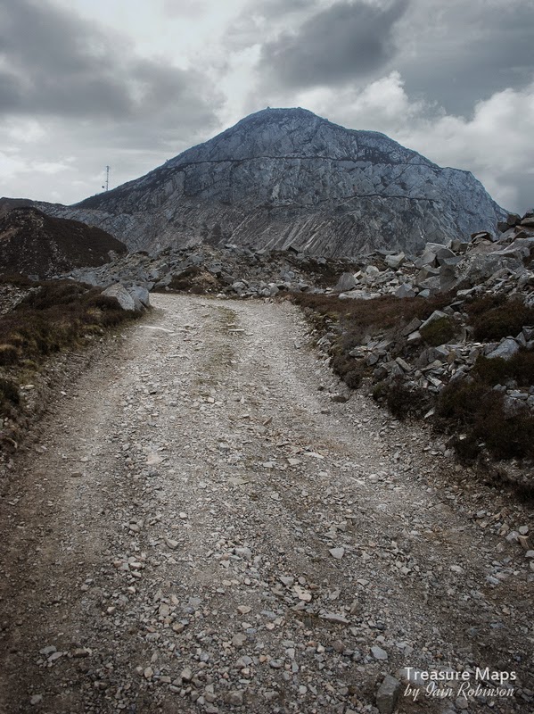
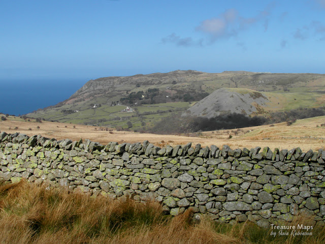
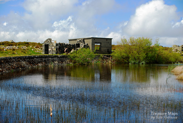
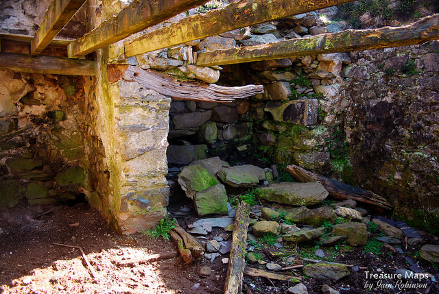
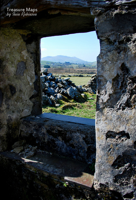
It seems that different horses were used for the 2' gauge quarry lines and for the tramway itself, which was laid to 3'6" gauge and utilised waggons with double-flanged wheels. Over the years, different contractors were used to supply the horses. One such was a Mr Pritchard, who lived in a house in the lost village of Talysarn Uchaf, underneath the vast Gallt-y-Fedw buttresses across from what was once Foundry Terrace, where the divers now park their cars. Here there was a stable block and a waterwheel driving a chaff cutter, to prepare food for the horses. John Williams remembers the constant thumping sound of the oil engine that replaced the waterwheel in the 1940's.

Here are a couple of my photos of the stables and Mr Pritchard's house- for more, see my set on Flickr here.


Most of these contractors had several different occupations and it certainly seems that Mr Pritchard kept pigs and other livestock and had a cart for other transport jobs outwith the scope of the tramway.. I've not been able to source any old photographs of the stables, but took several of the ruins on my many visits to Dorothea. Trees have grown around the slabs that separate the horse-stalls, and nature is taking over in her slow but inexorable way. I don't think it will be too many years before the huge bastions that teeter over the houses here will fall and engulf everything. I always feel at Dorothea that I have been priviledged to see this...one way or another, it won't be around for too much longer.

In later years, the redoubtable Mr Oswald Jones and his horses, "Prince" and "Corwen" worked the line. Oswald had inherited the business from his father, William Richard Jones, who had started contracting from Talysarn, in 1930. I have had conflicting information about the stabling of the horses, some say that Jones stabled the horses at Talysarn, in a yard behind the old Post Office. I tend to think this is correct, as Mr Jones also had a lorry and a bus at one point. Since Talysarn Uchaf was well off the metalled road, Talysarn would have been the logical base. Others maintain the horses were stabled at Pen-yr-Orsedd, or at Mr Pritchard's stables in 'Uchaf.

What is very interesting is that Gwynfor Pierce Jones stated that the quarry horses were contracted from a Mr Pritchard, from Taldrwst farm ...that farm is still run by the Pritchards. Could they have been the same folk as those of Talysarn Uchaf? I'm still trying to find out.

In the 'fifties, the horses became minor celebrities. They even had an article written about them in the Liverpool Daily Post. They handled a few railtours, such as the one below, on the 5th May 1957, photograph by kind permission of the J W Sutherland Archive.

This looks like the stretch of line just west of Bont Fawr, the enormous slate bridge that carried the quarry waste tramway over the road between the Talysarn pit and Cloddfa'r Coed slate quarry. Note the Nantlle Railway symbol on the waggons. 


One amusing story is that on one of the railtours in the fifties, a couple of young ladies accompanied the gaberdined gricers. During the trip, sugar cubes were given to Prince and Corwen and on the way back the horses got a little "high". In a fit of equine exuberance, they pulled the entire train away from the track and set off for grass, thankfully with no injury to human or horse, although I can imagine the shouting from Mr Jones! Not that the horses were unused to treats, there are many photographs of them with local children on their backs or standing contentedly being petted by folk.

Like most horses, they were also very intelligent. It is said that they could work a return empty train all the way back to Pen-yr-Orsedd unaccompanied, where they would stand and patiently wait for the waggons to be crewled up the incline. One of Prince's last assignments was to appear at  the Ffestiniog Railway Vintage Gala in 1963. By then, Corwen had died and Prince followed soon after. The railway itself closed that year.
In the quarry, horse working had already ceased. Gwynfor Pierce Jones said:

"they stopped using the horse as the result of a Business Consultant's report (from London, who was horrified by the noise and dirt of quarry working!). He said it made the business look old fashioned and was a bad image. So they bought a grey Fergie instead."

I spotted this interesting image of Corwen at the Eastern pyramid of Dorothea.  Hauling slab to the Dorothea mill, ears back, listening for instructions from the handler. The slab was  probably from the Pen-y-Bryn working, which was re-opened in the late fifties for a while. It's by Max Sinclair and can be seen on the excellent "Narrow Gauge Heaven" web site. This photo confused me at first, until I realised that the transparency was back-to-front. Suddenly everything made sense!


By all accounts, the horses were much loved. During one of our conversations about the quarry and the horses with John Pen-y-Bryn, he showed us their grave...it's a lovely, peaceful spot. I wish I could know more of their story. Needless to say, if anyone reading this has any more information, I would be most grateful and would love to add to the article.

After Prince and Corwen had gone, it wasn't quite the end. There were a couple of other railtours along the tramway before total closure, hauled by a red and yellow international tractor. For me, it just wouldn't have been the same.

A fine shot looking towards the quarries from Talysarn yard. This scene is still just about recognisable today.
Geoff Charles Collection, by kind courtesy of the National Library of Wales.

References:
Geoff Charles Collection at the National Library of Wales  including a very good biography.

Max Sinclair's photos on Narrow Gauge Heaven

The Nantlle Railway, Branch and Tramway, by Bryan L Wilson and J Atyeo: Railway Byelines Annual No.3, Irwell Press

The Narrow Gauge Railways of North Caernarvonshire, Volume 1 by J I C Boyd, Oakwood Press.

Industrial Locomotives of North Wales by V J Bradley, IRS publications 1992

The J.W. Sutherland Railway Print Collection

One of the horse-stalls in the stable.
Inside Mr Pritchard's house.


The Abandoned House

$
0
0

After the equine excess of my last post, I thought it might be nice just to show some photographs, from an abandoned house that we found. While looking for a mine, of course. Normal industrial coverage will be resumed as soon as possible...


Ice cold in Alex

$
0
0


It was another bitterly cold day above Y Fron as we set out towards the Alexandra Quarry. We took a road that wound up towards a smaller quarry, Bryn-y-ferram, as we had spotted something fascinating and  rusty on the tips. I thought it might be the water tank that is mentioned in the Slate Gazetteer. We hadn't been walking long before meeting an elderly gentleman who looked just like an old quarry man from the thirties, being dragged along by a brace of Jack Russells. Imagine Petra's surprise when her greeting to him in Welsh was met with a very posh, home counties "Beautiful morning"... never judge a book by it's cover!


We had a mooch around Bryn-y-Ferram, which is a small pit working and, like all the quarries in this area, breathtaking views are fitted as standard. The main mill area was sadly obliterated by tip reclamation and the rusty thing we'd spotted turned out to be a very large sieve for sorting the sizes of reclaimed rock. It made some interesting photographs, anyway. The surviving tips themselves were very impressive and the views from them, of course, were priceless.


A while ago, I was taken to task by a Welsh speaker for saying that Maenofferen came from "the rock of the mass" and was told that the name was simply a corruption of the word "farm". So here, Bryn-y-ferram would mean "the hill of the farm", which seemed logical to an ignorant fellow like me. Except that none other than that doyen of historians from Dyffryn Nantlle, the late Dr Gwynfor Pierce Jones, thought otherwise when it came to this place. He said:
"The end part of the name is a corruption of 'offeren' as found in the Ffestiniog 'Maen-offeren', referring to the mass and possibly to do with the recalcitrant Catholics hiding from Protestant persecution in the 16th century." (1) Just saying...


Further up the hill from the working area were two pits and their run-in tunnels. There is a hillock here which is composed of sand and gravel, perhaps some kind of morraine left by the retreat of the glaciers. At the very top of the quarry, with the Alexandra workings in sight, we came upon another set of tips. Between the two tip runs are the ruins of a number of structures and what looked to be a water wheel pit...possibly the first farm on the hill and perhaps where the catholics took refuge in the C16th. There's a fine weigh house and we were both quick to exploit the photographic possibilities against Mynydd Mawr and the snow-clad bulk of Snowdon, seemingly touchable in the cool air.


A short walk over grass took us to the complex of ruined buildings belonging to Alexandra quarry. These structures date from the later days at the quarry and are mainly concerned with generating electricity and winding the blondins which were stationed on this side of the pit. The tips are extensive and each finger runs for a hundred yards or more. I was surprised to see the long rake of Betws-y-Garmon iron mine across the valley, making me realise where we were. At times like this I am reminded that Snowdonia is really quite a small place, so many good things crammed into a few hundred square miles of quality, unlike the highlands of Scotland, which seem to go on forever. After spotting the tenth Munro one can't help but be a little blasé.

While photo-ing happily away in the ruins, Petra and I became aware of a mighty growling, becoming increasingly louder. It was as if two enormous dragons were battling in the pit below. I looked over the edge and saw four trails bikes and a couple of quad bikes roaring over the berms and tracks. So much for the site of special scientific interest, then. I don't mind them cutting about over this place, I just wish they were a little quieter, but then I guess the noise is part of the fun. Perhaps I am becoming an old fart, but I haven't taken a subscription out for the Radio Times yet.


We descended towards where the Alexandra mill area had been, now flattened. It's walls were used for making slates and all the machinery was taken by the scrap man. Later, the quarry was amalgamated with Moel Tryfan and much equipment was taken away to be used elsewhere, while the pit was used for dumping Tryfan waste.


The wonderful tramway still remains, winding downhill from the pit towards the Bryngwyn drumhead, where it connected to the Welsh Highland Railway via the Bryngwyn branch. The trackbed is owned by the Ffestiniog/Welsh Highland Railway, who have co-operated with local bodies to allow a permissive path over the length of the branch, to be covered soon on this blog!


It was getting late in the day, but we decided to head on down the quarry branch towards the incline, and I'm glad we did. The route is spectacular, perhaps not in the same league as the Rhosydd tramway, but the views towards Caernarfon and Anglesey that open out are very fine. After a while, a line of tips marks the start of the now run-in tunnel, "Lefel Fawr", engineered by Spooner to provide access to level 5 of the Alexandra pit. This would have come out at Alexandra just below the present water level. There were several floors below this eventually...I am not sure I understand why the Lefel fawr wasn't used to extract spoil/product instead of the longer tramway from the mills, perhaps the logistics were more difficult. At any rate, it must have drained the quarry, as there is now a Welsh Water pumping station at the tunnel mouth. After the remains of the tunnel, the line takes a left through some smallholdings, losing height via a fine switchback curve. At this point darkness was beginning to fall and I wasn't quite sure where we were. There were huge tips to our left which I thought might be the Moel Tryfan tips, but equally, they could be the Braich workings as I had left the map somewhere in Alexandra.


With considerable bluff, I announced that the steep track to our left was the Tryfan exit incline and we wearily strode up. I was very glad when a digger appeared out of the gloom and we realised we were indeed at the old Moel Tryfan mills level. Phew!

Thankfully, it was all downhill from here to the car, which was at Y Fron. The walk had been a series of fascinating contrasts, from the bleak Snowdonian grandeur of Mynydd Mawr and the quarry plateau, to the "alpine" tramway and latterly, the line of the trackbed through cluttered and charmingly untidy smallholdings. It felt like we had walked a considerable distance because of the contrasts, when in reality it had only been a round trip of about four miles. That is definitely one of the wonders of Snowdonia!

(1) "Cwm Gwrfai, the Quarries of the North Wales Narrow Gauge and Welsh Highland Railways" by Gwynfor Pierce Jones and Alun John Richards, Gwasg Garreg Gwalch,  ISBN: 0-86381-897-8


Baron Hill

$
0
0


Early spring is definitely the best time to visit abandoned places. Later in the year, boskage and the ferocious growth of brambles/nettles makes exploring and photography difficult.

This spring we set off for Beaumaris and found the place very easily. It must be the worst kept secret in Wales - there is a well-worn path to the place and it appears to be a popular venue for young folk, explorers and homeless folk, despite being hidden in dense woodland. There's a long avenue, presided over by several gatehouses and a bridge over the main road. Once into the grounds proper, the gardens present a tangled picture although it is possible to pick out the ruined temple, water features and ornamental walks among the vigorous tree growth.

One of the gatehouses on the driveway.


Nearer to the house, or what remains of it, we found the stable block and coach house. The number of doors gives an indication of how wealthy the owners must have been.

The house is a teetering shell of a place, very dangerous, with the plaster decoration crumbling from the brick walls. One feature I found most impressive were the cast iron joists holding the walls together, supporting invisible floors which had long since rotted away. Graffiti covers the walls, something I love to see, especially on an old mansion like this. I know folk get very heated about graffiti, but to me it adds to the atmosphere and so often contributes a note of humour, even when that was not the original intention. No doubt, back in the halcyon days of the mansion, the owner would have been a magistrate and would have put away a good few local youths in his time. Not these youths, anyway.


I found the doors and windows particularly evocative, flaking paint adding to their fascination.

I always feel ambivalent about "stately homes", mansions and their builders. In my early teens, I was sent away to a posh school in a grand country house, full of young toffs. Having a northern English/Scottish accent, I was vilified by the little lordlings. Of course, I developed a  robust defence which ensured I was left very much alone after a few unfortunate incidents, but since then I have always disliked the idea of a "ruling class" and all that goes with that ethos. That's probably why ruined places like this delight me. I will acknowledge that many people were provided with jobs as a result of these folk and that in their own patronising way they were a stabilising influence within the community, but the prosperity gap between the people who could build something like this mansion and the ordinary folk of Beamaris was vast. The Bulkeleys seem a relatively civilised bunch, not having gone in for slavery like the folk over at Penrhyn, although if old accounts are to be believed, they did dabble in a bit of poisoning- the grasping for the family fortune became a little intense at times. Finally, death duties helped to suck the little remaining life out of the place.

The old kitchen, where cooks and maids worked long hours to provide food for the house.


Now the broken windows of the Bulkeley's mansion gaze emptily over the fields above Beamaris. Yet,  I imagine that the place has as much fascination, if not more, than it ever has. Old photographs show a rather charmless place, neat and tidy but much like any other rich man's pile of bricks. Now nature's artistry has added something else, something special that we can all appreciate. By the look of the wealth of material on the web about the place, it seems that many folk have been doing just that, for at least the last thirty years.

Much has been written on the forums and blogs about this fascinating ruin, mostly filched from Wikipedia, so I won't add to the white noise by repeating the same mantra. Here's the link for the history.

Finally, there are many more photos on my Flickr stream of the explore here.


The Rhiwbach Railway Incline

$
0
0
Rhiwbach and the Engine House chimney, seen on a stormy day, looking east from the Rhiwbach Tramway.

Slate quarries are often sited in awkward places. Rhiwbach is no exception; it is a remote site, spread over a wild corner of the moors between Cwm Penmachno and Blaenau Ffestiniog. As most folk know, the quarry was served by a fascinating tramway which carried the finished slates down to the Ffestiniog railway and on to Porthmadog. Since the area is well above even the elevated position of Blaenau Ffestiniog, several inclined planes were involved. However, rather perversely, Rhiwbach and its near neighbour, Blaen-y-Cwm quarry were both situated below the tramway as it ran over the moor. Thus, they required inclines to lift their slate uphill for transport, rather than the norm, which was for slate to be run downwards.

In the first days of the quarry at Rhiwbach, well before the tramway had even been considered, finished slate was sent by horse and cart down through Cwm Penmachno and then to Trefriw wharf for shipment. At least it was downhill all the way. However, wharfage charges and the sheer inconvenience of the distance to the River Conwy began to be an issue and so the quarry management began to look for a cheaper way to send the product to market.

In 1820, a new road was built up Cwm Teigl from the south and a cart load of slate was taken down to the quay on the Afon Dwyryd at Trwyn y Garnedd. It is one of those mysteries that will never be satisfactorily cleared up, but although the trip was shorter and easier and the wharfage charges less, the journey was not repeated by the quarry for ten years. Slate continued to be sent to Trefriw until 1830.

Eventually, in 1860 with the expansion of the quarry, Charles Spooner was asked to survey and design the tramway from Blaenau Ffestiniog to Rhiwbach. The contractor chosen was no less than Owen Gethin Jones, a celebrated local civil engineer, responsible for the railway bridge between Pont-y-Pant and Betws-y-Coed. Ironically, he was a slate mine owner himself, in a small way*.


Looking down on Rhiwbach from the top of the incline sheave pillar. A horizontal wheel would have been set atop the pillar in the bearing below the beam.


Today, the incline is an impressive feature, which rises up from the mill floor some 220 feet below, to the return sheave at the top. It is is 280 yards in length. At first, it was proposed to build it as a water-balance incline, but no doubt Gethin Jones pointed out that the lack of plentiful water in the vicinity would make anything relying on copious water supplies a non-starter. Instead, he took the unusual step of building an engine house at the foot of the incline, with a cable that would run to the top on sheave guides and then return down in between the rails, being kept taut by a ballast waggon at the end of the cable. It is a tribute to the builders that the incline and the engine house chimney still stand today, despite the wild nature of the weather up on the moor.


The Engine House Chimney and the incline from the mill level. 

While this arrangement is unusual in the area, neighbouring Blaen-y-Cwm quarry also used a similar incline system with a sheave pillar that can still be seen beside the tramway. Back at Rhiwbach, Jones oversaw the building of the engine house and incline. It was powered by a large and powerful, 20" single cylinder horizontal engine of four foot stroke, from the Haigh Foundry in Wigan. It was equipped, we are told, with link motion and reversing gear. Two, later three, six foot diameter winding drums were fitted, one to work the tramway incline, the other to bring slate up from the "New Mill" incline at a lower level. More significantly, the newer drum worked the incline from the Cwm End quarry, the underground workings opened out to the North. Only one incline could be worked at a time.


The men, not surprisingly, dubbed the new machine "Injan Mawr" (Big Engine). Steam was supplied by two massive Cornish Boilers, 24 foot long and 5 feet six inches in diameter. All the machinery was hauled from the railway in Ffestiniog, up Cwm Teigl to the bwlch at Carreg-y-Fran. A journey that taxes empty slate trucks these days, let alone teams of horses pulling heavy machinery up a barely surfaced road. When the boilers were replaced in 1901 they came instead along the tramway and were designed to fit within the loading gauge at the rock cutting just south of the Cwt-y-Bugail quarry branch.

A team of fitters had come from Lancashire to assemble the "Injan Mawr", but their embarrassment can be imagined when it was found that they were unable to make it work properly, although there was nothing intrinsically amiss with the machine. So, the quarry owners advertised for an engineer who could get the machine to do the work it was designed for. Soon, a man from the Wrexham area, John Jones, applied for the post. By all accounts, he quickly mastered the arcane ways of the machine "without loss or confusion" and was taken on the payroll with some alacrity by the management. He was apparently paid a substantial wage for his skills; most certainly a man who was in the right place at the right time. He later left to become manager at the nearby Bwlch-y-Slaters quarry.


It must have been an extremely difficult job, controlling several inclines, especially since the Cwm End incline could not be seen from the engine house. It required a cool and methodical frame of mind. On the railway incline, the driver had a clock dial on the wall . With each revolution of the dial, a bell rang, so that by counting the bells, the driver would know the position of the load on the incline. There was also a lever at the crimp attached to a wire which ran to the engine house, so that when waggons were being lowered the wire would be pulled, ringing a bell in the engine house. Taking waggons up the railway incline was taxing on the engine and stoker, for even though only two loaded waggons were taken up at a time, steam could be lost. Evan Owen Roberts (2), who started work at the quarry in 1922, remembered:

"The Railway Incline...where runs (of waggons) were very heavy, we needed to watch these, if the pressure dropped and failed to raise the load, it was serious for you. If you stopped on the way up...the engine's piston had a long stroke and you could not re-start the haulage, you had to lower it down to the bottom again."
Raising a run was time-consuming. Firstly, three men would be sent up to the top to act as crewlers, to manage the loaded waggons as they reached the top. There is only a small level area before the sheave pillar itself and it was essential to unhook the waggons before they ran into the pillar. Waggons could only be raised two at a time, so a good run of waggons could take a couple of hours to get on to the tramway.

Roberts recalled that he was paid £1.15s per week, but had to raise steam for the engine in his own time on Monday mornings.

Slightly to the north of the engine house is a stone built winding house which was used to raise slate from a shaft to the three underground galleries of the Old Quarry. (The pit to the east of the incline). From documentary records, we know that at one time there were three drums attached to the engine, working the railway incline, the "new mill" incline at floor C and the Cwm End incline. As working in the old quarry had probably been run down by 1860 when the engine house was built, it is unlikely that it was also used to work the headgear for the Old Quarry workings.


Earlier, the lack of any significant surface water was mentioned- luckily, there was enough to fill a small catch pond slightly uphill from the engine house and this proved sufficient to supply the boilers. A pipe went from the pond to a cast-iron tank which ran the length of the east end of the boiler house.

The mill and quarry went over to electricity in 1935, by which time the annual tonnage at the quarry was well below peak 1869 levels. Sadly, nothing is recorded about what happened to the Injan Mawr -presumably it was carted off for scrap along with all the other redundant steam machinery. What a pity that it hadn't been left - along with the engine house and chimney it would have been a jewel in the crown of the windswept moors above Blaenau Ffestiniog.

References:
*Chwarel Gethin Jones

(2) From "Rhiwbach Slate Quarry, its History and Development" by Griff R Jones ISBN 0-9533692-2-2-6

"Blaen-y-Cwm and Cwt-y-Bugail Slate Quarries", M. J. T. Lewis, ISBN 0-9522979-3-0

"Gazeteer of Slate Quarrying in Wales", Alun John RichardsISBN 1-84524-074-X

Link to the Haigh Foundry Wikipedia entry. Rather surprisingly, part of the original premises is still being used as a foundry, although on a smaller scale. Haigh were renowned engine builders in the C19th and built winding and pumping engines, notably a large Cornish pumping engine for Talacre Lead Mine, near Rhyl, with a 100" diameter steam cylinder in 1862. They also bid, unsuccessfully, for the manufacture of "Prince" for the Ffestiniog Railway.

One of the sheave/guides alongside the incline which took the steel hawser wire to the top of the incline.


One of the supports for the Cwm End incline cable as it ran across the mill level from the Engine House to the incline in the north of the site.

A glimpse into Bryneglwys

$
0
0

After a gap of a couple of years, we returned to Abergynolwyn to have another look at the Bryneglwys slate quarry. It was a beautiful, bright day and the landscape was beyond any adjectives I could think up. I will have to settle, for now, on idyllic which still falls slightly short.
Since our last visit, some of the millions of conifers covering the site have been harvested, while other areas have been replanted with ever more of the pesky things. Meanwhile, in other parts of the quarry, birch scrub is taking over, making the place very difficult to understand or navigate around. Never mind, at least it is relatively untouched since the forestry commission took over, and attitudes from that body are infinitely more enlightened these days. Not that the quarry itself was blameless, apart from covering a beautiful valley in waste tips, the allure of which is a moot point for some folk, an ancient prehistoric stone circle was destroyed while sinking a shaft within what later became the mill.


This time, we knew what we were looking for and managed to quickly find the location of the daylight adit, leading into the large open pits on the South, or Narrow vein. Despite the dry spell, the adit was flooded to over critical welly level and the entrance choked with clinging mud. The adit is a wide one, reminiscent of Rhosydd 9 adit...not surprising since they were both major transport arteries for the quarries they served. The roof of the adit looks fragile in places and there have been minor falls recently. Once out into the twll, the scene is an impressive one, with a huge arch opening into the eastern twll. Below, a vertiginous drop into darkness betrayed the incline down into the bowels of the quarry, now only accessible by abseiling down.


Petra brushed accidentally against the rock wall outside the adit, moving some moss and revealing graffiti and jwmpah holes. Some of the graffiti appeared to be from the 1940's, other marks could have been older.


We ventured into the mine at what was known as the adit level. The quarry had a curious way of describing the floors. The daylight adit was datum level at floor 20, and each floor below, usually at a nominal 75 feet, was numbered 25, 50 and 75. Above adit level (floor 20) there were three floors, almost impossible to enter or locate now because of very dense tree cover or collapses.

At floor 50, there was the "Lefel Fawr", a 1935 foot long tunnel built to drain the workings. This was still accessible until recently, but is now blocked by falls at both ends. Below floor 50 was the notorious floor 75, or "Sinc Ddu". This had to be pumped out constantly and, lacking in proper ventilation or drainage it is said to have given the quarry a bad name throughout the industry. But the slate here was good, so men toiled in the darkness and hot, unhealthy conditions. No wonder that another name for it was the "Sinc Dial", or Devil's Sinc.


Dangerous roof - and to the left, the blocked entrance to a chamber.


We were only able to explore a fraction of the adit level, but what we found was a dangerous and unstable place. There's no denying the fascination of it though, it certainly has the atmosphere of a mine that has been closed for sixty four years or so, with chambers jammed full of fallen rock and tunnels deteriorating to the point where they will undoubtedly collapse in the next few years. It's frustrating that access to other levels is only possible by SRT, but those with the necessary skills (and cojones) are due some rewards for their efforts!

So we left Bryneglwys to slumber on in it's beautiful valley, overlooked by the timber clad domes of the Tarrens and quartered by ravens and buzzards. There's still much to explore here on the surface and I don't doubt that we'll be back before long.

Stacked deads and shaft to lower workings to the left.


The way back, towards Nant Gwernol.

Pompren Barytes Mine

$
0
0

Earlier this year, we had a wander along the Llŷn peninsula. Not really looking for anything special, but with the hope that we might encounter a mine, a quarry or at the very least, some forgotten bit of rusty machinery. After lunch in Aberdaron, we wandered along the beach; at which point my mine senses began to tell me that the game might be on.

The remains of a jetty stretched out over the west end of the beach at a place called Porth Simdde. The geology just here was very interesting, with evidence of great folding and disturbance within the igneous rock.

Looking landward from the beach really gave the game away. There were the unmistakeable signs of spoil tips in the little creek above, with what looked like a couple of small quarry pits. Nearer the shore a ruined building was just about hanging on at the end of what looked like a tramway run. Of course, this needed the famous mine-spotters eye of faith to recognise, but with the aid of a handy set of steps put in by those coastal path folk, we gained a little height to try and see more. There was evidence of two small pits, possibly containing run-in adits, but access was guarded ferociously by thick gorse.

Photo: Petra Brown
Further up the little valley a modern house had been built, with an almost choked adit in front of it. I wonder if they had commissioned a mineral workings survey before building had started? Although a friend recently told me that he had a copper mine underneath his house, so the answer is probably not!  Back at Porth Simdde, low tips fanned from the adit portal, such as it was. A little way further down there was a collapsed tunnel in between the tips. There had obviously been a fair bit of activity here connected with the mine.


Back home I discovered that the mine was actually the Pompren Barytes mine, managed by one James Crighton in 1912. It was then operated by Lleyn Mines until 1914. The mine seems to have been first driven in 1883 and closed in 1917 although there is no information as to the ownership between 1914 and closure. There is also information that the quarry pit above the mine (Dwrhos Quarry perhaps) is something different and was an attempt to extract granite. Some sources say that the jetty was built for this quarry, others that it belonged to the mine. Strangely, the jetty only appears on the 1914 OS sheet XLIII.SE, yet the quarry is marked on the first edition. The photo above, from Rhiw.com, shows the pier in existence, probably in the early part of the C20th. The house on the cliff top would probably be Dwrhos farm, just above the granite workings.

The last mystery is what exactly did they need the Barytes for? Nowadays it is used in oil drilling and as a filler in plastics and resins. It also has medical uses as in the dreaded barium meal, but I can't see any of these uses being important at the turn of the century. Perhaps one of my knowledgeable correspondents will know.

Oh yes, the name.  Porth Simdde means "Harbour (of the) chimney" -in case you were wondering. Despite the cloudy history, the place is well worth a visit to soak up the views and enjoy the magic of this part of North Wales.

Thanks, as always, to the Hendre Coed mining database and to Rhiw.com for information.
Also of interest is this document, commissioned by CADW

Some more photos...


The ruins of Ty Tanyrallt, above and to the west of the mine. Aberdaron in the distance.

Cefn Mawr - A fascinating post-industrial Landscape.

$
0
0


Cefn Mawr, put simply, is the ridge enclosing the north end of an  industrial area that developed because of the Pontcycyllte aqueduct, its canal and its tramroads. Tourists who flock to look at the aqueduct rightly marvel at its pedigree as one of the most significant industrial structures in the country. Yet, more than this, it was a catalyst, an agent of change.  Ironworks were set up to provide the enormous, high quality castings that Telford and Jessop's bridge required. Collieries were sunk to exploit the local reserves of high quality coal. Stone for building was quarried all along the ridge. Yet, there's surprisingly little to show for all this activity today, apart from the bridge. It's as if there is a collective shame about the signs of early industry, a feeling that it must be swept away out of sight.

A ruined farm near one of the coal pits at "The Ballast"
The excellent booklet, produced by a local community initiative*, goes a very long way to redress the balance. It describes a series of walks not far from the aqueduct with just enough industrial archaeology to enable the visitor with half an imagination to join the dots for him or herself. The Tourist Office carries a dwindling supply of these booklets about the trail, which as far as I can see, is now out of print- a huge shame.
A glance at the Ordnance survey sheet for Cefn Mawr in 1904 will show a bewildering warren of tramroads, plateways, coal mines, foundries and countless other industries, none of which are remotely evident today, save as the odd retaining wall made from furnace slag or an alignment of road or footpath. Oh, for a time machine set at 1860.

And yet, there's something intensely pleasurable in taking in the genius loci, noting with a sudden thrill that the stone wall or abutment you have been looking at is actually one of the vestigial remains of a tramroad or a lime kiln.

Armed with one of the booklets supplied by the very helpful ladies of Trevor Basin TIC, Petra and I chose route D.

Interpretative Map by CreativityJones Design

I have to say that it was an eye-opener. We walked towards the north end of the Trevor basin, (3) on the map, past the truncated arm of the canal which once served the ironworks. It was an idyllic, bosky scene, and it didn't take much imagination to picture the place as it was a hundred years ago.

Then, the atmosphere changed. A large area of waste land resembling a bomb site opened up behind tall security railings on our right. High masts supported security cameras and lights, guarding the ransacked land where stunted, blighted birches and conifers were struggling to grow.
A far view of the Monsanto site from atop the Cefn Mawr ridge. Our route took us immediately in front of the tree line in the middle distance. The Vale of Llangollen is in the far background, and the aqueduct is just out of the photo to the left distance.


This was the Plas Kynaston estate, where several important industries sprang up in the 1800's to service the construction of the aqueduct. There were brickworks, potteries, engineering works, foundries and, notably, a chemical works which eventually grew to engulf the whole estate. Robert Graesser started an oil works here in the late 1860's to extract paraffin oil and wax from mining waste, later coal tar and explosives. He became so successful that he formed a partnership with the American chemical giant Monsanto. There were changes in ownership later to Flexsys, who closed most of the site and swept away the structures (and any remaining archaeology) but it has since been impossible to develop the area because of the very heavy chemical ground pollution.

There have been several plans mooted. The Plas Kynaston Canal Group want to re-open the canal and build a marina. Others suggest capping the site with concrete and building much-needed houses. There was even a suggestion that development could be funded by extracting the vast mineral wealth that supposedly lies below the site, although I don't see a modern quarry sitting well in a world heritage zone.

Putting those questions aside, we walked on, realising that the embankment to our left was the alignment of the Pontcycyllte Tramroad, a horse-drawn operation, later converted to accommodate steam locomotives. It eventually linked with the railway line to Llangollen, and some bridge abutments could be seen just before the A539 Llangollen Road. Along here on the left was once the mighty Trefynant Fireclay Works, owned by J.C.Edwards, who once supplied glazed terracotta bricks and tiles to the world. Edwards bricks decorated the Natural History Museum in London, as well as the fireplaces on the Titanic! The still new-looking produce of the  factory can be seen all through Cefn Mawr as many houses and shops are decorated with the shiny red bricks, made from local clay and fired with local coal.

photo: Petra Brown
We had to cross the A539 Llangollen Road, noting the Trefynant Pottery manager's house, built entirely from Terracotta bricks and tiles.


Once across the road, we took a public footpath alongside a stream, where informal gardens adjoined the opposite bank, Their walls were made from an impressive jumble of different tiles and bricks, something we would become used to seeing on our walk. Tiles marked "J.C.E" lay on the ground or half-buried everywhere along the path, as it passed the disturbed ground and overgrown tips of an old colliery, masked by woodland.

A tunnel was reached, under the disused Ruabon to Barmouth railway, closed in 1965. This is known locally as the "Darkie", as is the tunnel on the south end of the Pontcysyllte aqueduct.


Once out of the tunnel, we encountered an old ruined building, half constructed in Sandstone and half in JCE bricks. Many structures in Cefn Mawr bear the marks of later alterations with local bricks like this. According to the booklet, this was a place known as the "Ballast", an open area pock-marked with vestiges of old pits, shafts and tips. We emerged into a beautiful meadow with many different species of wild flowers which Petra took delight in identifying. Some Vanner ponies were watching us from the top of a low spoil tip, but they must have known that we didn't have any sugar cubes or carrots, as to my disappointment,  they kept their distance.

We carried on and emerged, via some giant Lego bricks, into Bowers Road.


Bryn Terrace, seen in the above photo, was built in 1906 from...J.C. Edwards terracotta bricks. Bowers road was rather interesting in that we encountered some bridge abutments that looked to date from the mid-C19th. Later, when browsing early maps of the site, I discovered a reference to the road on an 1880 edition that had a tramroad from the Acre House colliery over the road to a tipping ground on the "Ballast". This area of Cefn Mawr is Acrefair and I wondered if the name came from Acre House farm nearby.


The Bowers Road tramway bridge abutments. Above the wall is a new road which, looking at Google Earth, obviously takes the line of the tramway formation. We carried on, following the booklet's map and found ourselves at the A539 again. There was once a large railway bridge at the junction, supporting the Ruabon to Llangollen Railway's line. This was removed in the 1960's. The nature of development here felt quite English; the houses for the most part made from local glazed brick with tile embellishments.


Our route now took us onto King street, where I spotted a likely sign...


Which led to this...


At first, I thought it might be an old station or a goods shed, but I realised that it was on the wrong alignment...the GWR line runs North West through here and this is slightly East North East. Looking at the booklet, it could be on the alignment of the GWR Pontcysyllte branch...I wonder...the two lines intersected  not far from here, the GWR Llangollen line crossing by a bridge over the Pontcysyllte.

We carried on to High Street, where there were more tiled and glazed brick homes. As the road gained height, stone buildings started to predominate, obviously settlement was older here, pre-dating the tile works. The structures were quite haphazardly built, too, few being square in plan, as if they were fitting into a plot. Many houses date back to when squatters were allowed to build their own homes here on the common land. Gradually, plots became fewer and increasingly odd shaped structures developed. We saw a few with dates like "1760" on the door lintels.

We reached the site of the Zion Chapel, where another mystery reared it's head.I can find no photos of this building before it was demolished, only references to members of the congregation in parish records. A memorial plaque on the wall behind the new house gives the date "1805". Behind, a memorial garden has been built, giving superb views out over the Plas Kynaston site to the Vale of Llangollen. There are some very fine tombstones in the cemetery; unfortunately the only seat has succumbed to the elements, so we perched on a wall to consume lunch, thinking of all those people buried here and what stories they could tell.


A little further along High street and we found the very fine building that is the former Grosvenor Inn.


The booklet recommended taking one of the many alleys and narrow wynds that abound here, down to King Street, where I had a sudden revelation. I realised that King Street was actually built on the alignment of the Pontcysyllte tramway, which would join with the "main line" at Acrefair. I don't think I would have understood this but for the excellent map in the booklet. The pathway was certainly narrow and steep.


We emerged into an area known as "The Crane", pretty much the centre of  Cefn Mawr, where roads converge in a haphazard but determined way. According to the booklet, the post office here is the actual site of "The Crane", which was used for hoisting or transferring waggons from one tramway to another at a different level. Or was it?
A report by Govannon Consultants for CADW suggests:
 "At the moment there is no firm evidence even to support the existence of a crane, let alone explain its purpose. There has also been a suggestion that the word ‘crane’ has nothing to do with the railway but is an Anglicization of a local Welsh dialect word, ‘craen’ or ‘y graen’, which means slope."

There are certainly plenty of those about here. We descended a steep one called "American Hill" which felt to me a little like a tramway incline, with a stone base at it's foot.

American Hill
The path was apparently named after a local man who made a large sum of money in the States, then returned and opened a shop. In 1849, perhaps?


The photograph from the nineteen thirties, above, shows "the Crane" site and also the route of King Street and American hill. No wonder we couldn't see any remains of the Plas Kynaston Pottery as we came down the hill - all that development on the left of the photograph is Monsanto Chemicals, where the pottery would have been.

We descended yet another tiny alley and dropped down to Queen Street where we took a trackway back to Trevor Basin, past a mothballed industrial plant, itself built over an old colliery shaft. I get the feeling that, like most post-industrial areas, Cefn Mawr would become more interesting in proportion to the time spent studying it. This time, we discovered more mysteries than we found answers for, but that's the thrill of the chase, isn't it?

"Cefn Mawr and District — Understanding Urban Character" superbly written Cadw Report available as a PDF

 * Very many thanks to the Cefn Mawr, Rhosmedre and Newbridge Community Association Ltd.

The Plas Kynaston Canal Group


NAMHO 2014, Rhiwbach and Cwt-y-Bugail

$
0
0

Every year, the National Association of Mining History Organisations holds a conference to discuss and assimilate knowledge about mining history. This year, the conference was in Bangor and was being organised by AditNow, the premier online resource for mine history and exploration. At these conferences, mine history enthusiasts come from all over the country to listen to lectures by experts in many and various subjects. There's always something to learn, no matter what your level of knowledge.

The only trouble was, this year I was asked to take a field tour of Rhiwbach and Cwt-y-Bugail quarries for NAMHO. Now, my faithful readers will know that I am not the most sociable of people, but after some very gentle persuasion by Dave Linton of the Welsh mines Society and Simon Lowe of Adit Now, I realised that resistance was futile. Besides, I reckoned that it would be nice to share somewhere I love and know pretty well with like minded folk. Except that I wasn't sure I knew enough about the place and I recognised some pretty heavy-duty names on my list of attendees for the day.

With a doubtful mind, I signed off the various risk assessments and safety cases, handed in my call-out time to Simon and then waited anxiously for the day to come, when I would be tested and found wanting.

My daughter Sam and I stood at the car park at Manod Quarry waiting to greet the folk who were coming with me. I hoped they wouldn't notice my knees shaking.  They were a cheerful, friendly group, some of whom I recognised from photos on the web, others whom I knew by their reputations as experts, but I tried not to think about that. We set off and very soon, I felt my enthusiasm taking over from my nerves, especially as people were asking questions and seemed really interested. I realised that the mines on the moor were actually the star turn. They had laid it all on and I just needed to point people at the good bits ( although there are rather a lot of those).

Blaen-y-Cwm


An added bonus was that a local man was with us and he chimed in with a good deal of useful information, filling in the gaps where my knowledge fell short. The enthusiasm of the group was one of the things I will most remember about the day, especially at Rhiwbach. I took the group to see the mysterious pile of metal shards near the compressor house and asked if anyone could think what they could be. A few weeks prior to the trip, Dave Linton had posited an opinion that they could be belt ties for the continuous belting in the mill, and sure enough, someone in the group knew the technology and could give a positive identification.


Later, we discussed the entry for the quarry in the Slate Gazetteer and I mentioned that Alun John Richards had written about an underground waste tramway here. I thought he might be confusing things with Blaen-y-Cwm, further along the Rhiwbach tramway, but as I spoke, two people were lifting a slab and disappearing down a hole, to my cries of  "No, no, that's not in the safety case!" I can confirm that Mr. Richards was right, sorry Alun.

Investigating...
Another stand-out moment was as we stood overlooking the abandoned village and I talked about the core samples taken of the rock and the long building built to store them. I mentioned how I had never seen one. At which point, right on cue, John Griffiths produced a fragment of one from his rucksack!


I guess the highlight for me was Cwt-y-Bugail. It was like introducing people to a close friend you are immensely proud of; I'm glad to say that everyone felt the same as I did about the place and vowed to come back again.

I was also struck by how unassuming my companions were. At one point, I was discussing some firebricks at the Rhiwbach boiler house and mentioned that I knew of an expert on bricks, amongst other subjects. I mentioned his Flickr stream as a source of information and the authoritative work he has done on the history of Poynton Collieries. I know the gentleman through correspondence and by his screen name of "Tarboat". In fact, he was instrumental in helping me get hold of a rare book about the quarries here, for which I'll always be grateful.  A few days later, I was trawling the Adit Now forum and came across a note by Tarboat, from which it became obvious he had been on my trip! I hope I didn't embarrass you, David!

Despite my misgivings, I have to admit I had a blast and met some great folk into the bargain. Thanks, everyone for making it a great day. I wouldn't have managed out of the door without the support from Sam and the encouragement from Petra. Thanks, too, Dave and Simon for your faith in me!

NAMHO

Welsh Mines Society

AditNow

Looking towards Llyn Bowydd from Cwt-y-Bugail


Last Man Standing

$
0
0

The last of the Blondin towers at Pen yr Orsedd, against a cold December sky. It's fellow towers lie on the ground where they have fallen in fascinating disarray. As someone who has difficulty working out how to lace my hiking boots, my hat goes off to the folk who constructed and operated these fascinating contraptions.


Much of the equipment on-site is listed as historically significant and information on it can be found on the Coflein database. While it is not being actively conserved, the quarry operators are not disturbing it either, an attitude we should be thankful for given what has happened elsewhere.

Activity at the quarry is going on constantly at the moment, due to a new vein of beautiful rich green Nantlle slate being found deep in the sinc. Blasting is carried out regularly and access is extremely sensitive- we were very lucky to be able to view some of the site, but it is normally strictly off-limits.

I managed to take some photos of the winders, quite similar to the example in the open at Blaen-y-Cae, further down the valley. These were powered by electricity, with all the fascinating associated equipment. They have had visits from vandals and thieves, but are intact enough to interpreted by the knowledgeable. (i.e. someone other than me!)  For a glimpse into how the quarry used to look, Graham Isherwood has a wonderful set of photographs here on AditNow, taken in the seventies.


Morben: a mysterious wander in the woods

$
0
0


The area around Machynlleth fairly bristles with slate quarries- the mighty Corris enterprises like Braich Goch spring to mind, or Ratgoed and Aberleffeni. The name Morben was a new one for me and although it isn't on the same scale as those great quarries near Corris, it certainly has much in the way of charm and fascination. It's lost in thick woodland above Derwenlas, a couple of miles west of the town.


We made things a little difficult for ourselves by trying to reach the quarry from above, using a little road that goes over the shoulder of Mynydd Cynffrych. It's a lovely road and passes some interesting cottages where, at one point, we found some feral Citroen 2CV's, sans engines and much else besides. Presumably another Citroen, sporting the cannibalised bits, was chuntering about the lanes somewhere. There was a new footpath here, recently laid out and entreating the walker to "Discover Dyfi". Curious, we ventured along it. After walking for five minutes, we realised it wasn't going anywhere interesting. A mighty wooden bridge with gates at either end had been built across a minute stream- obviously the sort of path made for walkers who don't like to get their new boots dirty, or go anywhere too far off the beaten track.


It didn't seem possible to gain access from the top, so we returned to where we had parked the truck and headed back down to the pell-mell of the A487. As we passed the woods, Petra spotted what she thought was an incline, so we parked in a gravel area and walked back. At last, the game was afoot and we tramped up into the beech woods to find the first structure mentioned by Richards in the Slate Gazetteer (1). This is a two-roomed powder house. It still has the remains of the wood lining to the walls, although the roof has been robbed of slate in the last few years. It is deteriorating rapidly and is pretty much the only remaining structure on site, apart from the vestigial remains of the drum house at the top of the incline. Where the office, also mentioned in the Gazetteer, was hiding...that was to remain a mystery.


Feeling very enthusiastic, we carried on uphill, where an adit came into sight. It is flooded almost up to roof height and appears to be blocked partway along. To my mind it seems obvious that this was for access to the pit and for drainage, as there was a fair quantity of water issuing from the mouth, where a berm of earth has been pushed up to discourage access. Further up the hill, through thick Birch, Bramble and Beech saplings, the pit can be seen through a narrow opencut. The strata of the rock is very interesting - I found this, from the "Geology Wales" site which gives an idea of the significance:

"This disused slate quarry is of regional geodiversity importance because it provides a
particularly well-exposed section from the Cwmsymlog Formation into the Devil’s Bridge
Formation. These Lower Silurian formations comprise mudrocks that clearly illustrate the
effects on sedimentation of variations in the oxygen content of the sea-bottom in deeper parts
of the Welsh Basin. The rocks are deformed by an unusually tight fold, seen in 3-dimensions,
in which part of the succession has been inverted. The style of quarrying is noteworthy: a
deep vertical-sided pit that required a tunnel (adit) to drain it and remove the slates."


The faint line of the tramway goes from the bottom left corner to the incline crimp to the right of centre.
The remains of a tramway runs from the opencut to the incline crimp in a curved cutting, a very attractive feature, albeit one that needs the eye of faith to see. The Drum house has almost weathered away to nothing, although the formation of the incline is still recognisable, dropping down to the powder house. We carried on further up the hill to another, earlier opencut and ledge into the pit. From here it was possible to look into the sinc, where people have, as usual, been dumping rubbish.

The Drum House remains
 Like so many of these sites where nature has taken back ownership, there is a lovely atmosphere with a great variety of woodland birds giving voice and a fine diversity of plant life. We stood on top of one of the tree-grown tips and speculated on the double-powder store, which just felt a bit crazy to me. Petra thought that it might have been to store powder landed here from the quays at Derwenlas and Richards does say that the powder house post-dates the quarry. Perhaps the structure was in fact the office, later converted to a powder house- that does make sense. Most of the stone making up the structure isn't slate waste, though-  and bears the marks of mason's hand-tooling. Only at the left hand end nearest the incline do we find sawn ends, but sawn very finely...for a quarry working in 1887 (2), I would have expected the marks of a reciprocating saw, so this seems to confirm the later date. In any case, there are no records of slate sawing on site.

Inside the pit from the lower opencut
 Back home, I discovered several references to Morben and Derwenlas. I didn't realise that Derwenlas was an important quay for loading and offloading all manner of materials, from hides, slate, lead ore and oak bark to grain. So it makes sense that explosives could be brought (perhaps) from Cookes at Penrhyn by water and landed across from the quarry. Apparently many of the major quarries had offices on the quay; perhaps Morben did also and that's why we couldn't find the office-we were looking in the wrong place!.

The National Library of Wales records contain a document by J H Evans (3) which sheds a tiny chink of light on the mysteries of the site:

"One of the last two boats to sail to Derwenlas brought a load of powder to be stored in a magazine-which is still there, up in the woods by Morben Quarry -and taken out when wanted by the quarries at Corris and Aberllefeni. The boat lay by the side of a meadow close by and the powder, in small casks, was taken to the magazine. The day was a jubilee for the hauliers, as they got good pay for the haulage. The secretary of the powder company was Mr. John Evans, father of Mr. W. P. Evans, J.P., and Mr. Albert Evans."

As is often the case, a visit to a quarry, one that we thought would be a straightforward and fairly uninteresting site, has proved to be a fascinating study. Derwenlas, too, is obviously worthy of further scrutiny.As for the rest of the known facts about the site, Morben was predominantly a slab quarry. It's produce mainly went to the enamelling works at Aberystwyth via the Cambrian Railways.

And for all this talk about explosives...close examination of the quarry faces has shown no marks of shot holes, indeed the rock looks to have been crowbarred off the face.


(1) Gazetteer of Slate Quarrying in Wales, Alun John Richards, ISBN: 1-84524-074-X

(2) BT 31/3954/25083 25083 Morben Slate and Slab Quarry Company Ltd 1887 (Wales National Archives)

(3)"Derwenlas" Montgomeryshire Collections, Vol. 51, (1949-1950), p. 75-85.

The powder house gable wall


Closely Observed Blondins

$
0
0

I took another, closer look at the remaining aerial ropeway equipment in a certain North Wales quarry last weekend.  I was fortunate to be accompanied by industrial photographer deluxe, Andy Marland, whose "Mechanical Landscapes" blog and web site has long been one of my favourite inspirations. It's great sharing somewhere special with another like-minded person - but it was also fascinating to see how we individually approached the photographs. Despite my having quartered the site very thoroughly before, Andy saw quite a few new angles (and new artifacts). His shots give a very good feel for the site and it's unique atmosphere, despite us having to leave before being able to cover all the goodies on offer.


It's such a significant site, in a stunning location - but it has to be said that the weather was against us. I know what you're thinking, but no,  it wasn't rain that was the problem, rather the opposite- brilliant March sunshine. It was difficult not to lose mid-tones or blow whites and I found myself seeking the peace and decorum of the winding houses to take some suitably sober (and dark!) photos.


Many of the buildings face west and the one remaining Blondin pylon was not particularly well placed against the sun- the challenge was also to trade off the intense light against the gloom of the interiors and still retain detail. It was huge fun, although I took the fainthearted way out, going for a more intimate portrayal of the winders. For Andy's very fine record of the visit, take a look at his   excellent "View from the North" site. His Pen-yr-Osedd set is here.

It just remains to thank Andy for his excellent company and for giving me the justification to visit this lovely place again.


 I am afraid that I have to say access is not encouraged at the quarry, quite the opposite as it is a dangerous and sensitive site with blasting going on during the week. Permission should be sought -and at the very least, the site should be treated with a great deal of respect and care.


Trefor quarry, part one.

$
0
0

Do you have a "Bucket List"? A list of things like swimming with Blue Sharks, bungee-jumping off the Empire State Building or paragliding naked over the Taj Mahal?

Just lately, turning sixty, I've been thinking about the time I have left and how I shouldn't waste it. Being a man of modest horizons, my bucket list turns out to involve Welsh mines and quarries. (I'll bet that surprised you). I'm lucky, because my partner in adventure shares my list pretty much to the letter. She does get occasionally distracted by abandoned buildings, but at least sharks or white water don't feature. Yes, sure, I wouldn't mind going to New York, but realistically I'd rather explore Dinorwig a bit more. Anyway, my daughter has been to New York and she told me all about it. It was cool, by the way- but so is Dinorwig.

And so we came to the entry on the list that said "Trefor Granite Quarry." We wanted to try and see it by walking from the car park north of Llithfaen, up over the Bwlch yr Eifl and down onto the Minas Tirith-like structure at the bottom. This way, we would get a feel for the place (or so I thought), but the more we looked at the maps and Google earth, the more the list started to grow as more quarries and interesting features emerged. For now, though, I'll concentrate on Trefor Granite Quarry.

A view of Nant Gwrtheryn from Carreg-y-Llam quarry. Trefor quarry is on the mountain whose top rises above the horizon to the left of centre.


The quarry nestles on the vertiginous flanks of a mountain within the group known as "The Rivals", or more correctly, "Yr Eifl" on the Llŷn Peninsula. The Welsh are in the habit of calling any feature higher than a house a mountain, but in fairness, you are aware of  "The Rivals" in the distance from most places on the coast of Cardigan bay, usually glimpsed behind a modest gauze of mist or haze, depending on the weather. Up close, even from the elevated position of the Nant Gwrtheryn car park, the range is impressive. It's hardly Glencoe, but there is considerable charm about these pocket peaks.

Cae'r Nant quarry, on the south facing slopes of  Garn For.
We set off on a very well trodden path- obviously the walk is a popular one, although only one other pair of folk were glimpsed all day, apart from a cyclist with his fists gripping the brake levers, passing us with a haunted look on his face. Walking the path, the remains of two quarries are passed, while down on the coast a few hundred feet below, the Welsh language centre of  Nant Gwrtheryn can be seen, a crazy hairpin road descending towards it. This was a deserted quarry village until recent years and while I like the idea of the Welsh Language centre very much, I can't help wishing I'd seen the deserted village.

There was a special feeling along this section of the route. Perhaps it was the weather, which was beautiful, or the felicitous arrangement of the landscape, but something was working on me. Other people have said how these mountains have offered some of the best walks they have ever done, and I can believe that. A combination of the sea and views into Snowdonia, I guess.  I should also mention the remarkably well-preserved Tre'r Ceiri hill-fort on the east flank of Yr Eifl, a powerfully evocative place. (which now sits on my sub-list, "to photograph" around Trefor Quarry...).


The North top of Yr Eifl, Garn For, was where the interest began for us- in fact it has almost been quarried away and is very exposed. Beneath it, the coastal path curves off, away from the quarry, while we were drawn inexorably down the haul road into the chaos of the workings. Begun in 1830, there is much evidence of working and re-working, the remains of inclines and ruined structures lying everywhere.
Interestingly, the place was first opened by Samuel Holland, the well-known Blaenau Ffestiniog slate baron- his son became prominent in the development of many of the granite quarries of the Eifl area. The story goes that when Trevor Jones became the quarry supervisor, the village at the foot of the Eifl - Trefor –took his name. Trefor quarry developed to be the world’s biggest granite quarry in the 1930's, and by 1931 had produced 1,157,000 tons of setts. It closed in the 1960's. Recently a new operation runs the quarry, taking small amounts of the granitoid stone for ornamental work and for the production of curling stones.

A rather silly tilt-shift view from halfway down the quarry, showing the incline.

An incline operator's cabin teeters on the edge of a sheer drop...
 As we worked our way down the quarry, the main incline could be seen, now a metalled road, stretching like a slender thread to the village of Trefor and further towards the quarry quay. At one time a narrow gauge 1 ft 11.5" (597 mm) railway ran to the quay, with a short branch to the village.


 In recent times, a great many structures have been demolished, including an extensive crusher house on one of the upper levels. Only the steel holding-down bolts for the machinery survive, sticking out of the concrete foundations. Elsewhere a fine compressor house survives. It is built of the quarry stone and is still an impressive structure, with an electricity generating room and a small locomotive shed attached. Inside, a fossilised typewriter sat on a window sill. I wondered about the memo's and receipts it must have typed.


Even on a beautiful day, we were aware of the exposure and I wondered about the tough men who worked here in all weathers. On a level below, there was a double line of "waliau" or shelters for the men to work in as they chipped the stone into setts, but in the winter the cold must have been unbearable. The stoicism of the quarry workers is commemorated with a memorial on Pen y Nant . The author, Myrddin ap Dafydd , describes them thus:

"to work, bent double in the teeth of the wind.
They are tied to earning their living from this rock,
as if they chiselled it with their fingernails, summer
or winter, it’s the same yoke of stone on their shoulders.
But they, on the path in the sky, bending, stumbling
to the top of the mountain, they are the
cornerstones of our walls – and we, so far from the
wind that cuts like a knife, are shaped from what
they once were."

The next installment of the story will follow, where we explore the giant 1920's stone hoppers and the remains of the ancient iron mines around the headland of Trwyn-y-Tal...ticking off more items from the list...


Trefor Quarry, part 2

$
0
0
We return to the Trefor Granite Quarry to take a look at the amazing crusher house and hoppers which dominate the landscape near Llanaelhaearn.

It was another rain-free but hazy day, so we started at the old granite loading quay in Trefor, hoping that by the time we made it to the quarry, the light and haze would have improved. The harbour area is interesting, although much of the archaeology was lost in the 1980's due to a misguided landscaping scheme where the massive stone hoppers which stood in the stockyard by the harbour were demolished.

The timber pier, with Gyrn Goch and Gyrn Ddu in the background.
 Today, the quay consists of two features, the original stone pier, built by the Welsh Granite Co.Ltd in 1869 and a later timber one, added at right angles to the seaward end of the stone quay. This was built  by the Penmaenmawr & Welsh Granite Co Ltd , who took over the quarries in 1911. It was a big improvement because steam ships could dock on both sides, whereas the original quay had only one loading face on the lee side. Also, a small dock (‘Cei Bach’) was constructed within the landward shadow of the stone quay.
It's not clear when the timber pier was added, but production at the quarry went over to bulk aggregates in the 1920's and sett production stopped completely in the 1930's, so some time in-between is a good guess. The big stone hoppers were also put in at this time, so that ships could be loaded with crushed stone more efficiently. This was top-fed by means of a conveyor belt ‘elevator’ that was itself fed from material tipped from railway wagons into a ground-level hopper. The silo was made up of individual hopper ‘cells’, presumably for different grades of crushed stone, and it is said that "each hopper discharged via chutes directly into the ships berthed alongside".  I'm not sure how that would have worked, perhaps involving extensive conveyors or chutes, perhaps. Something similar can still be seen at Porthgain in Pembrokeshire.

The iron mine is in the foreground. The tramway to the quarry goes off right, just a little bit below the caravan on the right hand edge of the photo. There are quarries on those distant hills, too...watch this space!

Once we had mooched around the harbour and the arid wastes of the hopper site and stockyard, it was time to explore the remains of an old iron mine on Trwyn Morfa. This is on the Coastal path and on land owned by the NT -as usual, is very well stewarded by them. The site is interesting because an unconfirmed account has the mine operating at Trwyn-y-tal  between 1860 and 1880. There is reference to "an undersea mine". The land was rented from Lord Newborough of Glynllifon, the annual rent being £5 plus a royalty payment of 3d per ton of ore produced. The mine is listed as "disused" on the 1888 ordnance survey and the amount of spoil seems to suggest that not a great deal of activity went on here although GPJ* suggests that the mines might have been re-worked in WW1; there are concrete footings and a revetted trackway from the headland, where a concrete pier has been made, to the lower adit.
Petra photographs the iron mine adit, with the quarry on Garn For in the hazy distance.
The mine site is well worth exploring; there are a number of opencuts, a filled in shaft and the lower adit is open for a very short way, although waterlogged and very uninviting. Seabirds nest on the cliffs below on Ynys Bach and Ynys Fawr, two stacks cut off from the cliffs. Gannets and Greater Black-backed gulls were noted on our visit.

We kept to the coastal path, which took us along a majestically picturesque route. As it is wont to do, the path did a sudden detour and headed inland so as to avoid the precipitous cliffs along the coast south east from here, but not before taking us past a row of ridiculously photogenic cottages. Called "West End", these look to be holiday lets.

By now, the quarry was beginning to loom above in the haze, reminding me of the fortifications of Minas Tirith, or perhaps some undocumented Welsh warlord's stronghold.


The coastal path was leading us towards the incline from the quarry as it swoops down towards the quay, and my plan was to join the now metalled road and access the quarry from there.  A bridge soon came into view, taking the incline over the minor road that we were now walking on.


 The coastal path takes a hike across some fields after this, although my plan to gain the incline was thwarted, as we were warned off. Undeterred, we followed the coastal path up the hill in the general direction of the quarry until the map marked a footpath going off towards the incline, just below the crusher houses. We hadn't been walking long before once again, we were told to get off the land. Many footpaths like this are lost each year because of lack of use, neglect or sheer bloody mindedness by the land owner. I do feel some sympathy because the landowners aren't to know that we are the least likely people to cause any damage. We regrouped and sought the cover of the coastal path, now following a lovely sunken ancient lane, until we made a break for the quarry across some fields. Again, a right-of way looked to have been here at one point, with stone gate stumps and an iron gate, secured with a bike lock. Here there were some delightful fence repairs with old iron bedsteads, Pen-y-Bryn style.


Our struggles forgotten, the quarry buildings presented a formidable aspect in the late afternoon light. I felt under considerable pressure to do them justice photographically, aware of other (superior) photographers having covered the ground before me.  For the moment, I will leave you with some  photo highlights, as I have been researching the quarry in greater depth and will publish the findings here soon.


That cottage in the distance is the "West End" row that I mentioned earlier.

Evening at the crusher house. The incline goes down on the left and the quay can be made out beyond. The village of Trefor sprawls to the right of the incline.


We did make two new friends on the day's explore, a couple of lovely horses who tolerated us wandering over their field and then stood with great dignity as we photographed them.

*Gwynfor Pierce Jones, "Ports and Harbours of Gwynedd- Trefor" a report produced in 2007.


A look at Penmnaen West Quarry

$
0
0

 I always look forward to driving along the A55 from Bangor to Conwy; while it is highly dangerous at times, depending on how late the HGV's are off the ferry at Holyhead, it also rewards with some breathtaking vistas. To seaward, there are views of the Ormes and of Penmon Point on Anglesey, but it is to landward that my attention always wanders. The magnificent remains of the Penmaenmawr inclines and drumhouses cover the headland like weathered veins of mineral on a pebble..for years I've wondered about taking a closer look at them.

So, finally, we pitched up at the foot of the Hanson Aggregates access road above Llanfairfechan, parked the truck and set off along the footpath that eventually, after many dog-legs and climbs, reaches the plateau of the mountain. Incidentally, I know it isn't a mountain any more, thanks to the quarry, but it was once and I am still blooming well going to refer to it as one. Call me a traditionalist if you like. The weather forecast was for a brilliantly sunny day, which is probably why after half an hour's walking we found ourselves crouching beside a dry-stone dyke, sheltering from a strong westerly inundation of rain. I almost hadn't packed the waterproofs that morning, but Petra had insisted we brought them. 'Nuff said. Then a thick mist descended (it certainly felt like mountain mist...) forcing us further behind the wall and into an early and soggy attack on the cheese and onion pasties we'd bought in Porthmadog that morning.

  As if guided by some special equine radar, two wild horses appeared magically out of the mist, gazing in a very dignified way at our early lunch. Pastry wouldn't go down well with the equine digestion and I didn't have any apples or polo mints but our new friends didn't seem too put out. I did have some raisins, but I didn't want to risk those- the horsey high spirits that ensued the last time are still a worrying memory. Eventually the rain eased and, accompanied for a while with a distinguished escort, we branched out up the steep path to the quarry, leaving the North Wales path as it headed for the Carneddau. Some stunning views opened up below and I remembered that we were looking at the other end of an old Roman route through the Bwlch y Ddeufaen. We'd explored that a couple of years ago and it was good to see it from this angle, especially the ancient settlement of Dinas, which from any angle, looks suspiciously like a South Wales coal mine bing.

Dinas, from the north west

Dinas and Penmaenmawr from the south east, and the Bwlch-y-Ddeufaen path.

 After a while the path eased up and we arrived on a plateau, where a ruinous concrete building revealed a rusty old machine- a fly-wheel could just be made out behind a fallen wall. In front was a small holding pond and evidence of some leats running towards the structure. Inside there was a modern-ish turbine or impeller while in the other, older compartment of the structure was a victorian three-cylinder pump. I looked at this for a while and came to the tentative conclusion that this must have been for "hushing" the rock faces of spoil, the pump providing a strong pressure jet of water. At this altitude the quarry hardly would have needed to be pumped out.

Who said quarries weren't picturesque?

I forgot to Photoshop out my walking pole, but perhaps it needs a little tribute as I was so glad of it coming down the track again!


After mooching around and looking over the lip of the quarry face, where the wind was strong enough to send you flying backwards, we headed up the hill to a ramshackle range of structures looking as if they had strayed from a Sergio Leone movie. Here, various dire warnings greeted us on signs installed by the quarry company. I guess if I owned the land and was responsible and concerned about litigation, I would put signs up too. I think mine would be worded something like "You're big enough and ugly enough to think for yourselves, so don't come crying to me etc..." I was, however, disappointed that there were no signs featuring the falling man with flared trousers, an omission, I think. These structures here were compressor houses and some smaller buildings that might have been cabans or the like. The larger ones were made of concrete, a material readily to hand on site, while the others, which must have been older, were expertly constructed from Whin Stone, a hard, brittle form of rock which chips sharply and is difficult to build with. It must have overlaid the granite as overburden and used as it was easily to hand.


A very steep incline ran down from this level, the top level of Penmaenmawr- and there was no safe way to access the lower level, where several more interesting structures lay. That would have to wait for another time. Instead, we contented ourselves with the panoramic views from every angle, but especially of the magnificent modern quarry pit. I know that the mountain has been despoiled by the quarry- and that the quarry masters are like some mischievious agent of destruction, obliterating not only the pretty views but also anything of worth archaeologically which gets in the way of making money. I admit to being one of those people who love scenes like this, although I regularly get my fingers burnt when artifacts from an earlier and more colourful quarrying era are destroyed by the very process that fascinates me. C'est la vie.
 

Having explored the top area, we made our way down again to try the old quarryman's path that clings on a precipitous shelf round the mountain to the floor of the West Quarry. I don't have any particular fear of heights- it's the darkness in a mine that terrifies me, but even I was aware that the exposure here in places was considerable. Definitely not something to try if standing on a chair makes you nervous! Looking at the 1890 maps the path seems to have been the main route for workmen coming from Llanfairfechan, but that it is also joined by a steeper path coming up, I can only assume that these old quarrymen were made of stern stuff. The track has collapsed in several places and sometimes progress can only be made by inching along a very narrow ledge- it's very dangerous, but as I said before, you are big enough etc...just don't say I told you to do it.

 As is always the case, we ran out of time and a description of the other gems the quarry has to offer will have to wait a little longer. Nursing our sore knees down from the quarry, we discovered a couple of footpaths that would have made the whole expedition easier and less time-consuming, but then we wouldn't have met those lovely ponies, or seen the beautiful views across to the Bwlch-y-Ddeufaen. On the way up, the North Wales path should be followed on tarmac until it passes a driveway that meets the road at a dog-leg near Plas Heulog. This isn't marked so that it can be seen from the road- the little footpath marker is only visible when you are nearer to it. (SH69757 74734). I don't think they really want you to use it.

Some of the photos have been converted to mono because I hadn't realised that I'd left my trusty Nikon set at "extra vivid" after an expedition in the rain and gloom to Diffwys. In some of the shots I just couldn't get the colour under control, so apologies for the driechness!

There are several sites on the web that describe the history of the quarry and the mountain, so I won't bore you by repeating the information here. For the interested, they are:

Penmaenmawr History site

Geotopoi on Penmaenmawr Granite Quarries 

Another point of view about the quarries - and flying saucers! (keep taking the tablets, guys)  Megalithic Portal

The superbJaggers Heritage site 

Some more random snaps of our explore:


Rural Decay: 1

$
0
0

Over the winter, we spent some time discovering and studying a good many deserted dwellings in the Llanllyfni area, on that stretch of high ground to the east above Dyffryn Nantlle.  One of the first (and highest) we found was Maen-y-Gaseg, at the end of a long road on the slopes of Craig Cwm Silyn.

Most of the cottages hereabouts were lived in by quarrymen and their families who, to eke out their meagre wages, did a little farming as well after work. I wonder where they found the energy. There are a few similar ruins along the road to the Cwm, only identifiable by searching the 1890 maps. Maen-y-Gaseg at least had a gate with a name written on it.


The decline in crofting in these parts probably happened after the second world war, when the quarries stopped and council houses with bathrooms and proper kitchens became widely available. No doubt there are some who mourn the way of life, but to me, it seems a brutal and hard way to live. I know what I'm talking about, as I spent ten years on a hill farm in Scotland- even with the aid of tractors and central heating, it wasn't an easy life.


The views from the small windows of Maen-y-Gaseg are sublime but I can't imagine being completely receptive to the scenery when it was freezing cold and there were animals to feed before walking the four miles to work, then doing the same upon one's return. I'd like to think that the cottage was a cosy one- the way it's built into the lee of that massive rock tends to suggest that it might be a draughty spot. I also wonder about the person that built the place. Back in the sixties, I was told by an old lady that her father had built the house I was living in at the time, when he came back from the first world war. Perhaps Maen-y-Gaseg was also built by a quarryman, having been given, or claimed a parcel of land. Many if not all the stones are rounded, glacial rocks, although some bear mason's marks- perhaps by the quarryman himself. It's a far cry from "Grand designs", that's for sure, but at this remove from the reality of life in victorian times, it does seem a delightful spot.


Penmaenmawr- a closer look.

$
0
0

I should have known better. I'd found a footpath that climbed up the mountain to the top workings of Penmaenmawr Granite Quarry and, checking the road access on Google street view, all seemed perfectly civilised. So when we arrived, why was I surprised to find the metalled road to be at an almost 1 in 5 gradient? Even our all-terrain truck was grumbling a little, although not as much as the Waitrose home delivery van that was following, a centimetre behind. 

The road took a tack across the contours, in between a row of quarryman's houses, before striking upwards again. I wondered at how the Waitrose van was managing to fit in the narrow space between the houses and still be glued to our towbar. I spotted a parking space and Petra slotted the truck in, at a disconcerting 45 degree angle from horizontal. The van braked, swerved and headed off down another street, needing someone else to follow. I hope whoever ordered that delivery eventually got their vegetables.

We had parked at the end of a set of three beautiful terraces, obviously built for the quarrymen and their families. I wondered at how folk got about in snow and frost with these gradients, but perhaps  winters here are mild. However, a sure sign of winter fun were the handrails on all the pavements...

Still, all this climbing meant some height under our boots, which had to be a good thing. Actually, I don't mind climbing, it's the descent that I hate. Too many Munro's, too many quarries have taken their toll on your patella-challenged scribe. I loaded a couple of water bottles into my rucksack and accidentally dropped one...it rolled down the road at an ever-increasing velocity, neatly illustrating the principle behind gravity inclines, before getting stuck under the tyre of a posh sports car, which itself was listing to starboard under the gradient.

Finally, we set off up the steep path to the quarry. I'd seen the path mentioned on the web as a popular walk with ramblers, and had feared that it might be a manicured and tame affair. As it turned out, I needn't have worried!


The path threaded steeply up the bosky hillside, eventually following an old incline- not one I could find on any of the old maps available at the NLS database. Then, like something from an Alfred Bestall illustration, a strange building appeared, surrounded by trees. It was a long-deserted power-house, for supplying juice to the many inclines and crushers in the vicinity. Unlike some slate quarries, these granite quarries relied on power bought in- and by the look of this structure, they used a fair bit of it. Inside were the tell-tale signs of insulators and switchgear, including a bank of meters, the like of which I wouldn't fancy finding under our stairs!


Of all the many charming things about this wonderful building, the stencilled signage and the graffiti caught my imagination most. I wondered when the music had been put there, especially as there were some imperial measurements pencilled on the wall near it.

Climbing again, the footpath struck a very uncompromising angle upwards. It was here that we met someone coming down the path who had been a little unnerved by the exposure- he'd decided to turn back rather than face the uncertainties ahead. While sympathising with the poor fellow I did experience an inward feeling of warmth- this wasn't going to be a Saga Magazine featured ramble after all!   Of course, if this was underground, I would be the one returning uneasily because of the dark, so I mustn't crow.


The path zig-zagged up the mountain and soon left the tree line where it did indeed become a little airy. A jolly message from the usual chap with flared trousers, about falling off the cliff appeared, which cheered us up. This path is marked on the old maps, so must have been a quarryman's route to work.


After much huffing and puffing, we arrived at a very substantial drum house. I've looked at the 1941 revisions of the Ordnance survey and can't find this feature- not helped by the fact that it's on a join in the sheets, (that's my excuse anyway.) The only reference I can find is on M Lloyd's map in Boyd's book*.  Uphill of the drum house was a substantial steel tank and a girder bridge carrying the route of the tramway from Fox Bank. The incline here must have been in use in the early forties- Boyd has the tramway at 1943, which explains why it doesn't appear on the 1940 map... perhaps. Now, we could see conveyors stalking up the mountain as well as a new quarry road. As if to remind us of the harsh  nature of granite quarrying, across the valley a gigantic truck came slowly down one of the roads, it's rheostatic and engine brakes working overtime. The driver was taking no risks with the enormous chunks of rock in the tipper- they must have weighed over fifty tons.


We headed over to Fox bank where there had been a mill and loading station from 1895- to be honest, the structures looked no older than the nineteen forties. However, this was a charming location if you like old tramways and breathtaking views. It was hard to photograph anything without including the gratuitous view of the Great Orme, which soon began to feel like a cliche. I decided to just enjoy taking the photos and examining the many abandoned wagons lying about. We were both taking photographs in Raw format for a change, as we now have the new versions of Lightroom and Photoshop CC. I was trying hard to concentrate, but slipped a couple of times by under-exposing... generally, though-  I like the new way of working.

You can't make them out here, but there were a surprising number of wild horses roaming the banks between the workings- I suppose this is a natural continuation of the moors over towards Bwlch y Ddeufaen for them.

A Side-Tipper, abandoned on the headshunt of the Fox Bank level.

The old, abandoned workings of  Graiglwyd quarry are in the distance.
We followed another zig-zag track uphill to the remains of the Attic Bank working, where the lip of the vast pit suddenly opens out below.  Standing here, I realised that the conveyor tower and this flat area, all that remained of the Attic Bank level, were what I'd been looking at as I drove past for all these years. It felt great to be standing here, the views and the ruins making it one of the best explores as far as I'm concerned.  While Petra is equally keen on quarry and mine remains, she has a side-interest in wild flowers and I had noticed that she'd been busy the whole time photographing little colourful plants. Alpines, apparently. Although I am allergic both mentally and physically to flowers, I do appreciate those with delicate, tiny little blooms- and here the hillside looked like it had been fitted out by Laura Ashley. It gave the brutal concrete structures a genteel air, somehow.


There was another transformer house above Fox Bank, probably to power the crushers and machinery here. It had a strange atmosphere, a dissonance with the other structures, but I couldn't put my finger on what the reason was. Outside, I was mobbed by a couple of Choughs and realised that they were nesting inside- so I moved away, not wanting to disturb them further. While having lunch on the headshunt, high above the town, a hawk rose quickly from the crags below. I couldn't identify it for certain, but it looked like a Kestrel.


One of the more bizarre features of the quarry was that, while it had a network of three-foot tramways, the main quarry at the top of the mountain, an amalgamation of several workings, had a standard gauge railway. (!)  Shades of Clee Hill, or the Cromford and High Peak, except this line was in glorious isolation. It ran along the two topmost levels, Attic and Kimberley ( now quarried completely away) from 1931. Some inclines were converted to hoist operation using electric motors (hence the transformer houses perhaps?) and thus the locomotives and wagons were brought to work, along with a crusher and a face shovel. Motive power was mostly internal combustion, although an ex-L&Y (no. 43)  "Pug" 0-4-0 was kept as stand by.

With the sun becoming lower in the sky we set off down to the town again. Rather than risk our legs on the patella-breaking descent of the zig-zag path, we headed down the quarry road until it met the official footpath again, at which point it was back to using the walking poles.  I guess the elevation at it's highest on our explore was around the thousand foot mark- not much compared to Sgurr Alasdair or the Inaccessible Pinnacle, but the presence of houses close to the cliff below, looking for all the world like a Google earth view, certainly lends a charm of it's own.

* "Narrow Gauge Railways in North Caernarvonshire", volume 3, James I. C. Boyd  ISBN 0 85361 328 1

Some more snaps from our day:

Enjoying the view.

The upper Transformer House at Fox Bank.


Rural Decay #2: Tal-eithin uchaf

$
0
0

Continuing our study of the deserted farms and dwellings around the ardal Nasereth/Nebo area is this look at a slightly larger structure, Tal-eithin uchaf. It's to be found off the road, but on a public footpath below Maen-y-gaseg. This area is a fascinating post-industrial landscape of quarry tips, scrub and birch re-colonisation - and of course, ruined farms and dwellings. Because of the stunning views and the rural nature of the former industry, the scene is never less than picturesque. An excellent map can be found on the Visit Snowdonia site here . Footpaths can be hard to locate and are often impossible to follow without local knowledge- I found this really excellent blog, "News from the Big Field"which has a handy description of the paths around Tal-eithin uchaf.

The farm lies a mile or so above one of the quarry pits in the South Nantlle series, Fron Heulog, later incorporated into the Nant-y-Fron operation, which was working in 1840. It was a source of the famous rich green Nantlle slate.


The ruins are obviously the remains of a proper farm rather than a simple smallholding or "Tyddyn". The house was an imposing structure, surrounded by steadings which included a pig-sty and a cow byre. A look at the NLS database and the Caernarvonshire XX.SE sheet for 1880 shows the farm clearly- but according to the parish records of St Rhedyw. Llanllyfni,   a William Williams was born in the house, (1759 - 1834) and married Margaret Roberts (1756-1832). They had five children and the last entry for the house that I have found gives 1953. The WLS census archive shows two sons working at the quarry in 1881.


As always, exploring and photographing a place like this is a bitter sweet experience. You are only too aware that each stone of the crumbling walls was placed by someone impossible to trace or record. There are still echoes of habitation; the fireplace, a window seat, some slate slabs from the kitchen.  Overall is a sense of blankness and loss, not just for the house, but for the stories, hopes and lives of the folk who lived there. I looked out on the stunning view from the front window and imagined others looking out in the same way.  It always reminds me of how insignificant my own life is- but also how lucky I am to have seen this place and been able to appreciate it.

Yr Eifl, framed in a window.
Looking towards Cilgwyn

Deeper and Down

$
0
0


The mist had closed in, to the extent that I wasn't quite sure where we were. Our footsteps on the slate road  sounded as if they were coming from somewhere distant, while the giant five-ton rocks lined up on either side of the road loomed, one by one, as dark sentinels in a milky world. No matter, we were on the pit road and it would be safe- there would be no blasting or activity today, I had made sure of that.


For months now, the sounds of thunder and falling rock from the big hole had been mingling with the screams of the zip-wire thrill junkies, their cries carried on the wind to this side of the hill. My curiosity was piqued by the constant noises. I wanted to go up to the badlands and take a quiet look over the edge of the opencast...

On the way up, it quickly became obvious that the weather topsides belonged to a different world. It had been a warm summer evening in the valley. Now, the mountain glowered above us in his dark war-gear,  a tattered, black mantle of cloud above his head. Trouble was probably afoot.


Generations have scraped and blasted the back out of this old place; beginning in the early 1800's with a few nibbles here, some discreet adits there. Later, there was more serious, organised delving into the igneous bowels of the beast, past the Tuffs and Microgranites, Quartz intrusions and Breccias, past ossified Shale beds until finally, slate was found, deep below the horizon of millions of years. Into the dark , empty belly of the mountain, hewn by countless gnarled hands, other treasures were placed. For a while it was given the misguided status of a bolt-hole for the chosen few, worried about the ultimate folly of nuclear war.  The thought of royalty and capitalists emerging from the main adit into some post nuclear dawn, to be picked off and eaten, one by one, by the survivors of a hideously misshapen, zombie benefit claimant underclass who ultimately inherit the earth...it has a certain charm.  

Thus, we found ourselves descending into the pit. The lid was blasted off many years ago, leaving a gigantic scar and a lot of gangue rock to be got rid of. All this accomplished by a couple of blokes and a lot of bang. These days it helps to have a big Cat or two, some all-terrain tippers and a line in slippery talk to distract the bank manager. The old boys round here still talk of the "old man" with unconscious irony-  the generations tapping away on the ribs of time, men that gave their lives and passed on the knowledge now carefully measured out between the rock falls. They say there's no respect for the old ways, but that has to be uttered sotto voce in this place.


We came to a gathering of huts that looked as if it had fallen victim to a post-nuclear zombie attack. Everything was smashed or burnt and the office ransacked. One of the surviving folders in a filing cabinet was labelled with the name of an old part of the quarry. I felt warmth at the use of this old term, as if somehow there was an echo of respect amongst all this chaos. We walked further down the road, taking nothing, touching nothing, leaving just our footprints.


A brief movement of the wind parted the curtain of mist, revealing a working face, guarded by the inevitable big Cat. I was astonished to see how deep the pit had become- the big chamber we'd seen a few years ago was now marooned high above and an adit had been exposed, iron rails pointing out like the legs of a dead insect. We took photos before the mist fretted back in, swirling everything again to grey.


There are no treasures now, save the slate, which is all they, the delvers, diggers and agents of destruction ever wanted. All this mischief ... for what?  I don't know; it was always thus, except that in the past, the cost was measured in human suffering.  Up here, the few that pass rarely glimpse the cleverly concealed pit or smell the diesel. They hurry by, as if passing a beggar with a gigantic bowl on the street. We kept looking back as our truck grumbled down the steep road, until the mountain disappeared gradually from view behind the mist. Back up there, a corrugated sheet, coming loose from the eaves of one of the utility structures, was scraped one way, then the other by the wind. Marking a few seconds in the endless stretch of geological time.


The Coffee Pot Level

$
0
0

 Yes, that's right- we finally made it.  After some unavoidable business in Porthmadog, I realised that there might just be time to scoot over to Penmaenmawr and visit the old De Winton loco. The roads were crowded with cars, caravans, jet-skis on tow, AA trucks with cars on board and a plethora of other vehicles deemed essential when the British decide to enjoy themselves. Petra patiently negotiated all this and, with some relief, drove up the quarry road and away from the A55 mayhem.


Once parked up, we didn't see a single soul for the rest of the day. I've waffled on about the views and the location before, so please take it as read that Penmaenmawr didn't disappoint. It wasn't particularly easy to reach the loco, sitting in the sunshine outside the shed-  but we made it in one piece. The floors at every level were colourful, as the heather was in  flower and a smell of  Welsh Honey hung in the air. Spiders were everywhere, particularly in the ruins. Mostly the uninspiringly titled "Garden Spider", of which there were some fine examples. We also saw a wonderful Cinnibar Moth- unfortunately it didn't keep still enough to photograph. Underneath the ground cover it was evident that there were rails and wagon turntables, vestiges of wagons and countless bits and pieces of metal left by the quarry workers- particularly on the inclines, where rails were still there under nearly a foot of vegetation.


Eventually, we were standing outside the shed, looking at the old De Winton's remains. What a lovely thing it is, being left to rot away in peace. The unseemly paint daubs of a few years ago have faded away- after all, these days anyone who wants to know about the loco just needs a browser and Google. The light wasn't good for photography, it being five o'clock by the time we got there, but we soaked up the rays and enjoyed the views over to Llandudno. What better way to spend a Bank Holiday Monday?


Viewing all 103 articles
Browse latest View live