Quantcast
Channel: Treasure Maps
Viewing all 103 articles
Browse latest View live

An act of Selfish Vandalism?

$
0
0

The underground forums were a-buzz today, because someone well-known for his work in narrow gauge railway preservation circles had posted the above shot on his Flickr stream here.

A group of people went in to the Lower Balls Green stone mine, near Nailsworth, Gloucestershire and took a Hudson WW1 skip wagon. Except that they couldn't recover it in one piece, because it lay the wrong side of a collapse. So they cut away the castings and pressings and dismembered it, carrying it back to the surface.

Mr McAvoy, of the Flickr photo stream, is a little coy about whether permission was given for this exploit, although admits in his Flickr stream that it will be "preserved" and used on a line that he is connected with.

I don't really care whether permission was granted or not. It is an unspoken rule among the mine exploration fraternity that nothing should be taken from underground except photographs. If permission was granted, then he has stuck the finger up to the rest of us. The message is: "I'm more important than you lot and I can take what I want." Of course, if there was no permission, then criminal proceedings seem appropriate.

It reminds me very much of the incident at Cwt-y-Bugail, when an early Aveling traction engine in a very advanced state of decay was taken by a group of enthusiasts for "preservation". The resultant pantomime as they tried to move it down to the tramway was worthy of the Chuckle Brothers, and did more damage than the elements had done in all the years while it had lain idle. That had the blessing of Greaves, the owners. It was still a supremely selfish act and nothing good has yet to come out of it, despite the high aims of the folk who "rescued" the loco.

More recently, several items have been stolen from Maenofferen and Wrysgan mines. They were significant items with a high curiosity value for those who appreciate such things. They were probably stolen to order by people with questionable philosophies on archaeology and preservation..

Of course, Mr McAvoy comes from the field of  railway preservation, where it is seen as the done thing to rescue things like engines and restore them. In this he can be forgiven to some extent, as he has strayed into a different culture. I just wish he'd taken the time to test the water before wading in with his angle grinders whirring. 

Perhaps I'm being too sensitive. I don't like seeing things stuffed and mounted, miles away from their context. Judging by some of the comments on Flickr, I'm not the only one. But I'm sure it will all blow over and folk will forget and forgive. There will be a replica Hudson Tipper somewhere, running about behind a over-polished pet locomotive, while in the mines, the water will still drip and darkness cloak the rest of the treasures down there. Until someone else decides they're up for grabs, that is.

Oh, and the header photo is from the photostream. I took it because, well, it was there, wasn't it?
.

Deeper and Down

$
0
0


I make no apologies for featuring Cwt-y-Bugail again...we've been studying this mine for a little over six years and despite exploring it scores of times, it never fails to yield more secrets; sometimes major discoveries, other times just something small, but always very satisfying.

The first time we ventured into the South Twll, six years ago,  we gazed down at the abyss in horror...it seemed that the pit was an act of great mischief.. how this could have happened? Now, we have a fairly good idea.

The pit, looking down from Level B. The small shelter seen in the first photo can just be made out in the centre here.
The pit actually goes down to level D, lost in the gloom. Some time during the mine's existence, probably around 1910, an incline was built which ran from level B downwards and was powered by a steam winder from above.  There's very little trace of an actual incline now, in fact, the route down is highly dangerous and should not be attempted without ropes. The slope is very steep and slate gives way underfoot at the slightest provocation.  From studying old plans and reading, however, I became convinced that the incline was the key to the Back Vein, exploited by all the South Twll workings. The pit itself is actually a series of chambers, opened out to bank, comprising B1, C1 and D1.


Looking up at the roof of C2, where it breaks into B2 above.
Level C was new ground for us. On our first time underground here, we had gazed down into the black depths of level C from the bridge on B2. Now, we were looking up at it, and it was quite a sobering sight. Most of the development work on level C took place in the 1870's after which the eight chambers were bisected by miners roofing up from level D, finally breaking out to bank in the series of chasms evident on the moor today.

The roofing shaft from D. The impressions of rails and sleepers seem to carry completely over the shaft, so they must pre-date it. The C passage carries on at the other side.
There's a roofing shaft comes up from D in chamber C3, after which the passage breaks out, marooned, on the side of D4. From here you can look down to the sinc which was the unfinished start of level E. It's pretty far down; just how deep can be gauged by looking back on the surface from the Rhiwbach tramway and noting where the choked outflow of D adit emerges, below the tips.

More delving into the black depths of the mine soon.

A warm glow from conventional, non-LED lamps lights up chamber C3
Yours Truly looks up at level B


Level D


An Adventure in Penarth…

$
0
0
Big Pillar
I'm standing at the lower pitch of the incline, middle distance in this shot...giving a sense of the vast scale of this place.

The vast, dark chambers of Penarth slate mine lie atop a knee punishing climb, high above Llydiart-y-Parc in the Vale of Llangollen. On wet days, the spoil heaps sparkle on the petticoats of the Berwyns , as the land rises up towards Pen-y-Grog. The quarry pit and  remains of mill and tip suggest that the workings must have been extensive, yet on the surface all but one of the adits are collapsed or sealed.
This time round, we climbed up the remains of the steep incline from the road -perhaps not the wisest route, as lungs and leg muscles screamed for quarter.  The rucksacs had never seemed heavier; inside were all manner of lamps, camera gear, batteries and, not least, lunch. There was also the attendant anxiety of the farmer, as we were trespassing on this route, but we had chosen it in preference to walking the gauntlet of the farm dogs on the footpath.
As it turned out, it was as well we did come this way. We passed one of the side pounds for the incline, originally like small holding dams, but now a boggy morass. Petra’s keen eyes spotted something…we thought at first it must be a dead sheep in the bog, but no, it was moving almost imperceptibly. We approached as close as we could and soon realised that we would have to try and somehow extricate the poor animal.  Mine explorers aren’t fazed by mud, even if it is stinking of sheep poo, so we waded in and managed to get our arms under the poor girl, who was very weak. We set her on the bank and manoeuvred her so that she might sit up, then retreated to try and clean ourselves. Sheep are notorious for just dropping dead at the slightest trauma, but this one, a year-old ewe, looked as if she might have reserves of strength.
We thought we’d seen the farmer leave the farm earlier, and neither of us fancied the lengthy detour round to the farmhouse, let alone face the hell-dogs, so we trudged up to the mine, hoping the sheep would recover. We left a fragrant waft of sheepy pong as we went.

SAM_1007

We were glad to see the quarry pit and scrambled down through the collapsed chamber, into the shattered remains of the adit that leads underground. The mine was tidier this time, all the vodka bottles and tea lights had been cleared up…thank you, whoever that was. We followed the winding tunnels and chambers, each becoming ever higher and more impressive, until we reached the vast underground space where an incline climbs to another level. Somehow, I had forgotten that the mine went much further than this, although Petra had remembered. I had sealed my mental map of the place with the Moria-like chamber we were in.
We set to the work of making photographs, when we saw lights, far off across the chamber. Presently, a couple of explorers came over and introduced themselves. They had been exploring the furthest chambers of the East Vein, which excited my curiosity considerably. Chris, one of the adventurers, produced a map. Squinting over my varifocals, I immediately realised that the few hours left before night fell above ground were not going to do the mine justice. Petra smiled patiently at me. She, of course, had known all along.
After a pleasant chat, our new friends moved down to one of the lower levels via a precipitous spoil heap, but before descending, unexpectedly presented us with one of their laminated maps of the mine. I was delighted with this very kind gift, then chuckled. It was a “Zelda” moment. Here we were in the great dark halls of the underworld… I almost expected a voice to say “you have unlocked a map! Go to the next level!” (tinkling music).
Armed with this invaluable oracle, we found our way through the labyrinthine reaches of the mine until forced to turn back by the ridiculously fast passage of time. The chambers in the East Vein are very high and notable for the massive pillars supporting the roof. The roof itself is very uniform, being curiously marked as if it were the surface of a beach; which I guess it must have been in some unimaginably distant past. Even more so than Wrysgan, this place felt like the great secret halls of the underworld, carved out by a tough and proud race of men. I know that the reality was rather more mundane, although I find the industrial aspect equally fascinating too…but the feeling of awe in the black-roofed chambers was wonderful.  We avoided the last chamber, knowing from the underground forums that bad air lurks within…in any case, some lurid graffiti on the pillar left one in no doubt.
We reluctantly began the descent down to the road, negotiating the 1 in 3 top pitch of the incline on our backsides and using the tripods as deluxe walking poles. Upon reaching the pasture land again I was pleased to spot the farmer, although I can’t say he looked delighted to see us. However, when I mentioned the sheep, he thawed slightly, the dark celtic brows raised and he thanked us. It seems our underground friends had warned him to go and look for the unfortunate creature. He kindly directed us on an an easier route down to our waiting car, letting us know that the sheep would probably be alright, thanks to our muddy ministrations. We stumped off happily down the hill under the keen gaze of his collie, who I suspect would rather have rounded us up into a handy pen somewhere. 


Mine Truck
The incline looms in the distance...

Tip Tramway
An underground tip tramway. Roof supporting pillar in the background.

Drop to Lower level
A view down to a lower level.

Incline chamber
The roof looms about fifty feet above in this shot.


East Vein Chamber
The roof above the entrance to one of the long, high East vein chambers.


tunnel to chamber

Winch

me in chamber

Winch Base

Caban
The caban

Christmas in a mine

$
0
0
Moisture diffuses the light from a torch in the passage to chamber 3, while gour pools are lit up by my head lamp.
We normally go for a mine mooch on Christmas day; it's become a tradition with us now...so once again, we trooped out into a smirring of rain; the skies above Ffestiniog resembling a beaten pewter ceiling. Underground, though... it was business as usual - a little wetter going into the adit, perhaps, and more moisture in the air than normal, but the smell of wet rock and oxidisation was certainly more welcome than the lame festive fare on the idiot's lantern.

I didn't notice those bones next to Dan until I processed the photo...
This time, we had a real miner accompanying us: Dan Daear, or Thorin Resinshield, to give him his Sunday name. He seemed very much at home, although I had to stop him from trying to re-start the roofing shaft in chamber 3, since he was carrying a handy looking pickaxe. We distracted him with mince pies, while listening to the sounds of the mine: the distant tintinnabulation of water drops in a chamber, the low ullulation of air as the mine breathed. For once, there were no jet planes to fill the mine with booming as they flew overhead and no cars roaring over the Migneint road, half a mile below. A perfect Christmas morning- if you are a mine enthusiast. 

An old air pipe runs through a gour flow in one of the passages

Mineralisation on the roof of one of the chambers

Isallt Slate Quarry

$
0
0

Cwm Pennant. That beautiful, haunting cwm that rises from the hamlet of Dolbenmaen, past the vain glories of Huddart's folly(b) and the rocks of  Craig-y-Llan, following the Afon Dwyfor until the mountains close in ominously around. At the head, the mist shrouded citadels of Mynydd Tal-y-Mignedd and Trum-y-Ddysgl stand above the shattered ruins of slate quarries and deserted farms, echoing to the cries of  Raven and Buzzard.
I know that the bard Eifion Wynn, in his famous poem about the cwm, wrote:

"Why God, did you make Cwm Pennant so beautiful,
And the life of an old shepherd so short?"

And I agree, the cwm is indeed beautiful, yet, for me, it has an ominous feeling, as if something terrible is about to happen. It is a trick of the landscape, no doubt, but I have felt this every one of the many times I have walked along the valley. Here is a landscape where every field corner is thick with ghosts. I'm always glad to reach the ridge on one of the flanking hills and look down on the cwm, where I can appreciate it's beauty without being spooked by the atmosphere.

On the tramway, approaching the quarry
Isallt slate quarry, or Chwarel y Llan, lies on the ramparts of Craig Isallt in Llanfihangel-y-Pennant, where the valley spreads wide and the Dwyfor meanders. The course of an old tramway runs towards the quarry and can be traced the whole length. The first part is on a footpath, while the rest is on private farmland. The little church of Llanfihangel-y-Pennant can be viewed to the north and is visible the whole way along, as are the workings of the Hendre Ddu  and Moelfre quarries on the West side of the cwm. The tramway is well-engineered and revetted, making a very pleasant walk. I was worried that our presence might attract approbrium from one of the farms that overlook the valley from the slopes above, but I needn't have worried on that score, like most houses in this cwm, they are owned by folk from elsewhere and lie empty or are occupied by holidaymakers for most of the year.

Isallt, from Hendre Ddu slate quarry
Yet the landscape has a rich social history, full of stories and memories. I feel that it is sad that these are not recorded, that the folk who lived and worked here are forgotten, their dwellings and steadings swallowed up by subsidy seekers and speculators.One such is Isallt Fawr farm house, dating from 1570. It appears in a web-site for country cottages. Among the guff intended to lure the visitor (as if any was needed) there is the emolluent note that the "surrounding land is organically farmed".  Well, I'm glad that visitors get to enjoy the landscape and stay for a while here, far away from their labours in the city; that's some consolation. But it feels wrong, all the same, that these places are not lived in by local people working the land. I know, the visitors contribute to the local money supply, and coming from a hill-farming family I know well enough the problems of subsisting in a hostile economic environment. I'm just saying, that's all.

Interesting to note that at the nose of the topmost spoil tip, the rock is different. Normally exploration/overburden is at the base of a tip; perhaps there was a fall?

The Upper Pit
Back to the quarry. There are impressive tips and two pits, the lower one flooded and full of trees, making it difficult to photograph. Tip tramways run from both pits, although I couldn't find much evidence of the incline that Richards (a) mentions. The mill area has been robbed of stone, the foundations of a weigh-house betraying where the lower pit tunnel must have opened out to daylight. Wilkinson's Gazetteer mentions a date of 1847 but further records are not forthcoming. There is nothing to tell us who worked there, although parish records and census results would probably yield information.

View from the upper level: The tramway snakes away towards the road.
The upper levels present spectacular views, but the ground is infested with brambles, making progress hazardous to clothing. While negotiating the highest levels, I became aware of sheep looking down on us from the crags above. A fence had been made to protect them, among the wind harried rocks of the ridge. I felt that it must have been a labour of love to drive those posts in to the sparse purchase up there; that farmer must really care for the animals in his or her charge.

The tunnel to the upper pit was run-in, but the climb was worth it as the setting sun bathed the cwm in burnished gold.  We descended very carefully and made our way back to the road as the gloaming deepened the mystery of this strange, yet beautiful place.

Footnotes arising:

Isallt Fawr
A browse through the internet turns up the fact that:
"Owen, David [Dafydd y Garreg Wen] (1711/1712-1741), harper, was the son of Owen Humphreys and his wife, Gwen Roberts of Isallt Fawr, Llanfihangel-y-Pennant, Caernarvonshire, a member of a family that was traditionally believed to be descended from the physicians of Myddfai. "
(source: Oxford Dictionary of National Biography)

The above is interesting in that it is noted on the cottage rental site that between them, the Roberts and Owen families of Isallt Fawr produced over 100 doctors and surgeons. The same site notes that J.B.Priestley once stayed at the farm.

William Meirion Evans, Wesleyan minister and editor, was born on 12 August 1826 at Isallt Fawr. He emigrated to Australia and was significant figure in championing the use of the Welsh language. The Welsh church he founded in Melbourne city centre is still there and conducts two services a month in Welsh and it's Sunday school continues the tradition of holding classes in spoken and written Welsh.
source: Destined to Fail

The "Isallt"
A classic Porthmadog "Western Ocean Yacht", built in 1909,  was part-owned by Doctor Robert Roberts, of Blaenau Ffestiniog, whose ancestral home was Isallt Fawr. The ship was a slate trader, although there is no evidence that she ever carried Isallt slate or whether there was any closer tie with the quarry. She was lost in 1947 off the coast of Ireland.
Source: Immortal Sails by Henry Hughes, 
Porthmadog Ships by Aled Eames and Emrys Hughes

(a) GAZETEER OF SLATE QUARRYING IN WALES, Alun John Richards
Gwasg Garreg Gwalch, ISBN 1-84524-074-X


(b) The 6-story Gothic tower was built in 1821, by Sir Joseph Huddart, who lived at the nearby Brinkir house between 1812 and 1841. He was a high sheriff of Caernarfonshire and was knighted (on the Britannia Bridge!) for building the tower to welcome the Prince of Wales to the area. If true, that's a whole new level of cyri o blaid... but some accounts say that the tower was built during a spell of "work creation" for men who had fought in the Napoleonic wars, which at least allows me to think more warmly of the man.

Tramway bridge, now a footpath, over the river.


Tramway, looking towards Hendre Ddu

Moelfre Quarry, Cwm Pennant

$
0
0

Across the valley from Isallt, and a mile or so north from Hendre Ddu, lies Moelfre Slate quarry. It is hidden in woodland above the road and reached by an unmarked public footpath from Pont Gyfyng. The way goes to the left hand side of a farmhouse that was probably the manager's house of the quarry, with the lower mill to the left. This is in "re-use" today, although the water wheel pit and mill building are still evident as such, as are the fine launder pillars. The tallest of these is in use, ironically, as a support for a washing line!

The mill area and waterwheel pit today.
A trackway climbs to the first level of the quarry, up to a drum house- the incline itself obliterated by later disturbance of the ground. Broken water main pipes run between the pillars of the Drum House, once taking water to one of two turbines that used to power the machinery in the mill. Here, the owners appear to have built a hafod from what could have been a mill building or a row of dressing sheds.


Above this, things become interesting. A run-in adit leads into the bank, while an opencut drives into the hill, next to it a cei mulod or loading bank. In the woods above, we found a shaft, down on the line of the adit. We later found another, flooded adit  further to the north- perhaps these were trials to test the viability of the slate. The quarry itself is on the site of earlier metalliferous trials, so these workings may have been in connection with this. As the trackway climbs steeply upwards, a small pit opens out, where slate has been taken, then the working abandoned.


At the highest level and above the workings is a very fine round powder house. We had lunch in this, listening to the bayings of a pack of hunting dogs, quartering the hill above. Soon, we were surrounded by them, but they seemed to have little interest in us.

The Powder House
There are two pits up on the top level, a wet pit and a dry one. The dry pit has the remains of a water driven up haulage incline, chain worked, pre-dating the later access tunnel. An interesting feature of the pit is a marooned gallery which is probably part of a metal mine that the workings have broken into.

The dry pit, showing the marooned gallery in the pit face.
A view of the lower mill area, showing a curiously shaped curved launder pillar.
The present owners are harnessing the plentiful water from the top pit to drive a turbine; a plastic pipe goes from this down to the mill area - a nice continuity. As far as I can gather, the quarry dates from the 1860's and closed in the 1880's, re-opening in a sporadic fashion until the 1930's. Needless to say, the views from the quarry across the valley and up towards the end of the cwm are magnificent.

Looking across to Isallt Quarry.

The turn-off to Pont Gyfyng and the quarry.


Hendre Ddu, Cwm Pennant

$
0
0

Hendre Ddu is in many ways a typical Cwm Pennant slate quarry. Like most here, it wasn't very successful, despite a surprisingly deep pit and a great deal of waste, but at least managed more product than the Prince of Wales quarry up the valley, which was a gigantic white elephant.  As with other sites in the cwm, it has a lovely round powder house and some interesting surface remains; on a fine day it is a pluperfect spot, especially as the surrounding land has been planted with baby oaks and the quarry protected from further development.

The quarry is reached by a steep and rather rough access road, suitable only for 4x4 vehicles and tractors. It's a stiff climb, but worth the effort for the beautiful views. On our visit, we had almost reached the level of the tips when we heard the roar of an engine being gunned up the road. A farmer, I thought, or the National Park folk...whoever it was had no thought for their vehicle. Imagine our surprise then, as we stepped aside to let the vehicle pass, to find that it was a top of the range Jaguar saloon. It contained four ladies of a certain age. They waved merrily at us and continued to the level area of the tip, where they parked.


We walked quickly past and went to explore the pit. I had forgotten just how deep and treacherous the twll is at this quarry. It is reached by a couple of adits, but both are flooded and dangerous, one concealing a shaft under the water. On the top (and earliest) 1860 level, it is possible to walk along a gallery at the edge of the defile, where there is a curving trial tunnel.


The Barracks, with Mynydd Drws y Coed in the distance.
Never mind, there is plenty to see above ground, with drum-houses, weigh huts and a fine barracks. This has very tall windows, for some reason. It is slowly succumbing to the attentions of nature, with internal walls collapsed, but it is still a picturesque sight. On our second visit there, it was a dreich day, more reminiscent of an afternoon in Mordor than "sunny" Snowdonia, but an unexpected ray of strong sunlight lit the barracks up just long enough for me to fire off a couple of shots.

I read in the Slate Gazetteer that there was a steam mill on this site, but this was replaced in the 1870's with a turbine powered mill, possibly next to the road below. However, in 1875, the reservoir for the turbine collapsed. After that, production fell dramatically and the quarry never recovered. An attempt to re-start production in 1898 failed after a short time. So all the surface remains that are left date no later than the late C19th, which makes it a fascinating and intriguing site.


We ventured into the flooded adit from the mill for a little way. It was like something from the Lost World and neither of us felt like carrying on, knowing that there were shafts hidden under the water. There were enough fascinating things to see above ground- the weigh houses and incline were strangely atmospheric, surrounded by moss-covered trees and rocks. It was awkward progress stumbling down from the top level, but lower down the woods were full of birdsong. Petra spotted a Peregrine Falcon high above the trees, quartering the ground for a meal.

A drum house on the incline.
This wasn't our first visit, we had been three years or so earlier and at that point there had been some tip robbing/recycling (depending on your outlook on archaeology!) so I was keen to see to see how things looked...nothing had changed; the little oaks were slightly taller but the views were the same. One of the wonders of Snowdonia is that you can look one way from the quarry and see the coast and the distant ramparts of  Castell Harlech; yet turn the other way and the grandeur of the Nantlle ridge beckons. This time round,  I had a much better camera, so my apologies if some of the older shots are not as sharp as they should be.

Looking South East to Moel y-Gest and Craig y Gesail with the Rhinogs behind Harlech in the distance.


And, what of the ladies, you might ask? They mooched around rather noisily, talking at the top of their voices, but I could forgive them because they were obviously interested in the quarry. It wasn't difficult to overhear one lady recalling that an engine had stood in a certain spot when she had been a girl, then saying something about her grandfather. I wished that I'd approached and asked about her connection to the quarry, but my natural shyness precluded this. All I could manage was a a smile and a wave as we headed off down to the lower levels of the incline. And me only too aware that eye witness, or second generation knowledge of these places becomes rarer by the day. I do hope that Jaguar's suspension was still holding up after the ladies had returned home!

The lower mill by the cwm road.

The remains of a weigh-house.

The Powder Store

The road further out of the quarry, with a weigh-house leaning on one of the spoil tips.


Petra, my fellow explorer, looking out over the remains of the upper mill area.


The Lost World of Brynkir

$
0
0

One of the many lost houses of Wales, this fascinating ruin lies at the foot of Cwm Pennant, near Dolbenmaen. The site is thought to have been the centre of a medieval deer park, possibly belonging to Owain Gwynedd, whose court, or "Llys" was just along the valley where the present-day hamlet of Dolbenmaen lies.

There is known to have been a stone-built hall on the site in the C15th, inhabited by Owain Gwynedd's descendants, who took the name Brynkir, Bryncir or Brynker. Bryncir in welsh means "the hill of the deer". Records do not tell when the "k" crept into the spelling, as the use of the letter is rare in the Welsh language. Thus, the house passed from generation to generation of the Brynkirs.

The next owners were the Huddart family, who took over the estate of some 8,000 acres in 1809 and commenced a massive programme of upgrading. It became an imposing country residence, faced with fine microdolerite ashlar style blocks from a quarry further up the cwm. Elsewhere, lodge houses were built, the plas farm upgraded and a fine stables and coach-house constructed. Two bridges were also either built or upgraded at the same time. 


The first Huddart to own Brynkir was Captain Joseph Huddart, an important and influential English hydrographer, chartmaker and inventor who had made his considerable fortune from various entrepreneurial ventures, principally with some unique steam-driven machinery for binding rope. The estate, however, passed in 1816 to his son, also named Joseph Huddart, who continued improvements- notably the construction of a tower, which will be featured in another post. It is this Joseph Huddart who enthusiastically backed many doomed mining enterprises in North Wales, earning him the epithet: "Huddart throws money down a hole and calls it mining". This may or may not be strictly fair, since many of the schemes were thought to be early "job creation" exercises for men who had returned from the Napoleonic war and found themselves unemployed.


However, the Huddarts' unwise backing of too many doomed speculative ventures spelt financial ruin for the family and the house was abandoned by 1910. It was used as a Prisoner of War camp during World War 1 and later partly demolished. In April 1930 the estate was broken up and sold off in lots.

Last summer, a Cardiff University archaeological dig and survey, led by Cardiff University postgraduate researcher Mark Baker, has shed some new light on the house and it's surrounds. Pottery and porcelain shards have been found, some of Buckley pottery, dating part of the present remains of the house to the 1700's. The area around has been further confirmed as the site of a medieval deer park prior to 1230 when it is known that Llywelyn moved his regional centre elsewhere, to Criccieth. The investigation, sponsored by the National Park and the charity "Love my Wales" has shed some new light on a wonderfully magical place. Tree growth has been cut back and work done to eradicate the thick infestation of Rhododendron around the grounds. Many fine deciduous trees still grow closely around the site, giving it an air of something encountered during an expedition through some remote jungle. Elsewhere in the grounds there are some beautiful specimens of beech, dating from the late 1800's and of course, a monkey-puzzle tree. 


The house itself is too far gone to ever be restored; indeed, the walls look in many places as if a strong breeze would topple them, but we were grateful to have the opportunity to explore this haunting spot before nature takes it's inevitable toll on the place.


Brynkir Tower, Twr Bryncir

$
0
0


Best viewed in winter, when the trees provide a filigree backdrop, "Y Twr" was a monument to the vanity of James Huddart, of Brynkir House fame. He was knighted in 1821, the year when George IV succeeded to the throne and it seems that the folly was a celebration of personal success by someone with a little too much money. However, it also provided local craftsmen with work, in the slump just after the Napoleonic wars, so as a hubristic vainglory, it perhaps wasn't so bad. North Wales is full of these gestures in the landscape, one only has to look towards Portmeirion or perhaps the wedding present folly of Castell Brondanw.


Some claim that Huddart was knighted for his services to industry and the sinking of speculative mine enterprises, others that he had the tap on the shoulder from the king while on the Royal Britannia Bridge, which would certainly support the claims to be a captain of industry. He was also a chum of William Alexander Madocks; but at least the Cob was more than a monument to vanity, it was actually of some use.

Which brings the story round, rather ironically, to the present day. The tower has been finely restored by it's present owner, Richard Williams, after having fallen into disrepair. The floors had gone altogether and it was possible to look from the door up through the entire structure to the sky. Helpfully, the Welsh heritage body Cadw came to the rescue, as the building is Grade II* Listed. It then became possible for Mr Williams to apply for grant aid and after a great deal of effort and money from the owners, the tower is back to it's former glory. Except that anyone can stay there for a week or so now, providing they have enough disposable income to spare. It might  be worth it, reading some of the reviews on the 'net. I might even try it myself. The views across to Hendre Ddu Slate Mine would be fine, while sipping my morning coffee.

Link here to the holiday accomodation site

Bryncir home farm seen from the drive to the tower.

The tower is set in a beautiful landscape. The weather hides the distant mountains in this shot, but Craig Isallt rises up in the centre distance.


The Last Days of Talysarn Hall

$
0
0

This was our first visit to Dyffryn Nantlle- not really knowing what to expect, but inspired by a post on the excellent "Geotopoi" blog, and some mysterious photographs on "Welsh Ruins" which showed an intriguing rake of crumbling edifices. In other words, just our cup of tea!

Parking in Talysarn, it immediately felt like a proper Welsh mining village, with some fine chapels and a small building for the local brass band. On the outskirts, walking towards the north east, we were aware that serious mischief had been afoot. Several gigantic flooded pits loomed,  flanked by huge bastions, holding back thousands of tons of slate waste. It is a large and complex site, overgrown and mellowed by years of tree growth, which adds to it's charm, but makes it harder to get an overall sense of the place.


We followed a well-worn trackway through the woods, aware of tips and ruined buildings above us. Soon a ruin was seen in the trees to the left. It appeared to be a lodge house, repurposed by the addition of extra accomodation to the rear. A massive bastion wall overlooked the building, while inside, sitting next to a pile of lager cans, were some bunches of flowers, votive offerings near a small, wooden remembrance cross. Everything was cloaked in moss and mould and smelt of damp.


In one of the rooms that I thought might be later extensions, there were some strange chimney breasts, jettied out and open on several sides. The place was not big enough to be a forge, and there was no oven for a bakery...strange.


We followed the road on until we came to the ruins of Talysarn Hall, the residence of the owner of  the eponymous quarry, Thomas Robinson. The house passed to the Quarry company on Thomas Robinson's death in 1905.
To quote RCAHMW:
"The Hall predates the appearance* of the large-scale quarry workings and originally sat adjacent to the main Talysarn to Nantlle Road, but the encroachment and enlargement of nearby Dorothea Slate Quarry (NPRN: 40539) removed the main road and eventually the complex became sandwiched between Dorothea to the south and the Blaen-y-Cae (NPRN: 40530) and Gallt-y-Fedw Slate Quarries (NPRN: 40552) to the north."
* So this must mean that the hall was built at least before 1820, which was the date when quarry activity in the valley took a great leap forward in growth. The village of Talysarn had to be moved to accomodate the expanding quarry, indeed, even the river was diverted at one point. In like manner, the once fine mansion was given over to lodgings and facilities for the quarry, the stable block being used for showers.


There are many mysteries about the structure: the tiny kennels across from the stables, the arched bays at the rear of the building, and the strange "gothick" chapel being only some of the more baffling sights. We walked a little further before the light gave out and found a forgotten cottage deep in rhododendron growth, hard against a lofty bastion wall from the Blaen-y-Cae quarry above. There was still paint on the walls and slate on the roof, but vegetation had laid seige to it and finally broken in.

The study of this area may take some time. Another instalment will follow soon...


Tunnels, Pyramids and Tramways - Observations on Dorothea Quarry

$
0
0

Lest the long-suffering readers of this blog should think I have given myself completely over to bucolic melancholia, I thought I might present some observations made while wandering around the bosky edges of the mighty Dorothea quarry pit, in Dyffryn Nantlle.

We spent our latest visit following a complicated network of 2 foot gauge tramways around the workings; some very permanent, with massively revetted or buttressed formations, others more temporary, changing course from month to month as the quarry developed.  The tramway skirting the north west side of the pit snakes behind the folly-like remains of Talysarn Hall, protected by high walls of waste slate or through rock blasted cuttings. We passed the foot of an old incline (closed around the early 1900's) from Gallt-y-Fedw quarry, high above.

The Gallt-y-Fedw incline going up to top left...this one really needs the industrial archaeologist's "eye of faith" to spot, but you can make out the steps at the edge of the incline underneath the tree on the left of centre.


Here there was a kickback junction, with the route leading back south westwards into a tunnel.  A tunnel! Of course, we explored, stumbling over the trackbed. The tunnel turned out to be arched with slate, a thing of beauty, with thousands of straw stalactites hanging from the roof. Here, I have the usual confession to make; I was so busy getting the exposure and light balance on-point that I forgot to focus the camera. I have many beautifully exposed but blurred shots of inside the tunnel...perhaps I can persuade Petra to give me one of her excellent shots to show you how it was.

Me...forgetting to focus.

The tunnel ends in a collapse...or was it? I have the 1889 and 1906 maps of the quarry- while the tunnel is marked on the earlier edition, it has gone from the later one and the tips at the southern end have increased by a significant amount. I reckon the tramway simply got in the way and, in true Dorothea style, it was abandoned and it's line moved nearer to the hall. I wonder if the tunnel had been built in the first place to avoid close disturbance to Talysarn Hall, but with the death of the owner in 1905, it didn't matter any more.

Petra stands at the portal of another tunnel, of almost "standard gauge" proportions.

There are many kickback junctions around the quarry, probably to cope with differing levels. As we moved round the northern edge and towards the eastern Pyramid, we encountered another with an almost main line formation. Oh, yes, the Pyramids. There are two on the site and they're probably the first thing anyone visiting notices, once they have eyeballed the old Cornish-style pumping house. (I will cover that in another post soon.) They were built from slate waste and elevated above the pit so that rubbish could be hauled up and out by chain inclines and tipped behind.


This was one problem with the Nantlle model of slate quarrying; as the slate lay in a flat valley bottom, the waste had to be put somewhere other than the pit. In the early days, there were a number of competing operations and rubbish was disposed of in a haphazard manner, without any thought to what would happen if the land under the tip were needed. Hence the shuffling of the village, tramway, road and river as the waste situation became ever more tense. Later on, redundant pits were purchased and used for tipping, but by then it was too late and much valuable rock lay out of bounds, under thousands of tons of waste rock.


The pyramids are impressive things, with the inevitable tramways diving underneath them and surrounded by the remains of old buildings and cabans. There are some worrying cracks and erosions in the structures, but I am assured by a local that they have been like that since the eighties...all the same, I was wary as I climbed up the incline to the top of the east pyramid. By then, after five hours wandering about the place, the light was failing, but Petra spotted the marks made by a winding drum on the rock of one of the machine houses at the top. The view into the pit was sobering; somehow so much more frightening now it has been claimed by dark, cold water. I thought of the divers who have lost their lives here and realised that if I couldn't remember to focus the camera under pressure in a tunnel, I wouldn't be much use 40 metres down in a diving suit. By all accounts, the pit is 100 metres deep. How I wish for a Tardis, to go back to the fifties and see it as it was.

View from the nose of the pyramid. The other one is on the furthest edge of the quarry, with the Cornish Pumping Engine House to the right.


Today, all around, the remains were softened and made mysterious by the encroachment of nature, inexorably taking over again. From my eyrie on the pyramid, I could see the old inn beside the road down to the pit, with a couple of trees growing through the roof ...and the walls of Talysarn Hall through a jumbled tracery of branches. It's an utterly wonderful place, heavily used as a walking spot by local folk.

 Yet there have been several plans by developers to batter the place into shape as a "World Class Holiday Resort" or just a massive tip reclamation scheme. One such scheme lies before the county planners this week. So it's never too soon to have a look at this beautiful place and soak up the strange, haunted atmosphere before some clodding fool of a developer spoils it all for a little financial gain. Yes, I know, the whole place is here because of developers of one sort or another...but now, nature has changed it and while her work slowly advances, there is a point of grace to savour. There is some comfort in the thought that the shoddy empires built in the name of growth and development will all fall to the hand of nature in their turn, and none will be appreciated as much as this place is.

Tunnel under the pyramid


Recommended reading about Dorothea:
"Dyffryn Nantlle, a landscape of neglect" by Alan Carr  ISBN 0 9529244 1 2

Dave Sallery's superb web site, with pages on Dorothea click here.

Rusting away in Blaen y Cae ...

$
0
0

Or, Gentlemen prefer Blondins...

We resumed our study of the Nantlle Vale quarries this week, with a look at Blaen-y-Cae quarry. It's reached by climbing a bramble-infested pair of inclines from Talysarn, once the route of the John Robinson Tramway on it's way to join the 3'6" gauge Nantlle Railway. Nowadays though, it's mainly used by sheep, whose tracks we gratefully used to scramble up.


Once above the Talysarn pit, the country becomes a little wilder and views open out towards the Nantlle ridge and Snowdon in the distance. Not much remains on the levels above Talysarn except the drum houses and some ruined structures, barely recognisable among the gorse scrub that infests this part of the valley. A lonely chimney loomed from within a thicket of birch, oak and blackthorn...when I had hacked my way inside I was none the wiser, as there were no clues within the ruin. The 1889 OS map shows a mill at this spot, so perhaps this was the chimney for a steam plant, or possibly a forge. On the next level there seemed to have been a great many walliau, where the slate was roughly split and trimmed by craftsmen. A curious feature that we had not seen elsewhere was a series of sunken passages, rather like WW1 trenches, walled with slate. It felt a little like a Welsh version of Skara Brae. Trimming waste was everywhere.


I knew that there was something special on the highest level, below the Cilgwyn tips and as we climbed up I began to recognise features from the map and from photographs on the web. Despite my mine senses, Petra spotted it first. The remains of a "Henderson's patent Blondin Winder", almost engulfed by thorn bush but nevertheless, instantly recognisable by those who spend too much time poring over old quarry photographs. I guess most folk reading this will know how the Blondin apparatus is synonymous with the Welsh slate industry...or is it?

The Blondin Winder, looking east towards Gallt y Fedw.


Basically, a Blondin is a series of wires strung from pylons on either side of a pit. Along these wires runs a wheeled carriage, or as it was known in some welsh quarries, a ceffyl (horse). This was pulled between the two pylons, running on static wires. From the carriage descended another block arrangement which allowed a load to be lifted or dropped remotely by the operator, which is where our "Henderson patent Blondin Winder" comes in. An ideal arrangement for situations where there was a deep pit and no access from a hillside.


Despite what some folk will claim, the Blondin didn't originate from Wales, it was the idea of one John Fyffe, lessee of Kemnay Granite quarry in Aberdeenshire. He approached a local engineering firm, John M. Henderson & Company, of the King’s Engineering Works, Aberdeen, to manufacture the apparatus from his specifications. Here, historical accounts vary, as Henderson then claimed the invention as his own, built the first one in 1873 and took out a patent, No. 4196 of 1896, a machine for “Lifting and Transmitting Heavy Bodies”. The first Blondins installed at Pen yr Orsedd were of this particular pattern; the quarry was an very early adopter of the design, but not before Kemnay and Rubislaw granite quarries in Aberdeenshire.

What of the name?  They were named after the famous French tight-rope walker Charles Blondin (real name Jean Francois Gravelet, 1824-97). Blondin was famed for crossing Niagara Falls on a tightrope, pushing a wheelbarrow loaded with a stove. He stopped half way across, cooked an omelette on the stove and lowered it to passengers on the "Maid of the Mist" below. Not quite Welsh slate quarry practice, but certainly interesting.


Meanwhile, back at Blaen y Cae, we thoroughly examined the winder and thought about trimming back some of the herbage around it to get a better photo...but it seemed wrong. Personally, I rather prefer things to be left alone in their discussion with nature. We were followed along a revetted tramway towards Gallt y Fedw quarry by several desultory sheep, seemingly unimpressed by Blondins of any kind, but intrigued by our appearance. At the end of the tramway, a fallen Blondin tower lay on it's side, the impressively thick legs still in fairly good shape. The steel rope, however, had rusted to a lovely filigree pattern in places and looked rather fine, in both senses of the word. 


The Blondin Tower, with Mynydd Drws-y-Coed behind under threatening skies.


A stroll further along to the nose of the big tip revealed another tower, in much worse condition, no doubt because of the exposed location. I noted that we were directly above the tunnel mentioned in my last post about Dorothea. The sheer volume of material on the tip was no surprise when we looked over the lip of the twll, gulping at the drop. It was dry apart from a green pool in the deepest part, where a waterfall fell from the edge. A couple of stranded adits opened out high on the working face.

The Blondin pulleys at the nose of the tip, looking towards Mynydd Mawr and Y Garn

Looking down towards the Dorothea pit and across the valley to Nantlle Vale and Gwernor Quarries.


Meanwhile, the light was fading and the weather closing in. A cold wind blew from the east and I thought about those craftsmen working in the waliau in all weathers. No wonder they had dug those trenches. Back home, in the warmth of my studio, I thought about the winders. They were steam powered, yet there was no sign of an engine house on the level we were on, or even a shelter for the operator. I fell to studying more maps, trying to find an answer. I suppose coal came up the inclines, and shelters were corrugated iron or wood...perhaps. More research needed.

Blaen y Cae factoids:

The quarry was started in the 1830's and was eventually taken over by Tal y Sarn. At it's peak, forty men were employed, producing 800 tons a year. It closed in the 1930's. (source: Gazetteer of Slate Quarrying in Wales, A. J. Richards.)


A Monument in Decline: Dorothea Pumphouse

$
0
0

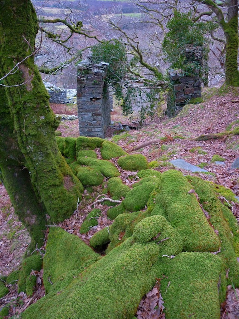
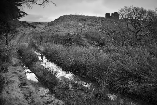
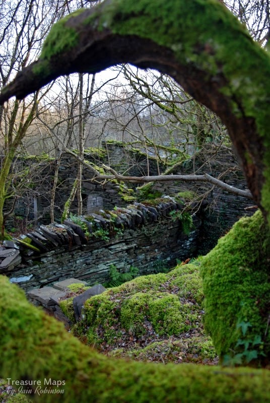
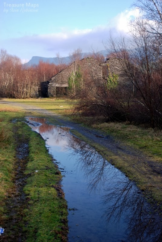
I was a little hesitant in publishing yet more photos of the Holman Cornish engine house at Dorothea. After all, there are hundreds of photos on the web, most taken in the last few years. When you dig a little deeper and look for information, most people seem to have paraphrased Dave Sallery's excellent description on his web site, adding nothing more of interest to the discussion, which goes round and round.


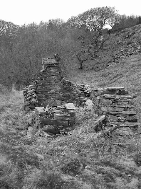
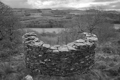
In a way, this echoes the events on the ground. A world-class chunk of industrial archaeology slowly sinking to ruin because no consensus can be reached over funding or care. A look through the 
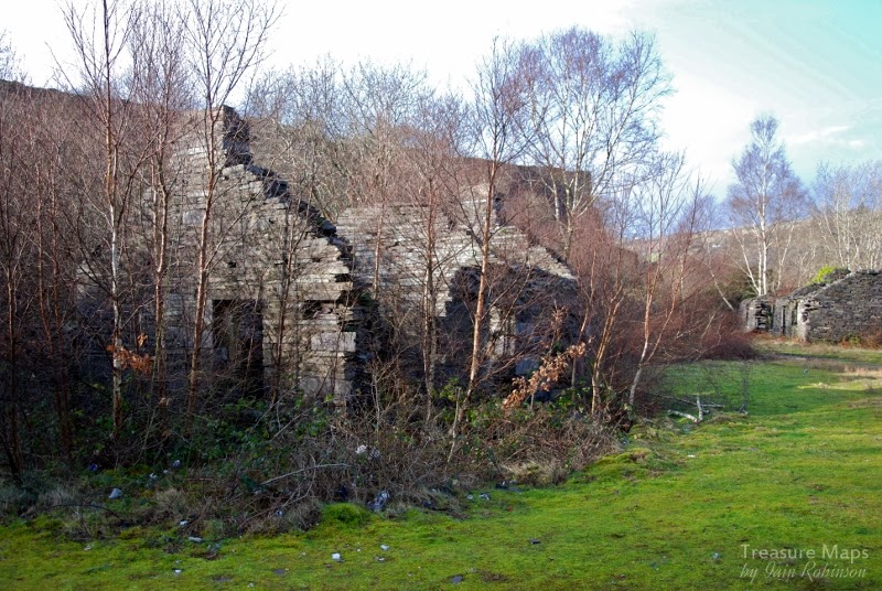
Coflein catalogue of images will show just what has been lost at this site in the last few years. There's more than a little will to do something about it- the people of the vale, for the most part, seem to appreciate what they have got. There are things going on, quietly in the background, but at a geologically slow pace. Meanwhile the artefacts in the quarries that make up the Dorothea complex slowly sink into rubble and rusty oblivion.


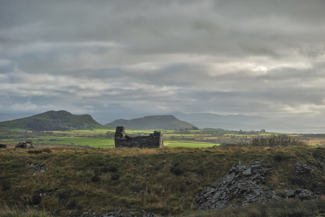
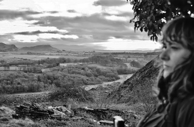
I don't really mind: I like my industrial archaeology rusty and forlorn and I hate the suburbanising of spaces as has occurred on other sites with their interpretation boards, trails and visitor centres...the "National Trust" effect. I just hope the alternative isn't the no-man's land of "landscaping" or bulk extraction, rather than careful conservation. Whatever happens, the area is a haven for wildlife and is much loved by local people. It needs to be handled sensitively, or not at all.


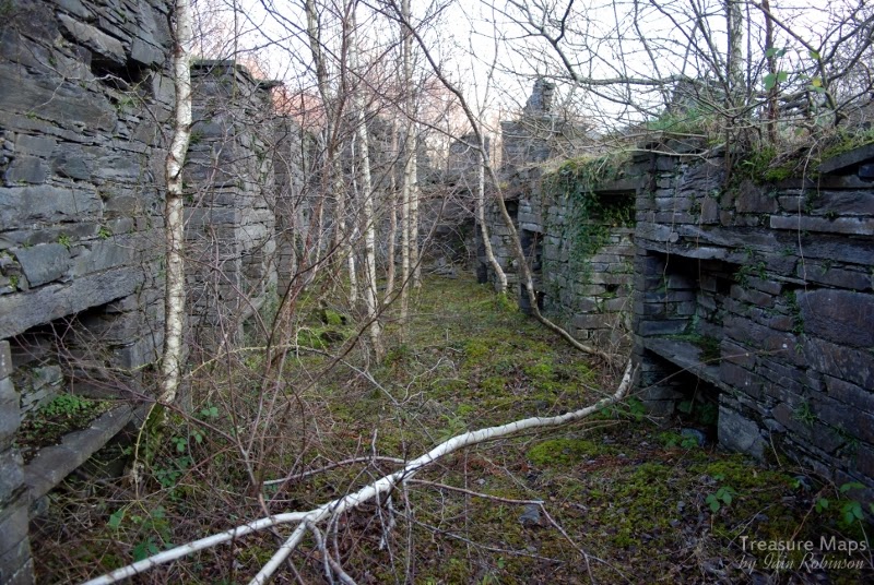
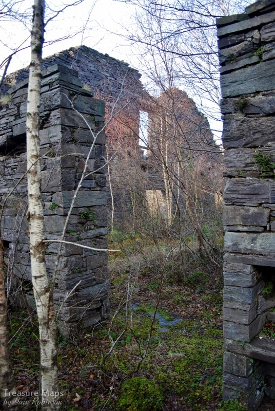
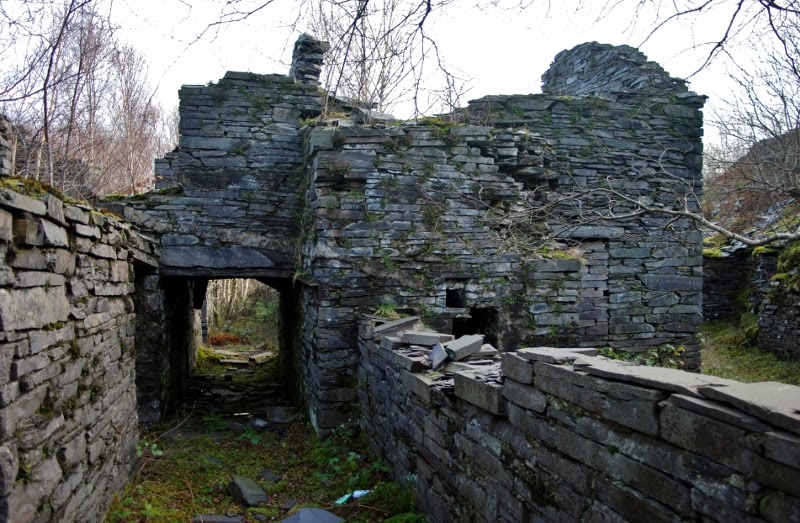
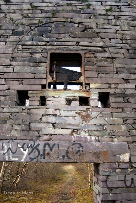
A significant fact, if one were needed, to justify the importance of the site is that the design of the engine at Dorothea is fundamentally unaltered from Newcomen's original of 1706. That this engine was one of the very last Cornish pumping engines to be erected, 200 years later, is an incredible thought.

Some notes on the early years of the Pump Engine House.

View of the sinc from across the quarry on an undated postcard. This shows the pyramid with chain inclines and the original chimney of the Engine House on the right.
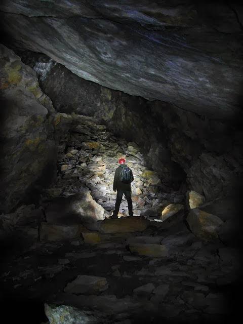
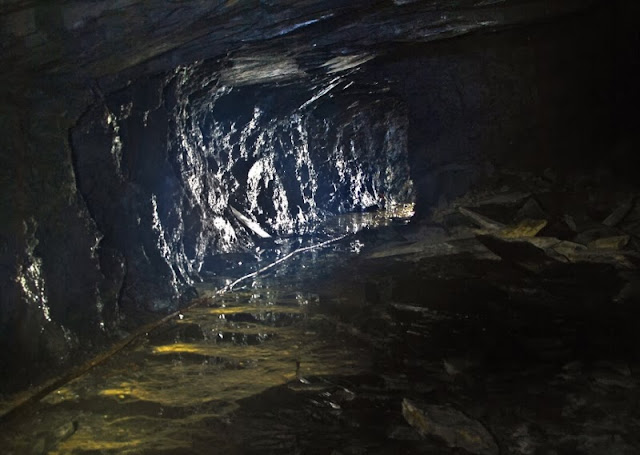
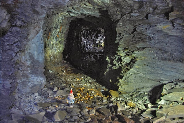
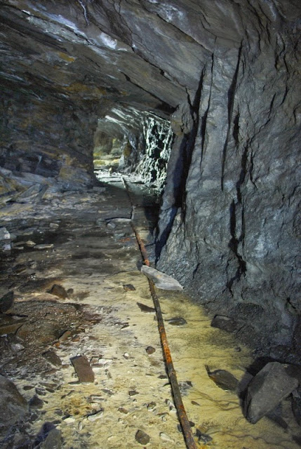
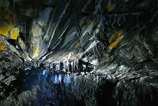
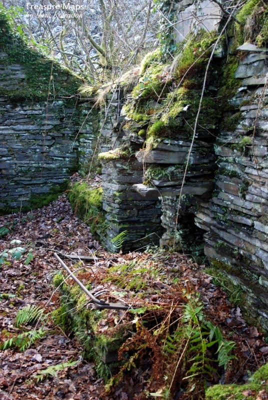
Walking around the place, with it's Lancashire boilers and various mysterious looking fragments of pipes made me think of the difficulties experienced in the earliest days of construction at Dorothea. The technology of the engine might well have been old school, but the problems faced at the quarry were very much of the immediate kind.

Documents from the Dorothea papers* shed interesting light on the difficulties. The sinc, or quarry pit, had attained a depth where it needed to be de-watered, in order for extraction of further slate to take place. Various pumps had been tried, notably some from H Owen & Son, Caernarfon. These were worked with steam from the winding engines, for instance, "steam from engine number 12, gallery Quarry C which was idle" according to notes made by the quarry manager. It was to no avail. It's difficult to see how the sinc was dewatered prior to this, possibly by buckets attached to a chain incline, but one thing was clear, something had to be done and soon.

In 1899 the first sods were cut for the "Big Shaft" and it's sinking done by John Williams and Owen Powell, likely small-time, but skilled local contractors who would hire gangs of men as and when needed. The shaft was to be 155 yards deep by 9 feet square. At the same time, a tunnel from another shaft, dug simultaneously in the sinc was to be driven, 135 yards away laterally, to meet the big shaft. It took 19 days to dig through topsoil and overburden (such as glacial till) to reach rock. A temporary engine house and head frame was soon needed to lift the spoil from the shafts, and a new winding engine ordered. It must have been quite a scene of activity, with the smoke from the engines and men and horses manoeuvring equipment and spoil.

An engine from Ruston's, similar to the engine used at Dorothea to pump water from the shafts. Engraving by courtesy of Graces Guide.
Another engine arrived from Nantlle station on 5th April 1901- a Ruston and Proctor 6nhp semi-portable. It was needed, as water was beginning to be a problem in both shafts. Then, on August 7th 1901, the granite was encountered, underlying the slate vein at 40 yards depth. This was actually pre-Cambrian porphry, the first time this had been encountered at Dorothea. Water flowed in copiously and the shaft had to be constantly pumped and bailed out by hand. Eventually, at a depth of 90 yards, (30 yards deeper than the South Dorothea sinc) the miners had to give up until steam pumping could continue on a 24 hour basis.


New pumps were requested from Joseph Evans, Wolverhampton. Their representative was a Mr Brindley, who "laughed when he heard that the quantity of water to be raised from the shaft was only 350 gallons per hour" Brindley recommended two smaller pumps, to be powered by yet another steam engine, a Robey 14nhp, working at 60psi. It would also have to drive ventilation fans and the winding engine, so was perhaps not such an extravagance.

The pumps were assembled and put in place on 21st December 1901, but proved impossible to start. The quarry engineers tried from the Saturday continuously through to Sunday night, but went home, exhausted and disheartened, "saying they could do no more".  Brindley was sent for and announced that everything was "capital work" but failed to make the pumps function. He announced to Hugh Williams, a fitter, that "A doctor cannot cure every patient" and left without informing the quarry management. Brindley was to be back again several times at the behest of Dorothea. Owen Evans, from Caernarfon, (the supplier of the original pumping equipment for the sinc) was asked to intercede with Brindley.

Brindley's response was that "In as much as the pumps had gone for an hour...they ought to go on for ever." Evans asked him why they stopped so often but he could not say. He then left, "on the 2.05 train from Talysarn" not to be seen again. On January 1902, the pumps and pipes were raised from the shaft, "being quite impracticable for the place."

Work stopped, and the expedient of driving another tunnel from the Twll Coch sinc was tried, in order to drain the shaft. On July 16th 1902, miners broke through, tapping the water and draining the big shaft. Work continued with further minor difficulties due to pumping until May 1903, when a fall in the sinc blocked off the shaft and buried engine, drum and pumps. This took until July to clear and in the meantime, the big shaft was allowed to fill up with water.

At last, the quarry's luck began to turn as the miners in the lower tunnel encountered a fault in the rock and "all the water that was coming hitherto into the shaft came into the tunnel".  Work continued until the required depth was attained in November 1903. It had taken them slightly more than three and a half years, without a single injury to the workforce.

The first foundations of the engine house were laid by Evan Thomas, mason and his gang, on June 21st, 1904. In October, the beam of the "New Engine" arrived at Nantlle station and was found too heavy for teams of horses to pull. It had to be hauled by a traction engine, hired from Abergele. The pumping engine took until June 1905 to be assembled, whereupon a great many teething problems were experienced, some due to the engine and pumps, some due to the brick lining of the shaft allowing water in to the shaft.  Eventually, on August 21st, 1906, the pumps began to work properly and "have worked since without any trouble" (W. J Griffith)
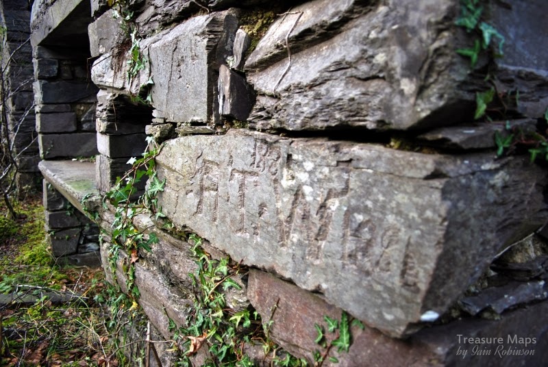
Some factoids:
The engine in the house weighs a little over 91 tons 3 cwts. and has a 68" bore cylinder.

The main beam weighs 22 tons, 12cwt.

The first engine house chimney was made from two old boiler tubes, weighing 6 tons and 60 feet high. This was later replaced by a cast concrete chimney.


Sources:
Power from Steam: A History of the Stationary Steam Engine By Richard L. Hills
*The Dorothea papers, Gwynedd County Record Office 614 and 627.
Alan Carr, "Dyffryn Nantlle, A Landscape of Neglect"
Great thanks to Petra for sourcing the archive information.


Dorothea Mill...fragments of time and mystery.

$
0
0
Photo 1.  Numbers correspond to places on the key map.
Nature is always there, patiently waiting.  Until we leave somewhere unattended and forgotten for a few years. Then she moves, with stealth and relentless energy, to transform the marks made by man.   One such forgotten place is the Dorothea slate mill, in the Nantlle Valley.

On the lip of a giant crater and surrounded by looming citadels of slate waste, it is a place so changed by nature and time, that walking inside the vast  machine area of the mill feels like taking a stroll through a forest. Birdsong echoes from the walls. The low beams that gave the place it's human scale have long gone, as have the saw tables. Sky is the roof, fringed with waving birch, while blackbirds bustle where the hoggia felin used to split the crawiau tenau into countesses. It now takes the eye of an aficionado to see the marks where the journals for the line-shafting used to sit, or the scoring on the slate wall caused by an ill-fitted flywheel.

Photo 2.  Inside the dressing area, where the men would split and trim the slates. The alcoves are notable...I wonder what they were for. 


So I was rather delighted to find the photographs below of the mill, taken by Tim Venton, on the 8th of July, 1974. The place had been abandoned then, of course. It had been lying quiet since 1968. The scrap man had taken all the metal of value, while the slates had been stripped from the great roof. No doubt the mighty beams would be next, to be re-used somewhere else. But these wonderful photographs mark a point in time, helping to make a little sense of what we see today. The Victorians and Edwardians didn't go too much for photography unless it was of a group of smug folk standing round an aspidistra. Photographs of a slate quarry would have given them a fit of the wilts and vapours.  I'm just glad that Tim didn't have any such misgivings when he visited that fine summers' day in '74.

Photo by courtesy of Tim Venton

Photo by courtesy of Tim Venton. Taken from the tip run along from the eastern pyramid in 1974. 


Today,  there's a well-trodden path beside the mill. When we stopped for a couple of hours to take photos, we were aware of folk nearby, walking their dogs or just out for a stroll. Most passed by without much of a glance, except to give a friendly greeting. A couple of folk stopped and gave us little snippets of information about the place, local pride showing in their smiles. I'm always keen to get any local information from real people as opposed to books and archive finds, even if it is sometimes coloured with a sprinkling of mythology.

Photo 3
Absorbed in looking at the back of my camera, "chimping" the shots, I didn't hear the two lads approach. The first thing I saw was a pit bull looking at me, gimlet eyes evaluating my ankles for chew value. Then I clocked a young guy, early twenties, standing slightly too close, sizing me up. He was holding what looked like a rifle, but was probably an air gun.  His mate, obviously the lieutenant of the duo, hung a little further back, waiting to see what would happen. They were the classic "hoodies" of urban repute. Just like my son, who is about the same age. I bent down to the dog, who immediately responded, licking my hand.
"He likes you", the guy nearest to me said, with what sounded like an ironic laugh. "Nice camera."
I stood up, surreptitiously wiping off the pit bull drool on to my disreputable, bramble-harried exploring jacket, telling him that I'd been taking photos of the old mill for the last two hours. The vibe immediately changed. Both the guys were smiling now. "Have you seen the engine house? The mansion over the other side of the twll? There's a tunnel there, my taid said it goes to the next village..." I could have said that I knew about the mansion, although not much, I admit. But I hate it when folk go yes, yes,  they know. So I nodded politely (there was still the matter of the gun, remember.) As it happened, I did learn much of interest from the lads. Among other things, they told me they were off to shoot tigers. As the current buzz-word goes, that's proper "re-wilding" for you.

Many thanks to Tim Venton for permission to use his photos of the mill in 1974.

Photo 4, the forge.
Photo 5. A nook behind the hearth for the furnace blower.

Photo 6. The hearth, with a chunk of metal that the scrap man missed.

Photo 7. One of the rear two-storey bays, housing machinery -probably some kind of engine- for powering the line shafting. Note the rubbish tramway passing under the extension at the back of the mill.
Photo 8. The West end of the mill. The other end can be seen as a light green square in the distance.
Photo 9. From upstairs in the two-storey bay structure.
Photo 10. The west end of the mill with Y Garn in the distance.
Photo 11. Marks from a flywheel and the cast horn guide box from lineshafting at the eastern gable end of the mill.
Photo 12. Some vintage graffiti: "A.T.W  1886."
Photo 14. The waterwheel pit on the edge of the Twll.
Photo 15. The East end of the mill.

Photo 13 . The Quarry Manager's office. I wonder if it was in here that the discussions about the Pumping Engine took place with W J Griffith and Brindley, the representative from Evans' pumps?


Key to photo locations.

The Dorothea Files 6: the Chapel at Plas Talysarn

$
0
0


When I first glimpsed this structure, it was from the tramway that skirts round the back of the Plas. It was getting dark, I had given up photography for the day and was just mooching about, enjoying the slightly spooky atmosphere that this place has. In the gloom, I saw a gothic window looming from the ruined walls below. I wasn't really surprised, there are so many intriguing features at this site and it seemed logical that the Robinson's, the owners of the Plas, would have their own arrangements for worship.

On our next visit, we walked straight to the chapel by taking the turning off the tramway at what might have been the original gatehouse for the Plas, just after the Talysarn pit, known to local folk as "Glen Cottage".


Passing between a pair of ornamental gateposts, we walked along a quiet sunken road, surrounded on both sides by slate bastions. The moss has covered these and trees have encroached along the way, over- arching the road and giving a magical effect. The chapel comes quickly into view, guarded by yet more ornamental gate pillars, while a mighty tree has grown out of the wall between them, dwarfing everything else.


I was surprised to find that inside, there had been two storeys, with a large fireplace in the lower storey. While internal partition walls have fallen down, it is obvious from the layout that a complex of apartments were installed at some point in the structure's life. It is cheek by jowl with the Plas stables, a door giving access to a jumbled arrangement of rooms in a most confusing manner, as if it had just grown. I wondered if this had been a summer house, or lodgings for the horse groom after it had been a chapel.


It seems that the reality is even more complex.

While researching the quarry, that I found various notes on the internet by the late and much lamented Dr Gwynfor Pierce Jones, the undisputed local authority on Dorothea. With the help of these hints, and by dint of some local information and my stumbling translation of his book about the quarry, I was able to flesh out the story a little more. We know that the Plas was built in 1825 on the site of a C17th farmhouse, and certainly the lower storeys here look old enough to be C17th...the stone is different and the coursing, too, in the lower sections, while bricks and slate are used on the chapel.

According to Gwynfor's notes, the chapel was at first a private place of worship for the family. The first Church in Talysarn itself was built in 1871 and paid for by John Robinson, the owner of the Plas and Talysarn quarry. This was the Church of St John, which had a stained glass window dedicated to Robinson's first wife, who had died prematurely.

The porch entrance to the quarry offices, at the back of the chapel.
It is probably safe to say that from that date, the chapel would have been surplus to requirements, and the notes hint that the place was converted into a rather grand cottage and lived in by the gardener. The rear portion, connected to the adjacent building by a haphazard range of passages and rooms, was used as the offices for the Talysarn Quarry company, which would have been an easy commute for Robinson in the mornings! (Although it was said that the man was an unusually "hands-on" employer, and liked to take a turn with the men in the pit, working the blocks of slate.) After the Great War, the chapel was completely taken over by the quarry as offices.

But, still nagging at the back of my mind, is the hint that the building might have been a gatehouse, which I don't feel rings true. Originally, "Glen Cottage", near the Talysarn pit, was a gatehouse and stood at the end of the road. The chapel was too close to the Plas, admittedly at the end of the stable range, but hardly a gatehouse. Unless the C17 farm was used as the foundations for the chapel and the stables and administrative block were built later. As yet, I have not been able to confirm this. As usual, what we find out just serves to highlight more mysteries that need to be solved.

That's not quite the end of the story, though. Gwynfor says in his notes that the building was gutted by fire in the 1950's and that, many years later, the arsonist confessed his wrongdoings. I wonder if that had been over a pint or two of Marston's Pedigree Ale in the Nantlle Vale Hotel...

Sources:
Chwarelyddiaeth Dyffryn Nantlle, Gwynfor Pierce Jones, Cyngor Gwynedd, ISBN 0 901337 94 3
Dyffryn Nantlle, a Landscape of Neglect, Alan Carr, Village Green Publishing 1996, ISBN 0 9529244 1 2
Dorothea Diving Group on Facebook
Various conversations with local people including John Pen-y-Bryn...thank you.


The Mysteries of Pen y Bryn

$
0
0
Pen-y-Bryn Upper Mill, with the Nantlle Ridge in the distance.


The Dorothea Files: No. 8

Pen y Bryn is a lovely old site, north of the main pit at Dorothea. It rambles for a mile and a half up the hillside, squeezing itself between two mighty neighbours, Cilgwyn to the north and Pen yr Orsedd to the east.
All old quarries are something of a mystery, but this one is rather special. At the southern, lower end it has a range of buildings that date from the C17th,  a fine early 17th farm house and the remains of a C19th mill and steam engine house. There are at least two visible pits on the lower level, both worked out and tipped over, but still frighteningly deep. Over the years of silence at the quarry, nature has enthusiastically re-interpreted the place, doing a fine job. The lens of history is further clouded by the long period of activity here, from 1770 right up until the 1960's, with a good few fallow periods in between. Later developments, such as tipping and a new access road to Gallt-y-Fedw have confused things on the ground.


On the upper levels, in the shadow of Cilgwyn, there is another very deep pit and a long, swooping incline back down to the Nantlle railway. There are mysteries up here, too. But, first, let's have a look at the lower workings...

The C17 farmhouse that gives the quarry it's name.

The lower structures have an air of romantic decline. At dusk, when we often find ourselves still wandering around trying to record the place, it can feel a little like a film set for a victorian ghost story.


There's a row of very old cottages, photo above which pre-date the quarry. They have ancient beams, planed to shape with rough hand tools and the walls are made from igneous rock. The few slates remaining are of a considerable size, (probably Duchesses*) and I imagine they replaced smaller, "moss" slates quarried from outcrops by the builders back in the 1600's. Richards suggests that the cottages were used by the quarry as barracks accommodation from the 1830's.


Here we see the beams from inside the cottages, which are now sadly falling in to disrepair very rapidly. The walls show evidence of much re-modelling but obviously, the original layout was that of a "crog loft" - headroom must have been pretty minimal. Later, internal alterations are built using slate waste blocks. Note the length of light tramway rail poking out from the wall!


One of two fine arched windows in the row photo above. The view out from these structures is magnificent, even if the interior accommodation was sparse.
The farmyard is shared with the remains of a substantial slate mill...


Until fairly recently, the mill contained the remains of a vertical steam engine and other artefacts. Sadly, most quarry companies give scant regard to the archaeological significance of what they have and Roberts of Ffestiniog were no different in this regard- the engine was sold for scrap when the quarry was re-worked by them in the 1960's. Now the mill contains an impressive selection of old rusty bedsteads, the elders of a mighty clan who have scattered themselves all over this site and neighbouring Gallt y Fedw. I imagine they make handy and economical fencing and gates.


One of the lower pits, above, which was partially infilled with slate waste from the neighbouring Gallt-y-Fedw quarry. This was taken from the west side of the pit. The path to the higher workings goes up the opposite side.
Walking along the side of the pit, various workings and structures appear beside the track. Most are very difficult to explain, even with reference to the 1889, 1900 and 1960's 1:25,000 Ordnance maps of this area. For instance, we puzzled over this, below. Was it a feature for an aqueduct, a blondin base...or what? A depression cutting under the track lies parallel with it and is marked on the 1889 map as disused, perhaps when the pit was abandoned for workings further up the hill.


A large housing for a waterwheel also comes into view along the track to the upper workings. There has obviously been a system of leats for power, pre-steam engine days. Five minutes more walking uphill leads to the top mill, where the mysteries start to gather. Reading the late Dr. Gwynfor Pierce Jones's excellent book, "Chwarelyddiaeth Dyffryn Nantlle" I get the impression that the upper quarry was a later expansion...but it could be my Welsh, which isn't great. However, I think he suggests that there was unsuccessful effort to develop the highest land at Pen y Bryn as a new quarry in 1923. There had been a pit and a mill here certainly since 1889, although a glance at the satellite view will show how much it has grown since then. The enterprise failed due to the cost of removing overburden and of removing rock from the pit and it closed in 1932, although further attempts to work it were made in 1949-51, and in 1963, but to no avail.

What has been left is a very deep pit, a long incline down to the Nantlle railway, the remains of a fine mill and a smithy. Several adits lead into the pit from below. The top one is open, but leads to a ledge over 100 feet above the bottom of the pit. Other adits and drainage tunnels lead off the long incline, but according to the maps, these were out of use by the 1900's. The lowest adit is a very long one and ends in a collapse after half a mile.
This is a mystery. If it led into the pit, where would the rocks be processed? Surely they wouldn't be dragged all the way up the pitches of the long incline to the mill. Pen-y-Bryn was taken over in 1832 by Dorothea, but it seems unlikely that produce would be hauled to the Dorothea mill from here. Because of it's elevation, this tunnel must have been a late enterprise; I can only think in order to access the pit floor...although another mystery is the lack of exploration spoil from the tunnel, unless it was tipped into nearby Twll Mawr.


This is the top level, above looking across to Pen-yr-Orsedd through a breach in the tip tramway embankment.  Below, a view from the crimp of the top incline looking down on the tip and smithy. The mill itself contains few clues as to how it was powered, but the remains of a very large bore pipe suggests perhaps a water turbine- although just where the water came from is yet another mystery. There's no obvious water on the site.


Below is a shot of the mill, with the incline down to the Nantlle Railway going off at the far end. Nearer to the camera, the smithy sits in a confused area of rubble, while the incline to the pit rises to the right. A tunnel to the pit drives into the slope from the nearest side of the pit incline.


Finally, a couple of underground shots to round off the post. Scroll down past the factoids to see them. There's still a great deal to be learnt about this quarry, and I will update when I find out more. Perhaps when my Welsh language skills improve!

Some factoids:

* A duchess slate is 24" x 12".

A feature of the Dyffryn Nantlle style of quarrying was that exhausted pits would be tipped over and filled in. There are remains of pits here and there while others simply don't exist any more...this becomes apparent when studying the old OS maps and surveys. Pen-y-Bryn incorporated Cae Cilgwyn, Herbert's Quarry, Twll Penybryn, Cloddfa Lon, Dew's Quarry, Hen Dwll, Twll Balast, Twl Mawr, David's Quarry, Middle Quarry, New Pen y Bryn, Owen's Quarry and Twll Ismaliod.  Some were absorbed into ever expanding neighbouring pits, as at Twll Mawr, others just disappeared under thousands of tons of waste.

Pen y Bryn was an early adopter (1830) of the Chain Inclines which were so prevalent at Dorothea before the advent of the Henderson Patent ropeways.


Looking out to the pit from the top adit.

The long lower tunnel, here strengthened by some walling. The course of the tunnel runs very close to the walls of Twll Mawr on the one side and an old infilled pit on the right hand side. This tunnel ends in a collapse and has a generally fragile feel to it...we didn't spend long in here!


Gallt-y-Fedw Slate Quarry- more Nantlle magic.

$
0
0


Gallt-y-Fedw means "The Birch Hill". How things change -the predominant vegetation these days seems to be various satanic strains of bramble, gorse and bracken. Oddly, around the mill area, a variety of Cotoneaster has grown over the structures, cloaking them in dark green. At least the stuff isn't prickly, and it makes a change from being tripped up by mischievious bramble tendrils...

The remains of this quarry, known variously as the Alexandria, Victoria and Y Foel, lies to the north of the Dorothea pit, just below the mighty tips of Cilgwyn. It's an interesting place, but what old slate quarry isn't? For me, it's charm lies in the atmosphere, the views over to the Nantlle Ridge and the curious mixture of buildings, some of which date from the earliest days of the quarry.

The crumbling bastions...how much longer?


As you walk past the Dorothea pit, the massive bastion walls of Gallt-y-Fedw are a constant presence, beetling above on the left. A couple of old inclines bisect the bastions as they come down to the tramway level, but ascending by this means would be dangerous. Better to take the 1960's haul road through Pen-y-Bryn and watch the views of Y Garn and Mynydd Mawr gradually open up towards Drws-y-Coed, to the east.
Once at mill level, which is really a man-made plateau of thousands of tons of slate waste (hence the bastions) a clutter of buildings comes into sight. It's a confusing place, constructed at odd angles and juxtaposed in a random manner. I could only think that things were added to and reconstructed over time. Engine and machine mounting bolts bristle atop mighty slate plinths while a boiler house and a machine house sit in a slightly elevated position. All that remains of the mill itself is a large and imposing end gable wall. We've been visiting this site for a few months, and on our last visit, I confidently expected to find that the wall had been blown down by the terrific February gales that swept through. But no, it was still there. It must be made of stern stuff.


An impressive incline formation comes down through the site from Cilgwyn, swooping to join the Nantlle Railway below. There doesn't seem to have been a connection from Gallt-y-Fedw on very early maps, the quarry using an incline which goes steeply down to the tunnel behind Plas Talysarn . The Cilgwyn incline is crossed, however, by a much later tip tramway heading east where the old Pen-y-Bryn twll was used for rubbish. Records show tramways here from 1857-1901 and in two differing gauges, 2' and the Nantlle gauge of 3'6". Perhaps the more southerly incline used this gauge from the mill at first, then a new incline was constructed beside the mill, which dropped over the Nantlle tramway and then joined it near to the side of the Dorothea pit. The 1912 Ordnance map shows the tramway was still an extensive system at that date.


The quarry pit on a rather dreich January afternoon

The main quarry pit is to the west of the mill and describes a shallow arc. It is tipped into and there are the remains of many walliau and also machine houses on the bastions. Richards* states that material was raised by a steam engine, probably powering chain inclines. As many as six saw tables were sited up here. I wondered if much of the output was slab, there were some particularly fine big chunks lying about. The pit is not so deep as others here, probably only 150'. It contains a drainage adit with a curious step and launder along it's course- apparently the tunnel was driven from both ends and there was a slight miscalculation when the two bores joined!
The official figures show yearly tonnages for the quarry in the hundreds, with between ten or twelve men employed-  yet the mill was a large one; the 1912 map shows a big area and the mill can be seen in the background as an imposing structure on many photographs of the area in the 1900's. The quarry was acquired by Dorothea in 1933, but was never worked further.


While on the pit level I really ought to mention the office, which has a wonderful patterned slate roof, now hanging on for the inevitable collapse. It might be good for a few years yet, given the bravura performance of the mill gable wall... There's also a length of fish-belly rail here, impossible to photograph with any meaning unfortunately, so you will have to take my word for it. *Richards waxes about the "Fine Privy structure" near the office, which I noticed, but privies aren't really my thing so I didn't take a photo. Uphill from here is a small and enterable drainage adit, probably from the older, original workings. There's also a strange round structure in the woods, about 30 metres in diameter. It looks like a holding pond for water, perhaps. Nearby are a couple of very overgrown buildings, possibly a smithy, so perhaps the round structure was connected to that.
"In a tight spot!"
On one of our visits, we climbed through the gorse and bramble on the old Cilgwyn incline and found the intermediate drumhouse high above the site. Hacking through the undergrowth, we eventually descended back by the old quarry, past a lovely little powder house. This part of the quarry is more-or-less jungle, but the discoveries are delightful. I have no idea what had happened here, in a little smithy structure...

Taken with hardly any available light and hand held!
It often seems to be later in the day when we arrive at Gallt-y-Fedw, after having wandered around Pen-y-Bryn, or having been talking with local people (gently "grilling" them for information). One such told me that the engine here at the pit was a De Winton and that there was a locomotive working along the mill level. I can't find any reference in the records of that. These are memories passed down from fathers in the nineteen thirties to sons who are now in their eighties and can't be totally relied upon, sadly...yet they are precious, and illuminate the place for me. My natural reticence prevents me from fully exploring all the stories about this place, of which I am sure there still some to be discovered. Perhaps it is part of the magic. On our latest visit, I was content just to appreciate the wintry sunset, bathing the Nantlle ridge a pale magenta, while listening to the birds and thinking how lucky we were to be in this spot.

References:

Richards, Alun John (2001). The Slate Railways of Wales. Llanwrst, Wales: Gwasg Carreg Gwalch. ISBN 0-86381-689-4.

*Richards, Alun John: Gazetteer of the Welsh Slate Industry Published by Gwasg Carreg Gwalch, Wales, 1991  ISBN 10: 0863811965

Boyd, James I.C. (1990) [1972]. Narrow Gauge Railways in North Caernarvonshire, Volume 1: The West. Headington, Oxford: The Oakwood Press. ISBN 0-85361-273-0.

Jean Lindsay.: A History of the North Wales Slate Industry , David & Charles, Newton Abbot, 1974.

RCAHMW Collection ref: C480586, 7.

The intermediate drum house on the Cilgwyn incline above Gallt-y-fedw.


Moel Tryfan

$
0
0


Scooped out of the side of the pocket mountain that gives the quarry it's name, Moel Tryfan (or Cloddfa'r Foel) is an impressive place. The tips are monumental as they rise five layers up, while the pit is spectacular enough to have been featured in several movies. It does have that "lost world" feel, although it must have been infinitely more spectacular when it went down to the full depth of the sinc.

At the top level, the pit joins the void of the Alexandra quarry, seperated only by a tooth of igneous rock. It's a wonderful site and well worth a day's exploration


As with most quarries, it has suffered a chequered history, not without drama. Unlike many in the area, it was successful, although plagued constantly by problems with falling rock and lack of investment.

The earliest mention of the quarry is back in 1745 when a lease was taken from the Crown estates although nothing significant seems to have been done until 1824, when a consortium of Caernarfon artisans took a lease on the sett. These men, two Jones Brothers and another unrelated Jones dug a small quarry near to the office building that still stands (just!) at mill level. They also started to dig further up the hill, which was later to become the twll mawr.


The quarry changed hands a few times, with problems due to the Crown's lax handling of the lease, incompetent management, thieving employees and of course, rockfalls. Several men were killed in a major rockfall in the main pit in the early 1840's. Five different lessees tried their hand at the quarry before 1876, all of whom invested heavily and came up against the same problems. While good rock was certainly to be had, sometimes the slate beds were elusive, sometimes they were gritty, had lacy veining (gwniadiau) or had "wild split", cleavage which shattered when split.


Eventually, the leasehold was sold in 1876 to local slate merchant Griff Williams, bankrolled by a band of adventurers who included ship owners, drapers and bankers. Williams built a new long incline and tramway to the Bryngwyn Drumhead of the NWNGR. In one move, the quarry was to become profitable; it was, in fact, one of the largest customers of the line, which closed shortly after Moel Tryfan's output went over to motor lorry. Immediately that the railhead became operational, the quarry's sales increased- £7,400 in 1886, then in 1903, £22,413. But this came at a cost. Rock fell regularly in to the pit and had to be manhandled out. In November 1909, 421,000 tons of rock slipped from the North face of the quarry, completely filling the pit.

Rail fans will know that the quarry was home to two curious "Quarry Hunslets", similar in specification to the Dinorwig "Alice" class, but with cut-down chimneys and cabs so that they could run through the very narrow tunnels connecting the mill to the pit.

Cliff Thomas, Quarry Hunslets of North Wales, Oakwood Press

Later production was never again to reach those pre-fall levels, although somehow various quarry lessees managed to keep things going, often profitably, despite the constant worry of rockfalls and the expense of pulling rubbish out of the pit. Foolishly, to save money short-term, waste rock was often tipped into the pit, making it difficult to access new slate. In 1918, the quarry immediately next door to Moel Tryfan, Alexandra, was merged in a move which also included Cilgwyn. Machinery was re-used  and some of the Alexandra pit was used to tip rubbish.

Incredibly, worthwhile extraction of slate took place up to the late nineteen sixties- in 1962 there was a workforce of 35 men, but more serious rock falls in 1968 and in 1970 made things ever more difficult. Finally, in 1972, the Safety Inspectorate condemned the work face, and the end was signalled. Since then, there has been tip reclamation and extraction of hardcore by various concerns- the latest being a Caernarfon based road contractor.

Sources:
"Cwm Gwyfrai - the Quarries of the North Wales Narrow Gauge and the Welsh Highland Railway" by Gwynfor Pierce Jones and Alun John Richards, Garreg Gwalch, ISBN: 0-86381-897-8

"Gazetteer of Slate Quarrying in Wales", by Alun John Richards, Llygad Gwalch, ISBN: 1-84524-074-X

 "Quarry Hunslets of North Wales", by Cliff Thomas,Oakwood Press, ISBN: 0-85361-575-6


Misty Moments at Ty Mawr

$
0
0


Of all the mad, marvellous and utterly futile follies in this corner of Wales, Ynysypandy mill ("Ty Mawr" as the locals call it) is right at the top of my list.

Petra and I pitched up early on a misty morning with the weather forecast giving all sorts of gloomy predictions. It was obviously too dreich for quarry photography, but just right for a bit of atmosphere at this already magical place.


It looks like a monastery or an ancient abbey- I'm sure it fools many a tourist who has accidentally wandered down the wayward lanes here into thinking they have found a lost Cistercian masterpiece. The truth is possibly even stranger...

A couple of wealthy adventurers with money and optimism but little common sense pitched up in the area with a view to making a killing on a sizeable investment. They knew slate was plentiful here and were in a hurry to cash in on the success that slate ventures in Blaenau Ffestiniog had enjoyed. In the middle 1800's the climate of optimism about slate was such that even shopkeepers and their employees were speculating in shares, helping to float mining concerns, quarries, railways, and sleek sailing ships for the slate trade. I suppose Robert Gill and John Harris, the men who took over the lease for the Gorseddau Quarry in 1854 thought it was bound to succeed. Their background was in railway engineering and a slate quarry was a logical addition to their portfolio of investments.


If only it had succeeded, because they did it all by the book. The quarry was run on theoretically ideal lines, having everything (except slate, perhaps) that a modern concern would need. The mill was designed by James Brunlees (later Sir James), engineer of the tramway that was to take the finished product to Porthmadog and it's new harbour for slate carrying ships. He had designed several mills in the North West of England, which perhaps explains the grandiose proportions of the structure.

I guess everyone involved in the giant job-creation scheme that this had become was desperately hoping it would succeed, while the owners were in denial, ordering finest slates for the roof and £10,000 worth of top quality machinery from Caernarfon for the works. It is said that the mill had the finest roof in the area, which is saying something in this corner of Wales. Sadly, the slate from the quarry rather disappointed. It wouldn't split well and was only of use as slab. This can be seen today in the quarry pit. The rock is full of quartz intrusions and has been distorted by pressure. It also seems to have a different composition to Blaenau slate, with less of the "soapyness" and ability to cleave; probably due to the molecular distribution of the mica within the rock. Whatever the reason for the poor stone, the tonnages of sellable slate from the quarry were very low. At it's finest hour, only 7 man tons per year were achieved, as opposed to 14.7 tons per man in Blaenau Ffestiniog (Oakeley Quarry).


It was all over by 1867. For a few years, before the roof was stripped, the place was used as a meeting hall. Local eisteddfodiau were held among it's spacious walls-  it's  a shame the place couldn't have been kept for the local community. I guess, back in the rapacious Victorian era, when only the wealthy mattered, something like that would not be on the agenda, especially for such an out-of-the-way corner.  I am not sure why the shell of the mill survived; but I am glad it did- it's a little miracle to come from such a quixotic scheme. It's now in the hands of the RCAHMW and is open to the public. Go and see it, preferably on a misty spring morning, before the sun burns off the cloud and the ghosts of forlorn hopes and ambitions still flit about the walls.

A previous post with a mist-free mill here.

Sources:
LEWIS, Michael J.T., "New Light on Ty Mawr Ynys y Pandy", Gwynedd Diwydiannol/Industrial Gwynedd, vol.3 (1998), ISBN 1-871980-42-9, pp.35-49


A Room with a View

$
0
0


The scruffy quarrying settlement that sits above Pen-yr-Orsedd, overlooking the Nantlle Vale, is my kind of town. Y Fron is about as un-chocolate box as it is possible to get, and has no picturesque architecture that would interest tourists, unless they like studying rusty cars and the art of using even rustier old bedsteads as fencing. It does, however, command a breathtaking panorama acoss to the Nantlle ridge- and is steeped in fascinating history. Until recently, there was also the only surviving disused slate mill in the area with a roof, until a bunch of corporate vandals bulldozed it down...take a bow, Hogan Bros.  However, while the resultant pile of rubble does add to the general feeling of a Kentucky strip mining town, there's still a great deal of interest here for folk with a leaning towards local history and the delights of a post-industrial quarry landscape.
Fron Mill...what remains today.

Fron Mill, before demolition- Andy Chisholm, fatmanphoto.co.uk
I'm still gathering information on the John Robinson tramway which ran through Fron on it's way to Talysarn. It boasted a fleet of phantom locomotives, "imagineered" by the eponymous Mr. Robinson, that only existed on paper. Origami locomotives; perhaps... that would have given Charles Easton Spooner something to think about. The story of the quarries and the exploits of my namesake here in Fron reads almost like the script of "The Wolf of Wall Street"...but that's for another post, soon!

On one of our visits, we parked up by the Old Braich pit and were drawn to a track which disappeared between two tips from the Pretoria workings. The March weather was hellish, strong wind and stinging hail, so we walked on a little way, the iron westerly raging at our backs. We were reluctant to end the explore so soon, yet not wanting to make higher ground, where we knew the wind would be too wild.


Soon we were at a ruined farmstead, "Cors Fron", sheltering in it's lee from the gusts of westerly hail. The roof was partly collapsed, but the walls were still firm and strong...they would have to be in this location. Probably home to a a quarryman, this place would have been like a croft, a part-time farm. This was very common in the Nantlle area as a way of supplementing the meagre income from the quarry. As the weather temporarily abated, I noticed the remains of a car beside the cottage. It had rotted where it had been parked. In the grass I could make out the vestigial remains of the wheels, the engine, axles and the steering wheel. All the thinner panels had disappeared along with the glass, but there were no markings on the engine block. I wondered how long it had lain in this spot...for at least thirty years, I guess. I reflected on the trips it might have taken- sun-stroked days to Llandudno, perhaps, for a stroll on the front. More likely it drove to Brincir mart, with a couple of sheep in the back.


Inside the house, amid the racket of the wind moving things about, was a pathetic scene of dereliction. There were small, tell-tale signs of the people who had once lived here. The remains of an old lamp, fragments of a child's toy and a kerosene heater- testament to the freezing cold winters here in such an exposed spot. The atmosphere was augmented by the dead sheep that was using the place to rot down in. Not a bad spot to end one's days, I guess, with that view of the Nantlle ridge out of the window and certainly preferable to the current alternatives available for sheep.


Outside again and the wind hit us at full force as we bent double trying to take photographs. Petra found another fossilised vehicle, possibly a Land Rover and an ancient hay tedder/conditioner. Later, sitting in our car by the Old Braich pit, I reflected on how this would have been just another day for the occupant of that little cottage. He would have had to walk up to the pit to work, at least eight hours of back breaking toil outside in the weather, and then he'd have come home to tend to the animals. I can't imagine what a life like that must have been like -and I was brought up on a fairly primitive hill-farm myself.

Petra set our rumbling wheels on to the road home and I felt slightly guilty at having such a cushy number, driving a desk all day. I guess, though, that the view from that window would always be some consolation. My own, childhood bedroom window looked out on to the Merrick, the highest hill in southern Scotland. That view fascinated and supported me throughout all the difficult times of my young life. Thinking about that,  I resolved to come back on a summer's day and see the view from the cottage again, when perhaps the wind wasn't so strong and the sun was shining. That sheep might not be so whiffy by then, too...

Thanks to Andy Chisholm for kind permission to use his photograph of Fron Mill.

Cors Fron front door.

The view from Cors Fron to the quarry tips.

Viewing all 103 articles
Browse latest View live