Quantcast
Channel: Treasure Maps
Viewing all 103 articles
Browse latest View live

Hendre Ddu, the Slate Quarry hidden in the Mirkwood...

$
0
0

 Yes, another expedition into the dark legions of trees west of Aberangell, to find the long lost Hendre Ddu slate mine. As always, the adventure began by a few words of greeting to the ginger dog who keeps his post at the end of the tramway. (see previous article here). The road through the forestry uses, for the most part, the trackbed of the Hendre Ddu tramway, constructed in 1857. It was a narrow gauge feeder line from the quarry to the standard gauge Mawddwy Railway.. Deeper into the forest, the tramway splits into several strands as branches go off to various quarries- Fridd Gartheiniog, Maes y Gamfa, Tal-y-Meirin, Coed Cwm Caws, etc.

Tramway Junction
 We parked the car and walked on, following the "main line" which is signed to Hendre Cottages, themselves the surviving barracks for the quarry. It's well worth walking this section as there is much of interest to the mining enthusiast along the way, with old trials and levels appearing at the side of the tramway. The farm of Gartheiniog is passed, with it's outbuildings constructed of what looks like slate waste, then the foot of the incline from Hendre Ddu is reached, all but obscured by those mischief makers, the forestry commission. The trees are mature and very tall here, no doubt due for clear felling soon, heralding more chaos and difficulty, but perhaps the site will be easier to interpret.

Looking East from Hendre Cottages. The rain kept off...just!
 The forestry extraction road does a zig-zag up the slopes of Mynydd Hendre Ddu towards the mill. From here it's possible to see the tramway snaking along the valley. Sadly, the mill area has been cleared by our sitka-loving friends, leaving little but foundations, there being no sign of the turbine bases, or the mill which Richards says had 18 saws, 10 planers and a "Jenny Lind polisher*", whatever that was. The mill office has been spared, it's lower windows bricked up. It would make a fine holiday cottage for mine explorers or coniferous tree enthusiasts.

The less-than encouraging entrance to the level one adit.
 The tips here contain some massive chunks of slate from the chambers of the level one adit, which we found eventually. There is some fine chambering inside, although the fragility of the mine is betrayed by one chamber which has suffered a massive fall. A slate block the size of a minibus had fallen at the chamber entrance. Crawling around and shining the torches upwards revealed a perilous looking roof.

Large blocks on the level one tip.


Old tramway level in the woods

Further up the hill, there are tramway runs to the other three levels. To gain them, we walked up a downhill mountain biking trail, containing some fearsome looking berms and jumps. We decided we would stick to mine exploring, far less hazardous! We met a couple of mountain bikers during the day, both very friendly, despite the fearsome looking body armour.

Windblown trees lay all around, making progress difficult towards the pits. Petra wondered if this was troll damage, having recently watched the film "Troll Hunter" . I was glad I hadn't seen it, as apparently there is a sequence inside an old mine. Meeting a troll sometimes seems a very real possibility when underground due to my very fertile imagination.


A very wet trial adit opens up in the woods beside one of the pits, looking very unhospitable. The FC have erected some massive fences around it which proved discouraging... this time.
The pits were inaccessible from our chosen access point without ropes, which we didn't bring of course. Another foray will have to be made from the western side of the site, which is a little less spruce-infested.


There are several drumhouses in the woods serving inclines, and a mysterious structure near the incline which may have been a smithy...it has hardly any windows.


For now, a very interesting site which promises to reveal much more, providing forestry operations don't destroy the archaeology. Here are some underground shots ...as always I have to add the statutory message from the mine police, that exploration here should not be undertaken without the proper equipment and an experienced member of the party etc...the mine is quite fragile and care should always be taken not to disturb anything or spoil it for the rest of us..

At the junction outside one of the chambers..light is coming from the entrance. The roof is quite low at this section.

A very heavy-duty climbing chain at the entrance to the deepest chamber. Lights courtesy of Petra, who likes to see where she is going...

A surveyor's mark probably from the latter part of the mine's life in the 1920's to 30's
An old tub at the bottom of a shaft...oops!

Artefacts at the back of one of the chambers.

More artefacts

Looking outbye

.
* In the 1880s the Jenny Lind polishing machine was introduced (the machine so called from its humming noise, which was likened to the Swedish singer of that name).

This had a steel ring - shooting ring - which rotated over the dressed stone surface while iron shot and water were used as an abrasive. Finer polishing stages used carborundum then emery.


Wikipedia article about the mine and tramway.


Simdde Dylluan Copper Mine

$
0
0

Driving through the Nantlle Valley on the B4418 from Rhyd Ddu towards Cilgwyn, the seasoned mine explorer will find much distraction, tempting one's gaze from the road. As the route winds over the bwlch past Y Garn and Llyn y Dywarchen, a line of old leat pillars can be seen at the left hand side. These leats run entrenched from the Llyn all the way down into the Vale to Drws y Coed where tips and run-in adits can be spied all around the mountainside...among the scree slopes of Craig y Bera to the north, while to the south, among the vertiginous outliers of Mynydd Tal y Mignedd. In the valley bottom, an old chimney and some building remains have been taken over by a farm, where a large old dam has been breached. There's an interesting article about this here on the "Scandal on Ben Nevis" blog. The farm occupies the site of the Drws-y-Coed copper mine, it's underground workings largely obliterated.

On westwards from the farm, an area of workings can be made out above, in among the crags. These are the remains of the Talysarn copper mine. There are several adits and shafts- the adits are all blocked, but some stoping breaks out to bank and it might be possible to SRT down to lower levels. It is all very unstable and precarious. Further west and some tips are visible above the road, these are the remains of the Simdde Dylluan mine. Only one adit is explorable, and this is flooded to above the knees for a good way in. It is also quite low, certainly too low for me at a couple of inches over six foot. My back was aching as we explored. I know, big wuss!

The rather unassuming adit portal
"Bridge" and winch headgear over the winze.

The ladder down to a flooded level.

The mine was obviously of some age and passages went off here and there in a labyrinthine manner, including some rather alarming drops down winzes to lower levels. From the photographs on AditNow, these drops are well worth a spot of SRT for those with the necessary experience and gear. There were some nice formations including some blue mineral leaching from the copper as well as the usual iron and pyrites flows.

 As always with a mine of this age, the place is quite fragile, especially at the area of the stope, where as well as a deep winze, stoping continues above, and like the David Blick quote, "soared to the limit of our caplamps." A ladder continued down to water across a dubious bridge, the chasm crossed by ancient timber baulks. Elsewhere progress was impeded by a shuffle beside a shallow pool full of what I mardily imagined might be quicksand. All in all, as with most old mineral mines, a potentially lethal place, although the worst of it is that my back is killing me today!

A choked and flooded winze
Across the valley as we looked out of the portal, we could see the adit for the Benallt copper mine, another fairly deadly, if rather fascinating place.

Petra took a movie of our visit which has some rather nice footage of the "pretties" in the mine, so I've included some stills here.

Further information on the history of the mine can be gleaned here on the Nantlle Valley web site.

Footnote: The valley and mines were home to a remarkable woman in the C18 called Marged ferch Ifan
whose fascinating story is chronicled here.

Some of Petra's video stills of the mineral flows:


Delicate and very fragile straw stalactites
Copper sulphate flow
A little iron flow volcano stalacmite
My very muddy hat, torches and tripod/camera after emerging back into the light!.


Mono Memories

$
0
0

Here are a couple of photos from Petra's collection. I found two that I had forgotten about, but which bring back very happy memories. The header shot was taken a few years ago in the large open chamber at Cwt-y-Bugail. (North twll, C2.) My daughter Sam is to the left and I'm taking a photo in the background. It brings out the size and atmosphere of the place far better than any of my shots. To the right, out of shot, is the crosscut to C3 and 4. The water is usually cold underground, but I have never experienced water as cold as in the adit here. This was in summer, too. We're going back to take some shots of C4 soon, with our improved lighting rig. I think I'll be wearing two pairs of wet socks!!

The second shot was taken at Graig Ddu on the slopes of Manod, underneath the vast Manod Quarry. I'm walking out into a blinding hailstorm...obviously I'm a glutton for punishment!


Nantmor Mine

$
0
0
Some of the fascinating remains of the Nantmor Copper mine, in Cwm Bychan.Starting point: Nantmor car park, grid ref: SH597462
 

Above: one of the remaining pylons for the aerial ropeway built in 1927 to carry ore from the upper end of Cwm Bychan, down the valley to where the Welsh Highland Railway had laid a siding in. Before this, ore was transported along the Afon Glaslyn, a small quay having been built in the mid 18C. In those days, the river was tidal -before William Maddocks built the cob at Porthmadog.

Four pylons from the valley's original ore-transporting ropeway are still in existence, along with the concrete bases of others. Historical accounts show that the system wasn't a complete success, with buckets often said to hit the ground, spilling their loads. The remains of the ropeway add to the other features seen across the whole valley, with adits, spoils heaps and buildings signalling back to the area's industrial past. It's also an internationally scarce wildlife habitat. The type of heathland seen here can only be found in a few of the western coastal areas of Europe. This area is home to insects and butterfiles such as the grayling butterfly and birds including the wheatear and whinchat.


  The corroded remains of the sheave and supports at the upper terminus of the ropeway. Below: the sheave with the tip in the background. The traveller wheel and tub rider support looks, to my eye at least, like a rusty cat...


Above: The less-than inviting mouth to the flooded adit.

Above: The NE crosscut adit showing the hanging planar wall to the right with yellow sulphides and mineralisation of the quartz. This is in a dryer area of the mine. The entrance drive is wet up to thigh height for a good way, before rising slightly to a large stoped-out area.


Above: The adit, which drives in for 70 soggy metres.


Light comes in from the stoping, which breaks out to bank 20 metres above. Deep water again, here!


The grotto in the crosscut, showing plenty of mineralisation from Chalcopyrites in the walls. The rock seems to be a kind of quartzy breccia. Here and there along the adit some drilling has gone on to chase apparent mineral veining.


Looking up to the stoping. For some interesting photos taken from within the stoping, have a look at  Graham Steven's shots of the mine, here at Geotopoi..

The NW crosscut towards the forehead was driven into barren rock, the mineralisation rapidly disappears along with the quartz vein, with only sulphides leaching out, making the water a vivid orange colour.

  Gypsum crystals forming along the footwall- from a video still by Petra.  Here are some further snaps of the walk up to the mine:

A gnarled Oak on the way up from Nantmor to Cwm Bychan.

.Clouds above the Moelwynion, seen from the path. Lastly, a rustic timber seat which was gratefully utilised during our walk to the mine:


Although I show photographs here from our exploration underground, I must stress that the mine is extremely dangerous and any exploration should only be attempted by those experienced and properly equipped.

Hafod Boeth Lead Mine

$
0
0
 A tale of big cats and broken tripods...
The passage leading on to stoping

We first visited this mine a few years ago; it was a difficult mine to access and is even more so now - because the trees have grown up alarmingly since. Apart from staggering about around felled trees and falling down gopher holes, the climb to the adit was accomplished with only a few cuts and bruises. We climbed the big wall that protects the site and found the adit, now almost submerged in vegetation. At this point, I managed to completely snap the head off my tripod. Much basic anglo-saxon ensued, whilst the roadside engineer (Petra) tried to fix things. She eventually came up with the elegant solution of a hair band, securing my camera to the tripod base. The whole point of coming back to the mine was to get some better photos and drive farther in than we'd been able the first time, so I was very grateful for the dear girl's efforts.

Evening sun streams through the trees near the adit, which is at bottom left.
Petra negotiating the lower adit
Degrees of flooding witnessed by the walls
 The lower adit was as inhospitable as ever, showing signs of having flooded well up to the roof. The floor was deep in slimy mud. The upper adit was more inviting and I crawled in, to find more bones and the skull of a sheep. The creature that was using the mine as a den was still in business and Petra started immediately speculating about whether it was a Puma, when bizarrely, I found a golf ball on the floor of the adit. So now the mystery was solved, it was indeed a big cat- Tiger Woods! Seriously though...a golf ball in a mine adit, well off the beaten track...what the?

We headed inbye, whilst the narrow adit corkscrewed north and then west, coming out into some stoping with a false floor. After some considerable shuffling and holding of breath, the bad point was passed and we emerged into a spectacular area where stoping continued down below and up above us, presumably leading to daylight. There were also passages filled with stacked deads...the main adit was too narrow for any significant removal of product through to outside, so I am guessing the ore was thrown down to the lower level via the stoping.

Inside the stoping- sorry about the blurring!
 The hair band tripod held up well, considering everything, although I can't make out why some parts of the photos are sharp and others not. They were all taken at 8 seconds with F7.5, and me holding my breath!

It was late when we emerged from the adit, and moonlight was in charge outside. The walk back to Rhyd, once we were out of the forestry, was enchanting, the fields painted with an eerie light. I did, however,  keep looking back to see if the dark shape of the phantom golfer was lurking in the trees...

Looking outbye through the stoping, light from Petra's cap lamp at top left.
Stacked deads in the main tunnel.
A view of Snowdon from the adit mouth.

A view of the processing area a few years ago, before the place became infested with conifers.


Losing my touch...

$
0
0
The game's afoot!
Any facility I might questionably have had for taking photographs above ground seems to have deserted me lately. We've had three fairly major expeditions from which I have managed to return with practically no useable photos.
Our first was to the Conwy stone quarry, accessed from the Sychnant Pass, an exposed and fascinating site. Photos taken: 54, useable tally: nil.
We then went on a sizeable yomp to the Gerynt and Berthlwyd quarries, very interesting sites in a remote valley between Nantmor and Croesor. The views from the high ground between the two quarries were breathtaking, but you'll have to take my word for it.  Photos taken: 80. Useable tally: 2
Finally this week, we went to the lovely shores of Llyn Cellyn to look at the Bryn Ffolt and Mynydd Nodol mines. Lots of interesting archaeology and not a few sheep ticks. Photos taken: 120, useable tally: 3.

At the last location, the weather was against us, being very misty and the heather was very deep, requiring the throwing of all sorts of shapes just to progress a few feet.  I felt like I had just done a six-hour Zumba class when we arrived home. All these expeditions were great fun (and very good exercise...) I just wish I had some decent shots to show you. Better luck next time, eh?!

The Smithy at Mynydd Nodol


From above the working face, Berthlwyd

Porth Wen Brickworks

$
0
0

 SH403945 on the Coastal path.

A fascinating relic sitting on the north coast of Anglesey. The works comprise a quarry, incline and the decaying remains of brick kilns and machinery from the early C20th. Clay of a very high silica content was found here, suitable for the manufacture of refractory bricks, which were shipped out via the quay beside the works to the steelmaking centres of the north west of England. Unfortunately, while the factory had good access to the sea, the anchorage was exposed to say the least and it was a foolish master who allowed his vessel to linger any more than was strictly neccessary at high tide. Vessels would be barged against the quay in a heavy swell and damaged. All raw materials, such as coal for the furnaces, had to be brought in by sea, so that when the price of bricks fell in the early 1900's, ships masters were not keen to dock by the brickworks for smaller returns. This caused the works to close in 1914.


 Access is very difficult due to the erosion of the clay hillside above the works. The path, on the day we visited, was little more than a torrent as water cascaded down. Progress was difficult. However, the site is a gem, in a quiet bay with a variety of fascinating artefacts still hanging on against the elements. The works is on private property and while there are no notices to that effect, I can understand the land owner being anxious about folk injuring themselves on this precarious site. For those wary of the path down to the works, it can be seen from the coastal path above, where the incline head and drumhouse can be inspected.

 I'm not going to regurgitate information about the site that others have gathered-for a proper account,  I suggest a look at the very interesting  feature about Porth Wen by Dave Sallery here

Petra's (far superior) photographs of our day are here.

More photographs by Graham Stephen here

One of three beehive kilns on the site.
The entrance to one of the kilns.
The rusty remains of a Lancashire type boiler resting against the quayside.

The remains of a very fine stationary engine, used to power machinery in the mill area of the works.The cylinder and connecting rod have been taken, probably because they would have been made of high-grade steel.

Engine details.
Brick kilns seen from the quayside, with the rock storage area behind.
A ship lying in the roads off Anglesey glimpsed from inside a Lancashire boiler.

From inside one of the buildings.


Petra takes a photo, seen from inside the rusted remains of a Lancashire boiler.

One of two chimneys on site.
Spiders still in the drumhouse above the site.


Autumn at Tan-y-Bwlch

$
0
0

A couple of weeks ago, we took a quick walk around the grounds of Plas Tan-y-Bwlch, a few minutes from where we live. The Scots say that "the cobbler's bairns are the worst shod" and we are guilty of overlooking this beautiful place in favour of more distant, often less worthy locations, mainly for the sake of novelty.

It was a rare and beautiful dry day, making the leaves glint and glow as they fell through the still air. Blackbirds sorted conscientiously among the fallen leaves, while a robin bugled from somewhere in the banks of azaleas...autumn is the only time I can stand these hideous plants, but at least they provide perches for the birds. The grounds of the Plas boast a wide variety of superb trees, from exotics to more common, but equally loved species. It's free to access, and of course, there is the Snowdonia study centre situated in the big house, where many an illuminating lecture on slate mining history has been heard. Rather appropriate, since the first owners were the quarrymasters of the mighty Oakley concern.

We enjoyed the colours and light in the woods, a last glorious flourish before the gloom of winter claims our valley for another year.  Summer seems a long way off now.

Huw Jenkins' excellent BBC article on Plas Tan-y-Bwlch here.

Looking over to Maentwrog from the slopes above the Plas.
A poignant reminder of a much-loved hound. I imagine he or she must have been some sort of terrier...
Manod Mawr, glimpsed through the trees.
The scurrying of little birds in the leaves...
A place to hibernate.

St Brothen's, Llanfrothen

$
0
0

St Brothen's, situated near what was originally the old shoreline of the Glaslyn estuary, dates back to the late sixth century. However, little remains of the original structure except the foundations- the church here is a medieval survivor, massively walled and roofed. It was rebuilt in the C15, but much of the shell can be dated to the C13th.

The churchyard contains many old slate gravestones, perhaps the most interesting of which is the grave of Robert Roberts, a poor quarryman. In 1888, a radical young lawyer called David Lloyd George, then only 25, championed the right of the family to bury him next to his daughter in the graveyard. He was a non-conformist, so the case was caught up in the religious intolerance of the age. However, the law fell on the side of the quarryman, despite the local vicar padlocking the gate. An apocryphal version of the story has Lloyd George cutting through the padlocked gates at midnight to allow the grieving family to bury the poor man by candlelight. Well, it made a good story, and brought Lloyd George national fame.


The church was well known to Clough Williams-Ellis, who had a great fondness for it. However, intolerance reared it's ugly head again as the congregation objected to a memorial to the man in the churchyard on the grounds that he was an agnostic. It can now be seen in Portmeirion.

The church is a grade 1 listed building in the care of the Society for Friendless Churches. Recently, it has had a minor restoration by local master craftsman Sion Langton. The society says that "He is one of the most sensitive and diligent builders we employ...he judges his success by the degree to which you cannot guess he has been there..."

A little bit of 21st century intolerance in the visitor's book.
The lovely old vicarage was lying empty and derelict near the church. A real shame that houses all over North Wales are left like this when there are so many who have nowhere to live.


Slate in the Lledr Valley

$
0
0
Moel Siabod from Ty'n-y-ddol slate quarry.
There's a turnoff  marked "Roman Bridge" just before the road ramps up Bwlch Gordinnan (the Crimea Pass) towards Blaenau Ffestiniog, when you are coming from the Dolwydddelan direction. From the other side, you'll likely not see it as you'll be desperately trying to reduce speed for the curve over the railway bridge. Well, after years of passing by, we decided to have a saunter down the road in search of the eponymous latin river crossing. I can't say we found anything that looked like a roman bridge. Subsequent research would suggest that the jury is out on that one. What we did find was a beautiful valley with some fascinating remains, not to mention some impressive views over to the mighty Moel Siabod.

I didn't expect to find anything of mining interest until Petra spotted what looked like a tip in the middle of the flat valley floor.  This kind of working is highly unusual in these parts, being more common in the Nantlle area, so I thought it might be something else, a roman fort perhaps. But the girl was right. As we came closer, it was obviously a tip made of dark slate topped with some ruined walliau. Before investigating, we met a friend from Blaenau who had cycled over via the old railway tunnel construction road. I was a little miffed that he wasn't even out of breath as he told us something of the quarry's history. As we watched our friend cycle off, I didn't envy the ascent of the Crimea pass that awaited him.

Banishing thoughts of toil, we walked over to the tip, where undergrowth masks a deep and extensive pit. There is a collection of buildings which could have been for processing, although one has the look of an engine house. Apparently, this is Ty'n-y-ddol slate quarry, worked between 1871 and the late 1890's. At first, the power for lifting slate from the pit was by water wheel, using water from the Ceunant Ty'n-y-ddol. Lewis* suggests an inverted syphon, but there is also evidence of a reservoir further up the ceunant. There are also some slate trials nearby, so this might be a possibility, although there are no traces of leats.By 1899, the waterwheel had been replaced by a steam engine. It's a fascinating site, especially on a moody-weathered day such as the one when we visited.

 There's a picturesquely ruined chapel nearby- whether it was for the quarrymen, or for the spiritual enlightenment of the locals, I don't know. It was built in 1876 as Blaenau Independent Chapel.

We strolled further along towards the end of the valley where, to my intense delight, more slate tips shone out from under the dense tree cover.This was the much older Hendre quarry, opened in 1838.Again, there was a deep pit, where slate was lifted by means of a horse whim. The remains of this are still to be seen, although we failed to find them this time. Above the pit there are the remains of two wheelpits and  various buildings, as well as an incline descending into the pit. It's a fascinating place, best seen in autumn or spring, as summer vegetation will make the place impassible.

Further up the valley there are more sights to be seen, but I will leave those for another post. I would say that it's well worth turning off the main road and having a mooch along the Lledr Valley- it's definitely one of those unappreciated gems that North Wales does so well.

*Further information: "Gwydir Slate Quarries", M.C. Williams and M.J.T. Lewis, published by Plas Tan-y-Bwlch, ISBN 0 9512373 5 7

Wheelpit at Hendre.

Incline into the pit at Hendre.
The Pit, Hendre.

Ty'n-y-ddol from the road. Extensive tip-plundering going on!

Chwarel Ddu

$
0
0
A very early quarry in the shadow of Dolwyddelan castle. The day we chose to visit, the weather was in a rather gothic phase, which suited the place very well. The castle, of course, is a fascinating old site but I have to add that exploration of the quarry is strongly discouraged by CADW, who have installed a sort of catch-all warning sign near the castle. It seemed as if this was a one-size fits all kind of notice, an impression further strengthened by the fact that the figures seem to be wearing onesies rather than the much more stylish flares of the mine warning signs that we are used to. It didn't say anything about the castle having contained nuts, which I think was an oversight.


The quarry itself has almost been landscaped into oblivion, but enough remains to get a flavour. It was a very early operation in Gwydir, probably from 1802 onwards and so can be considered the mother quarry for the Dolwyddelan area. From as early as 1810 the quarry had an internal railway, using rails of wood, sheathed with iron. Originally, the quarry produced black slates for local consumption, later for Gwydir Castle, then upon the construction of the new road in 1810, slate was exported further afield. Latterly, the black slate vein dwindled and the quarry was worked for rustic slate, closing in 1928. By that time, there were three main floors, a long trial level and a sinc drained by a pumping engine, steam at first, latterly internal combustion.

It's a brooding, atmospheric place out of season- and the ambience is certainly helped by the ever present stony sentinel on the crags above.

Petra stands where the trial level meets with the pit.


Bwlch y Plwm after dark

$
0
0
 Bwlch-y-Plwm is one of the more fascinating and accessible mines...well, if you like SRT and/or wading in freezing water up to your thighs in seemingly endless passages. Because of some of the rather dangerous adits on the upper levels, I had always assumed that this was a mine for the more "macho" mine explorer types, (whose presence can usually be heard by the jangling of carabiners), rather than the sort of place that we very timid adit-trundlers frequent. However, I note that we have been to the mine fairly often this year; so perhaps we, too, are becoming "hard core".

 Feeling rather intrepid, we made it to the junction chamber, when any hint of machismo that I possessed was shattered by the discovery of a geocache, put there by some schoolchildren. It contained a charming selection of chocolate and fun things. We signed the visitor's book and put it back into place. They must have SRT'd down, since I can't imagine children coming through the entrance adit up to their chests in freezing water. Since we had only been in the mine a few weeks earlier and hadn't spotted it then, it was fairly recent. It was a rather nice thing to find, and I hope other explorers treat it with respect.

Our reason for exploring was that we have lately developed a taste for night-time mining, I know it's all the same underground, but the mines are usually free of other explorers at night (unless it's a Thursday night*) and it's deliciously eerie approaching them in the dark. Bwlch-y-Plwm is quite near to home and we can find it easily in the dark. Plus, Petra had a new camera and she wanted to try it out, so it was either here or BrynGlas.

I've put some history about the mine in other posts and the adits are a rather enjoyable explore in the woods, so I'm not going to give directions here. Besides, it took us several years to find them all and it was huge fun.
The new camera? It works very well, so I am about to be outclassed...

Happy Christmas and a great, explorational New Year to the five or so regular readers who are kind enough to follow and comment on this blog ...it's been great following your adventures, too, guys. Cheers, Graham, Andy, Wez, Ian A, Andy E!

*The AditNow Thursday night group.

My other Bwlch-y-Plwm posts here. 

Petra's photos with the new camera are here.


The hidden valley, Drum Quarry

$
0
0
The Manod, from Drum South Pit.
 Like anyone else, when I'm far away on my travels, I like to think of home and of returning to walk in the sunlit hills of remembered adventure. But there's one place in Wales that is almost my favourite of all, and although I have wonderful memories of it, I have rarely felt the warmth of the sun there. Well, I did once actually, but the wind was so cold... The hills and mossy marshes around Drum Slate Quarry are fascinating for their diversity of terrain, flora and fauna. There are ancient settlements, too... and many old mining remains. It's part of the Migneint, a place that garners a very high annual rainfall, especially this year. So waterproofs are de rigeur in these parts, unless you are lucky enough to catch a fine, brittle day in March when the bogs are frozen. Even then, I managed to fall through the ice on one occasion, for an early (and freezing) bath.

Tip Run to the North and the Gamallt Hills
The quarry itself lies at SH735431 and can be accessed from the Migneint road, as I've detailed in a previous post here. Another way can be to climb up over the bwlch from Cwm Teigl, crossing Sarn Helen en route and over into the bog. In some ways this is the most rewarding way because of the fantastic views, to the Arenigs in the south-East, and the Moelwyns to the south west. Not to mention the ever-present bulk of Manod Mawr, looming over the proceedings. It is the soggiest route, especially coming down off the ridge that Sarn Helen runs on. If you're lucky, you might find the Sarn Helen slate mine, a small flooded adit leading to a chamber. The mind boggles, how the miners could have got the slate to market from here? Mules, I guess.


Looking over to Sarn Helen and the Manod from the Drum Tip runs. The Sarn Helen Mine is below the dark ridge of rocks about a third from the left; there's a small tip and darker vegetation indicating water from the adit.
 On one visit to Drum, Petra wanted to have a look at the mountain that lies to the north east of the quarry, the small(ish) but imposing Y Garnedd. We'd climbed it before when we'd explored Foel Gron, but this time she thought she'd seen a slate mine on the western flanks while browsing Google Earth again. Alun Richards in his "Slate Mine Gazetteer" seemed to agree although I never quite trust his grid references. This time, his grid reference actually pointed to some trials near the Afon Gamallt Lead mine. Where we were heading towards seemed a fair bit away from this, so we sploshed onwards.

I'm glad we did. The valley north of Drum is isolated and very quiet. Only a pair of Ravens kept us company as we walked up towards Y Garnedd, no doubt chuckling at the sound of us sploshing through the bog. The first thing we encountered was a collection of ruined buildings, barely more than foundations. The plan was wrong for a sheepfold; they seemed very much like habitations, but of a very great age. A little bit further and we found another structure, a small hut, roofless, not much bigger than a powder store or overnight bothy. It was an idyllic spot with no sounds except that of running water, the wingbeats of the ravens and some distant moorland birds. We stopped and had our lunch, not really wanting to move. It was probably a combination of the misty, still weather, and the almost "Wild West" feeling of the terrain, but we both found it a magical spot.

The hidden valley. The Y Garnedd mine is in the centre of the picture.
 As we sat contemplating the peace (we live next to a noisy river) Petra spotted the adit, or rather, the tip run. It was halfway up on the slope of the valley. Sadly, the adit was run-in, as was the one above, while the tip revealed very fine waste, probably from trimming, but the view was rather fine. I wondered if the miners had stayed in the bothy we had easten our lunch in. Drum was started in the 1860's, so perhaps these adits were early trials for slate on the sett. The adits that Richards refers to as the Y Garn Mine might be part of the same concern, although they are half a mile away to the north. There must have been some glorious views, as well as some absolutely beastly days of rain and blizzard up there, mining in the middle of nowhere. I don't think they were quite alone, though, since there are slate trials dotted all over the area, not to mention the lead mines of the Gamallt a little to the north. I speculated that the ancestors of the ravens that circled above us probably watched those miners in the 1860's. I didn't suppose much had changed since. Incidentally, the grid reference for this couple of adits is SH7414 4326

The run-in adits
As far as I know, this glorious area of unspoilt beauty hasn't had an application for a wind farm yet, or major fracking proposals. It is a fragile place, but probably reasonably safe from development because of the difficulty of the terrain. Oh, yes, I know that victorian slate mining is exploitation, but it wasn't done on a massive scale by one or two folk driving titanic diggers. To add to the paradox, I'm fascinated by large machines and modern quarries, but I would like this place, at least, to remain for the almost exclusive use of the Ravens and those who are keen enough to brave the bogs!.

The Moelwyns from Drum South Pit.


Christmas down under(ground)

$
0
0
Your scribe, caught by the wonders of photographic science -dashing about during a long exposure...
 I reckon we're all familiar with the feeling that sets in, mid afternoon on Christmas Day. It doesn't feel right, sitting about doing nothing and we certainly didn't want to be watching the Very Rich Woman with a Crown give us her patronising observations.  I find one handy antidote to yuletide ennui is to get oneself underground as soon as possible. The weather wasn't exactly seasonal here in Ffestiniog but, despite the pouring rain, we headed out for the nearest mine with the least walk-in, which we reckoned would be Bryn Glas.

The first Chamber
 The route to the mine was even boggier than usual due to the mighty quantities of rainfall tipped on us over the last couple of weeks, but we made it to the adit with only moderately soggy boots. This mine isn't a popular mine with explorers as it doesn't have any opportunities for abseiling, traversing zip lines or rowing about in rapidly deflating rubber boats, nor does it possess any massive rusty relics like capstan winches, waterwheels and the like. What it does have is charm and character. It's easy to interpret and explore and is relatively safe, although I do wonder about that roof in Chamber 2. I certainly wouldn't have attached a pulley just there, given the span of rock above.  However, I'm not a miner. I'm not nearly brave or knowledgeable enough.


Since we've been here many times, we concentrated on just mooching about with the cameras, trying out different angles...it was great fun. I found a shelf at the back of the first chamber where the rockmen (rockman in the latter days of the mine) had started to open out further to get to better slate. Petra managed to find some interesting mineral flows and we both had a go at photographing the gour pools. These are tricky to photograph; they are white and very reflective. The solution was to use a long exposure and flash the pool, then fill-in the background with the hand-held torch. Petra managed better than me (no change there).


We spent a couple of hours underground and of course, when we came out, it was dark. The huge rock bastion north of the adit loomed out of the mist, looking like an enormous minotaur. We've christened it Carreg y tarw llwyd, the rock of the grey bull. The lights of Llan Ffestiniog shone below, while the Moelwyns were invisible beyond, waiting in the mist and gloom.

We took the road back to the car, as there were far too many gopher holes to risk walking back the way we'd come in the dark. Things were bad enough negotiating the old tramway to the gate. We shone our torches, the light reflecting back off the mist. Any car coming towards us would surely spot us, especially since Petra had installed an extra two cree units on her hard hat, making her look like something terrifying from Dr Who as she approaches in an adit. Not that Dr Who is terrifying, although perhaps I would think differently upon encountering a weeping angel in the darkness underground..

Driving back I was concerned that the car's headlights seemed rather dim, but then so did the lights of the one or two other cars that came towards us. It was a shock to realise that our mine lights are brighter and we had become accustomed to them. Perhaps it's time to go back to those big chambers at Penarth...

Petra's photos of Bryn Glas are here.

Not an image from this visit, but I've included it to show the view from the adit towards Porthmadog and Yr Eifl in the distance.

The Will o' the Wisp Adit

$
0
0
Looking outbye from the crosscut.
 In October 1859, the managers of Catherine and Jane Consols mine had one last try at finding ore- Copper, Lead or Iron, it didn't matter; the mine was barely covering it's costs and something had to be done, fast. Except that fast, in mining terms, while not quite as slow as geological time, is pretty slow. A shaft was driven from the new engine house, on the supposed lode of ore, which sloped at an angle of 60 degrees. Lower down, one man, a boy and a donkey drove an adit into the hill, aiming to make a crosscut onto the lode.
The rock here is not particularly hard, although it is very sulphurous and rich in iron. Just not rich enough to turn a profit. The two miners made good headway and started to cut across and up. Sadly, it all came to nothing and to quote David Bick:*
 "At a special shareholder's meeting in March 1862, a Mr Timothy, a shareholder, observed that there was ore neither in the shaft, stopes, winzes or ends and concluded that the mine was a 'Will o' the Wisp.' "

As with many of these ventures, I can only wonder at the financial embarrassment suffered by the hapless backers, not to mention the hardship for the miners and their families upon the financial collapse of the mine. It would probably be scant consolation to them to know that their quixotic enterprises offer us mine explorers a great deal of pleasure.

Poppa Smurf, about to set up another photo...
 Now that she has her flash new camera, Petra has had a new lease of photographic enthusiasm; given that the aforementioned gizmo has a whole 60 seconds exposure, putting my titchy Samsung to shame. So, she's been wanting to revisit old mines, while our work customers are recovering over the holiday period. This adit has always been a favourite and she had not been satisfied with her photos taken on our first visit. Now, while we are at best timid mine explorers, we have amassed a good deal of experience and feel more comfortable doing some things that would have freaked us a couple of years ago. So we went a little farther into the reaches of the adit, trying to find the junction with the shaft, known as Ross' shaft. A fair bit of crawling and muttered expletives ensued, as the crosscuts and the drive are stacked with deads. We realise that added to wet socks, ridiculously powerful lamps, overalls, hard hats and good cameras, we now need knee and elbow pads.

Looks like another trip to the miner's emporium will have to be made.

*"The Old Copper Mines of Snowdonia", David Bick - Out of print, but copies turn up on Ebay, especially as it was reprinted by Bargain Books a couple of years ago. Now what was the thinking behind that? (Not that I'm complaining, perhaps they could think about reprinting "The Mines of Gwydir" now?)

Petra's photos are here.

In the crosscut, leading to the stope.

Becoming a bit of a squeeze now...

Looking out to Moonlight

Looking towards Bwlch-y-Plwm in the moonlight.


Why the long face? A mineral flow in one of the passages.


Looking Forward...

$
0
0

 To a new year of exploration and discovery...if the rain ever stops!

I hope you all have a great year ahead with plenty of explores and fascinating sites to discover. We've got our sights on some interesting new locations and I know a couple of my fellow bloggers have got plans...keep your eye on the sidebar!

Talking of interesting things, that blogger de-luxe and ace photographer Graham Stephens, alias "Geotopoi" , has published an e-book, also available in traditional book form, featuring his superb photographs. Highly recommended! Click the image to go to the "Blurb" site.


Here's to a slightly less wet 2013 and some dry(ish) mines!

A reminder of dryer times...Diffwys Drum Boeth incline from floor 3, with the tips of mighty Manod behind.

Conglog: of Bandits and Cathedrals.

$
0
0
Conglog, that fascinating little mine on the way to Rhosydd, has some intriguing secrets for those willing to brave freezing cold, thigh-deep water, or risk leaving their car parked at the end of the track, at the mercy of the local banditry.

While the mine does contain some lovely artefacts, I don't think that any of them would interest the people who stole the engine from Wrysgan in 2012 and somehow got it down from there without being seen. I'm glad I photographed it, a year or so before, but then there's the nagging worry that perhaps publishing my photograph might have led to it's theft, as was suggested by some folk when the GWR slate wagon was cut up and stolen at Maenofferen. But then, do bandits read blogs?

Just in case they do, I'm not saying where the adit is - because I want these things to stay where they are, to rot into piles of rusty ochre without interference from people stealing on behalf of collectors. With that out of the way, I can say that while not as spectacular as Rhosydd or Cwmorthin, Conglog does possess some beautiful chambers, cathedral-like in their size and acoustics. Not that I recommend singing in the chambers as there have been some mighty falls, like the dagger-shaped slab of slate that buried itself in the floor of chamber B4. The enormous lump of slate (the size of a single decker bus) at the back of B4 must also have made a bang when it landed. I've been told of men having burst eardrums and broken ribs from being in a chamber when a major collapse happens, and I can believe it. Luckily, nothing fell when we were underground.
Yours truly, with vestigial legs due to a time-exposure.

 Access to the level B chamber system at Conglog is past a perilous looking collapse, held up by a prop of timber and some dubiously stacked rocks, most too heavy to lift by one man. We squeezed past this with great caution, before entering into the airy space of chamber B4, where the roof rises 30 metres above, feint light coming in from a roofing shaft high at the end. An adit drives further into the hill, expoiting the north vein. The only chamber to work the back vein, the one worked by the Ffestiniog slate quarries such as Maenofferen, is near the adit portal.  A further three chambers lie along the line of the adit, running east-west. The adit then drives 249 metres further into the hill, although why, when the North Vein had obviously been found, I don't understand.

The Collapse.
 As far as we can find out, the level B workings were driven by Devon miners in 1872, under a sub-lease from Robert Roberts,  the main quarry lessee and a surgeon in the Oakley Hospital, whose men were busy on level C. The rent charged enabled Roberts to pay his rents from the landowner. Later on, the quarry was worked by a consortium of local men, trading as the Glyn Ffestiniog Slate Company until 1910, when the quarry closed. It seems that B6 was the last chamber to be worked, and rather poignantly, a loaded rubbish wagon sits inside, waiting in vain to be trundled outside and tipped.

For above ground photos and some description , my previous post on the quarry is here.

As usual, Petra's photos are here.

Further reading:
I can recommend the excellent booklet, "Conglog Slate Quarry" by Celia Hancock and MJT Lewis, 2006, ISBN 0 9522979 4 9

Remains of a crane
Petra in B2, next to some fallen rock


Chamber B1 on the back vein. Very interesting "spoon points" in the foreground.

The long tunnel


Man Made Mountains

$
0
0

Man Made Mountains from Fourth Dimension on Vimeo.

A collaborative piece between artist Bob Mitchell and film maker Jonny Maxfield. A project set in the stunning industrial landscape of north Wales. Huge photographic images up to 50 ft high displayed as installations in former industrial sites shown with time lapse photography. Once vast, the industry remains in just a few areas but the landscape created is testament to hundreds of years of slate mining.

Thanks to Michael Bewick, Dafydd Roberts, Roland Evans, Carl & Anya, Alan & Ianto, Mark Waite, Rhys Roberts, Ioan Doyle, Sean Copsey, Mark Parham, Becky Mitchell, Alistair Nixon.

Kit used:

Original stills shot on 5x4 Horseman view camera, Fuji Velvia100.
Time lapse & video shot on Canon 60D and Canon 5D mkii
Canon & Tokina glass
Dynamic Perception Stage One
Little Bramper
Lee Filters

http://www.bobmitchell.co.uk/
http://www.fourthdimensionvideo.co.uk/
http://www.manmademountains.co.uk/

Of Gears, Gunpowder and Gold

$
0
0
A visit to Tyddyn Gwladys and Gwynfynydd

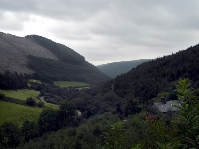
 Coed-y-Brenin Forest is rightly famous for it's world class mountain bike trails, a first anywhere in Britain -or the world for that matter. The inspired idea of Dafydd Davis, a Blaenau Ffestiniog outdoor adventurer, the complex has developed from one experimental run, growing into to a web of trails with evocative names like "False Teeth" and the "Beast of Brenin". I'm an old roadie, but sitting in the wonderful cafe overlooking the valley, it warmed my heart to see all the enthusiastic dirt bikers getting ready to take on the gnarly stuff.

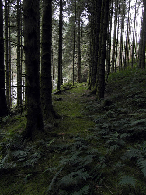
But as you might guess, we were there for something else -and not just the excellent food at the cafe. Equally famous among mine explorers, the honeycomb of workings in the upper reaches of the infant Mawddach weave a fascinating spell as the river surges through the Coed. The woodlands are dotted with remains, adits and stopes; the only drawback is that the ground is extremely hard going, a mixture of tight conifers, birch scrub and almost impassable clear-felling, but well worth the bruises and scratches.

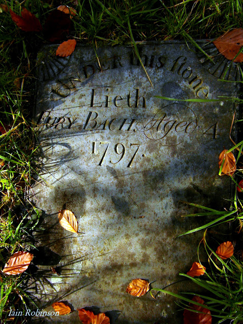
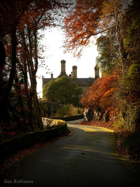
 Today's expedition was purely a recce, so we were travelling light. We parked up in the Tyddyn Gwladys forestry car park and took the track in the direction of the eponymous mine, or "Ferndale" as it is now titled. The first structure that came into view was what appeared to be a ruined victorian hunting lodge with the remains of an impressive staircase at the front. An old Land Rover sat outside, gently settling on it's rusty springs. I took a closer look at the Landie, to find that the chassis had been augmented with some wood and a few lengths of Rebar, plus some string. Not an MOT candidate, then.

We walked further on and came to the old barracks, now apparently in use as a hostel. Stern notices on the doors warned against "Bike Maintenance" inside.Odd, really, since that would surely be a sine qua non for anyone staying here in the forest.

Walking on past a bend in the track and the buildings of the mine came into view. They are much modernised, of course, but are still recognisably the same as in the old photograph here. The mine was originally opened in 1833 as a lead mine; galena is the dominant ore mineral and carries higher silver values than elsewhere in the district. However, as well as copper and zinc in the lode, gold is also found. Worked only intermittently, the recorded output is 12 tons of lead in 1848, 9 tons of lead in 1851 and 43 tons of gold ore producing 7 ounces of gold in 1899, the latter being the final year of working.

The mine at Tyddyn Gwladys, probably about 1870. There's little trace now of the lower structures, but the ones near the trackway are still there.

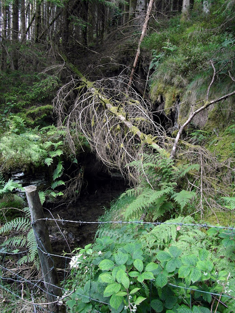
The river runs close to the trackway here, a fast flowing, bustling watercourse full of energy and noise.

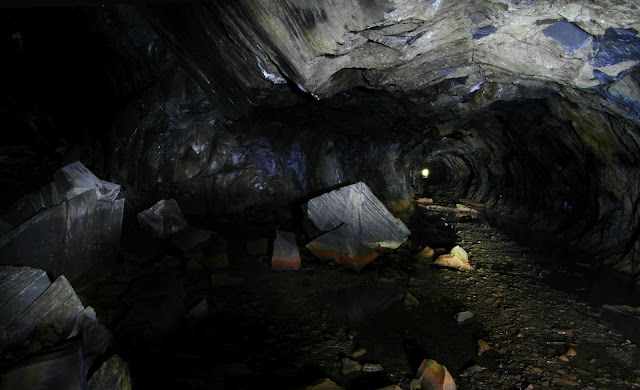
Two adits can be found up the side of the thickly wooded hill, with stoping to daylight at the top. The adits are open, but not very inspiring, with deep shafts down to the lower levels. Back on the trackway, the first building at the mine is the old smithy, now converted into a lovely private house. On the other side of the track an adit opens, half blocked with a stone cill. The remainder of the structures for the mine are converted into holiday accomodation and look very well cared for, although for sale at the time of our visit.


Walking further on, the track becomes more level and some strange structures with immensely thick walls come into view on the left. Nature has almost reclaimed them and they are covered in vegetation and fallen trees, but with a little imagination, their purpose can be teased out of them. The interested onlooker is helped by a very clever feature, a set of waymarkers referring to an MP3 track that can be downloaded from the Forestry Commission web site onto a mobile device. The narrative is angled at the very casual visitor, but contains enough nuggets of pay dirt to be able to solve the riddle of the buildings here.

The water-powered Corning House, where sheets of gunpowder were passed through a toothed roller ‐ that sat within the ornate brick arches ‐ to form granules, which were then sieved into regular‐sized grains of gunpowder.
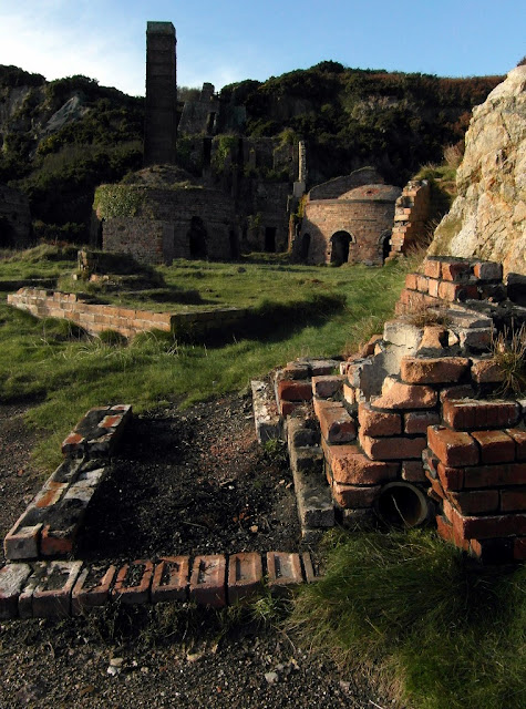
 And a very interesting story it is. Apparently, these are the remains of a gunpowder works, set up here in 1887 with a view to supplying the region with black powder. Given that the world famous Glasdir copper mine is just down the road and the gold mines of Cefn Coch scarcely more distant, it might have seemed like a good idea. Sadly, the show was spoilt by the invention of gelignite and TNT . In 1892, the whole enterprise closed.

Listening to the MP3,  the buildings began to make sense. There are some snippets of first hand accounts, too, like the one from mine worker Hugh Pugh, eventually a foreman at one of the mines in the valley:

 “I started work in 1888 with a lot of boys under 15. We used to meet on the bridge at 3am on Monday with a weeks rations in our white wallets, including a big homemade loaf. We would walk 8 ½ miles to start at 7 o’clock and we used to have a few minutes rest halfway.
Once we found a donkey meeting us on his own and found that 3 miners had taken the donkey to carry their wallets halfway and turned him back on his own”

(grateful thanks to Forestry Commission Wales for the above quote.)

The Incorporating Mill
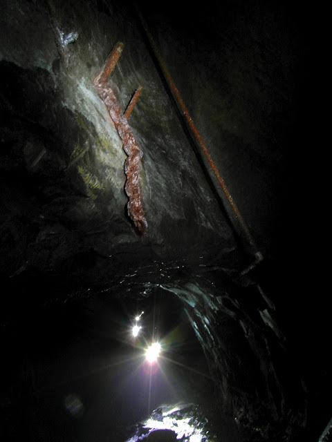
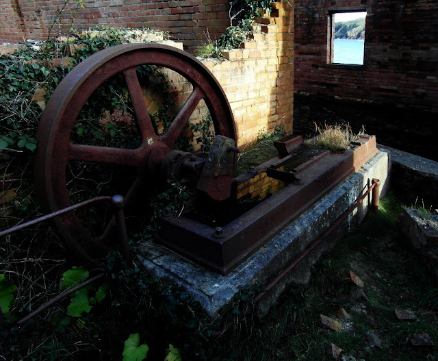
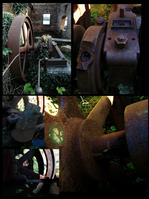
The building that fascinated me was the last one before the track curves to cross the Afon Pistill Cain. Elevated above the trackway is a six-compartment structure with a vaulted tunnel running beneath. This was the "Incorporating Mill".
Within this long building the gunpowder mixture was moistened and ground between large iron wheels, called edge runners, to create a ‘mill cake’. So dangerous was this part of the manufacturing process that the makers were forbidden to grind more than 42 lbs – roughly the weight of an average 4 year old ‐ at any one time. In the floor of each room an opening reveals a brick vaulted tunnel below. Here a shaft, powered by a waterwheel at the northern end of the building, drove the edge runners. The water wheel was a large one, at least if the pit is anything to go by.

The vaulted tunnel that housed the waterwheel-powered shaft underneath the mill.
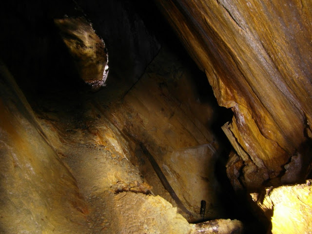
The wheelpit
 It was hard to hear ourselves speak, as the river roared below, joining with the Mawddach. Little wonder water power was the motive power of choice in the valley. Apparently, the river runs very high occasionally, the waters reaching to just below the deck of the iron bridge spanning the gorge..

Crossing the bridge led us to an area that had my mine senses tingling. Although there didn't at first seem to be anything to be seen, we left the trackway and explored the ground in the angle made by the join of the two rivers. A complex of foundations and machine bases soon revealed themselves, and we realised that we were looking at the remains of the original Gwynfynydd Gold Mine Mill. Surviving photos show a typical C19th multi-storey corrugated iron structure. Our friend Hugh Pugh, foreman at the mine, takes up the story again:

“The power was water turbines, 2 boilers and steam engines. The ore was tipped on the screen; the course going to the 2 stone breakers and crushed to 1 ½ inches into a Bing[?] underneath holding thousands of tons of supply for the night shift. Breakers only working days.
The ore was crushed to a powder and washed with water through very fine screens to the tables where there was copper plates covered in quicksilver. As the gold passed over the tables, the gold would stick to the quicksilver.
This we called amalgam. (It was) collected twice a day and put in wash‐leathers. The oils were squeezed out and made into balls about 2 ½ inches, about 35 ounces of which 1 in 3 was gold and put in the safe until the end of the month.
The amalgam would be taken to the assayer where it would be put in a rotator to get the silver from the gold – the silver to be used again. The gold would then be put in a plumbago crucible to be melted and poured out to ingot mould and when cooled the gold could be taken out and weighed by the manager and taken to the bank.”


This is the scene in the late C18. There is virtually no trace today, apart from the foundations.
The confluence of the Afon Gain and the Mawddach today.
The remains of screens and a large pipe carrying water for a Pelton wheel can be seen, although these are more than likely later additions after Hugh's time. Clearly, this was a big operation. Gold was discovered here in 1860, but the biggest find was in 1880 when the mother lode was struck and nearly 9,000 ounces were refined; worth a few million pounds at today's prices. Production continued, off and on until 1999, although from a site further north up the valley. Gold is still reputed to be there, deep under the hillside, but legislation controlling pollution of the Mawddach makes it impossible to sink shafts or continue work. The atmosphere in the mine is also dangerous due to the cocktail of mineral deposits oxidising and producing lethal gases, making health and safety issues a very real consideration. The mine continued for a while as a tourist mine, but inaccessibility and the deteriorating state of the mine meant that it had to close.


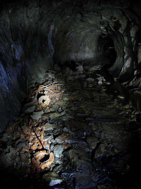
Today, the buildings present a fascinating and yet poignant spectacle. The half-buried rails leading from the tip to the adit amid classic corrugated iron mine architecture are a mine explorer's dream, as if the clock has been turned back and we can gaze with half closed eyes and imagine the bustling of activity and the sound of blasting. Ironically, the site was the subject of a failed attempt to build a village of timber holiday lodges, rather like the less-than edifying cabin village at Bronaber. Plans were drawn up to build over the tips and stopes  with little consideration of the fact that said tips were full of very unhealthy pollutants, and that many of the tips were little more than filled in shafts and stopes. In a deposition for planning, the developer promised to rid the area of the "eyesores" of the mine buildings. Well, it's all in the eye of the beholder, I guess.

The plans failed due to a very spirited opposition from the Welsh Mines Society and some environmental officers of the council who discovered rare lichens on the site. Although I also suspect that the cost of building a road and the economic downturn had a hand in the scheme being abandoned. The site as it is now is decaying quickly. It is also highly dangerous and exploration is not recommended, the river bank is eroded and unstable. It's a great shame, (but not surprising due to the state of the economy) that suggestions by the WMS that the site be preserved as a museum have not come to fruition either.

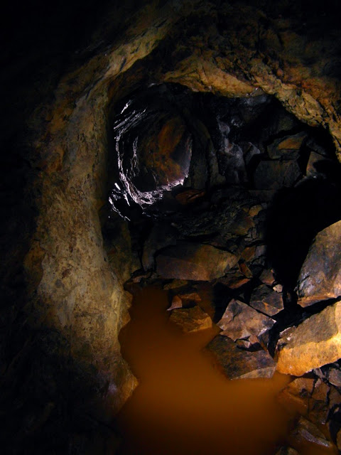
A view from the gated adit showing the considerable acid mine drainage problem.


Incidentally, the adits here are not to be entered under any circumstances, as the state underground is that any disturbance results in pollution being discharged into the Mawddach. The river is watched keenly for any sign of pollution and exploration would not be doing anyone any favours. On a more optimistic note, there are many fine remains to be explored above ground and felling has made the incline to the upper stopes just about navigable. It requires care and vigilance, but it is a fascinating site.

There are some more mines upstream from Gwynfynydd, but our legs were tired after blundering about in the boskage. We'll have to return soon to this magical corner of Coed-y-Brenin.

A link to the Forestry Audio Trails

The Cafe at Coed-y-Brenin

The Goldmines and Waterfalls Walk

Dafydd Davis, Bike Trail Designer


A bank of cap lamp chargers inside the mine building
Shelving that had once stored wellington boots for visitors.

Ystrad Einion Copper Mine, part 1

$
0
0

We often wander (or in my case, stumble and fall in mud) around surface mining remains, desperately trying to identify features. It's fun, like an exercise in archaeological detective work- and very rewarding when later research occasionally proves us right. Ystrad Einion, however, was slightly different. (Although I did disappear up to my knee in muddy gloop, so tradition was satisfied!) The mine lies in a remote valley, accessed by a hair-raising narrow road with very few passing places, so we were pleasantly surprised to find that the site had been conserved and interpreted for us. (By WDA Tirwedd Cymru...thank you.)

Roughly translated, the name Ystrad Einion means "the valley of the anvil", quite appropriate given the mine which nestles in its flanks. While the valley, especially it's upper reaches, is beautiful, I couldn't immediately see the reason for the other name, which is "Artist's Valley".unless it refers to Robert Plant, the Led Zeppelin vocalist who has a farmhouse somewhere in the cwm.

From the lower waterwheel pit which operated the Buddles.
Not quite as secretive as a rock-star's retreat, the mine nestles among conifers, whose seedlings are already beginning to take over the site again. However, the buildings are conserved enough to be able to make out and understand what went on at the site, aided by two really excellent reconstructions printed onto information boards. These boards show 3D graphics renders, with info panels giving some surprising facts about the mine. The graphics are taken from an excellent CGI film which I will link to at the end. Steps thread up the site to the open shaft, which is covered by an impressive steel structure, allowing you to gaze down into the abyss below.

One of two 3D graphic reconstructions on the site.
Remains of the waterwheel and flywheel pits near the winding gear at the top of the site.
As per, none of my above ground photos were any good, so Petra has kindly let me use hers for the blog. The only shots of any note that I produced were underground. Underground? Ah, well...there is a surprise awaiting in the next installment...

Ystrad Einion Factoids:
Compiled with help from work by Roy Fellows (AditNow) and "JustJay" (28 Days Later) :

"Although possibly of some antiquity, the mine was certainly one of those worked by the Company of Mine Adventurers from about 1700 - and slightly later, by The Flintshire Mining Company. Nothing was done from 1760 until 1853 when the mine was restarted by a partnership of Charles Kirkpatrick and TA Readwin of gold mines fame. They abandoned it within a year but then the mine was taken up by two brothers, Thomas and Henry Jones who worked the mine until 1869.

In 1870 the lease passed into the hands of Mr Adam Mason who ran the mine throughout its longest working period. During this time, a 12-fathom level was opened. Installation of a 16-foot diameter waterwheel for pumping and winding allowed the workings to descend a further 12 fathoms. Development at the mine continued with the excavation of a 30 fathom engine shaft, together with a leat which brought power to a 22.5ft waterwheel, used for pumping and winding. Two smaller water wheels drove the mine's processing machinery, which consisted of crushers, jiggers, and two 20ft dia. buddles. The new developments were celebrated in great style in 1877, but a distinct lack of ore meant full production didn't begin until 1891, by which point the mine was operating under new management. Ystrad Einion was never a rich mine, the production figures between 1891 and 1897 show that only 9 tons of lead ore, 10 tons of zinc ore and 45 tons of copper ore had been extracted."

The Video, by the Metal Links Project.

Thanks to my lovely better half for the use of her photos.

The fine circular powder house.
Underground, where my camera seems to be more at home...


Viewing all 103 articles
Browse latest View live